Stretching from North Salt Lake to Parley’s Canyon, Salt Lake City’s portion of the BST is a 13.5-mile trail that provides unparalleled views of the Salt Lake Valley. The unique urban-wildlife interface of the Bonneville Shoreline Trail offers many recreational activities from hiking and biking, to bird watching and nature study. The trail is owned in portions by the City, National Forest Service, and private organizations; it is only through these partnerships that this connective, beautiful area is available to everyone in Salt Lake City and beyond.
Several sites that Parks and Public Lands manages intersect the Bonneville Shoreline Trail or can be reached from the trail and other Natural Lands.
Amenities
- Natural Area
- Hiking and Biking Trails

History of the Bonneville Shoreline Trail
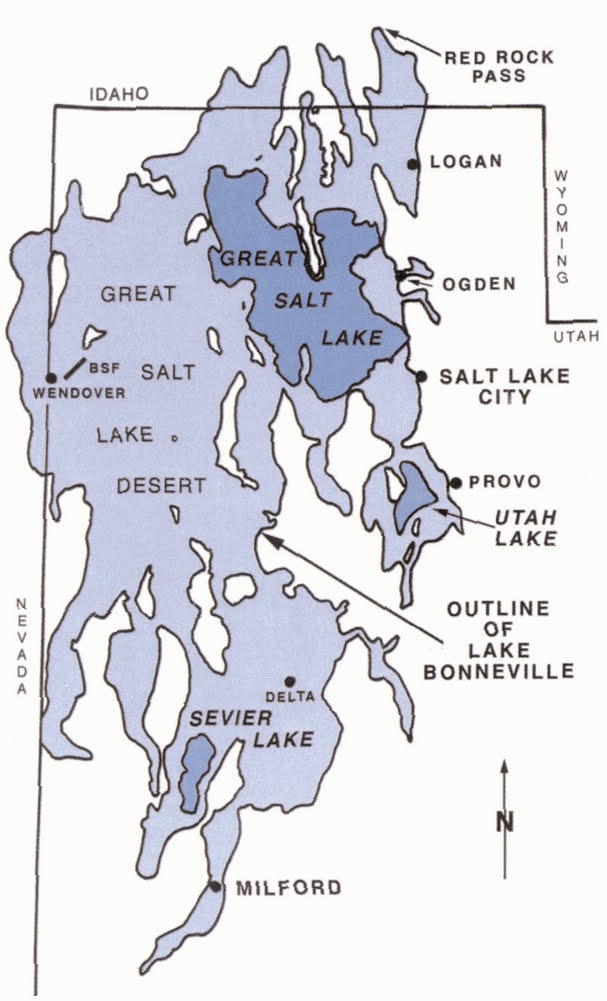
The Bonneville Shoreline Trail is not considered historic in and of itself, although it is significant for its relationship to Lake Bonneville, an ancient lake that existed during the Pleistocene- the last glacial period. Lake Bonneville was vast, covering 20,000 square miles in eastern Nevada, southern Idaho, and much of Utah. Direct precipitation, rivers and streams, and runoff from Wasatch Range glaciers fed Lake Bonneville, making the lake 1,000 feet deep.
With rising temperatures, the lake rose to new levels eventually causing it to overflow at its lowest point at Red Rock Pass, Idaho. Erosion of the mountain saddle rock layer soon gave way to a massive historical flood, known as the Bonneville Flood. This flood roared through Snake River Canyon, etching a 350-foot ravine as it continued its way to the Columbia River and eventually out to the Pacific Ocean. Over time evaporation and runoff lowered the lake, carving out canyons and ravines into the Wasatch bench.
The conception for the Bonneville Shoreline Trail began in 1990 due to inappropriate motor vehicle use, which degraded shoreline trails for those on foot and bike. By 1994, Utah, Salt Lake, Davis, and Weber Counties all agreed with the Bonneville Shoreline Trail Committee that a single, continuous, uniform trail should extend the bench of Lake Bonneville. By 1999, the 17.5-mile-long BST through Salt Lake City was officially completed with 22 trailhead access points, each with a slightly different purpose.