July 2026 Construction Update
Crews have completed sidewalk, curb, gutter, driveway approach, and roadway paving. Work is now focused on installing the traffic calming features shown below.
Overview
Salt Lake City is rebuilding Navajo Street from 300 South to 600 South to replace worn pavement. While the street is being rebuilt, safety and accessibility improvements will also be added to increase comfort and help calm traffic. Construction is expected to begin February 2026.
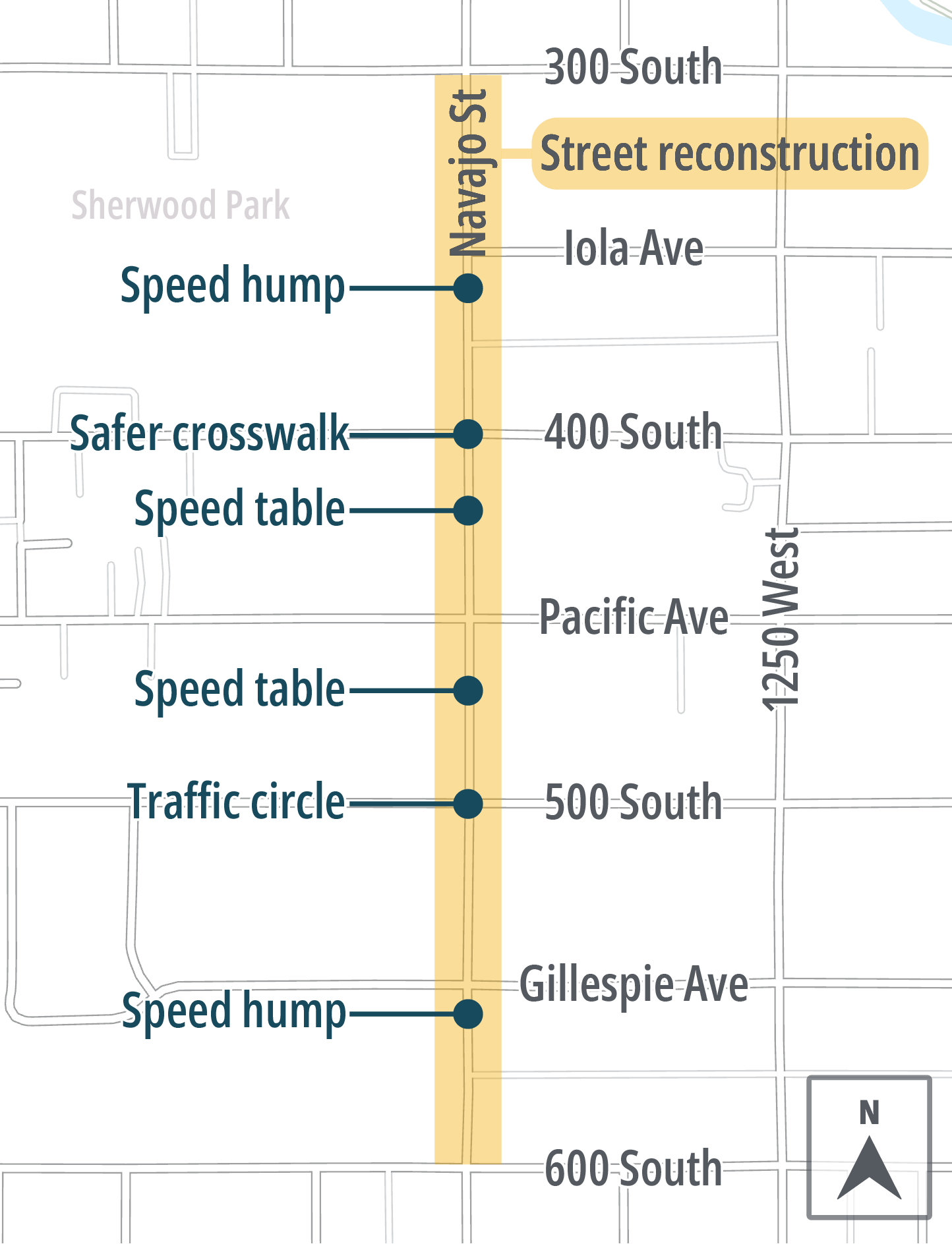
Improvements include:
- New asphalt pavement and targeted sidewalk, curb, gutter, and driveway approach repairs
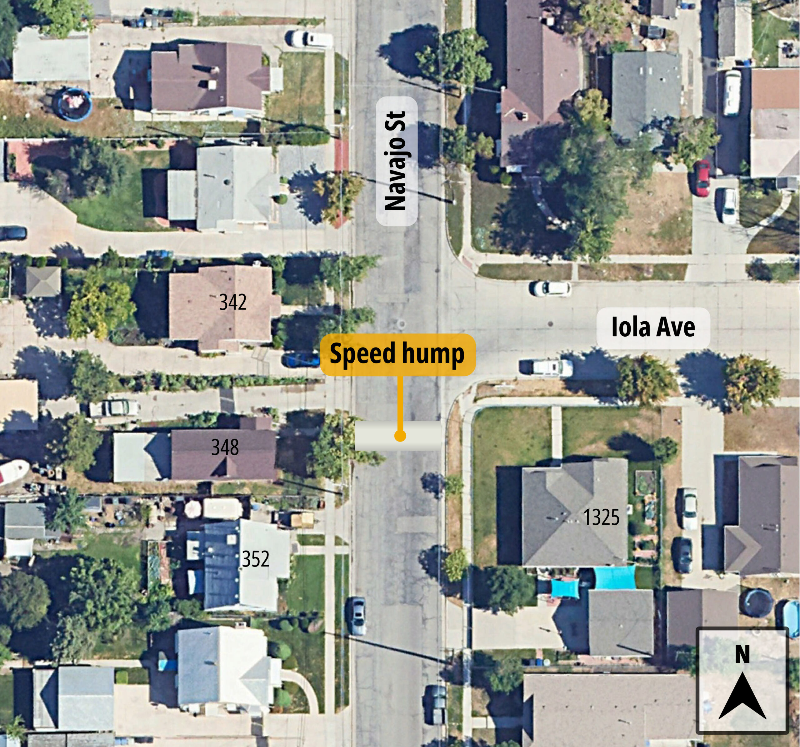
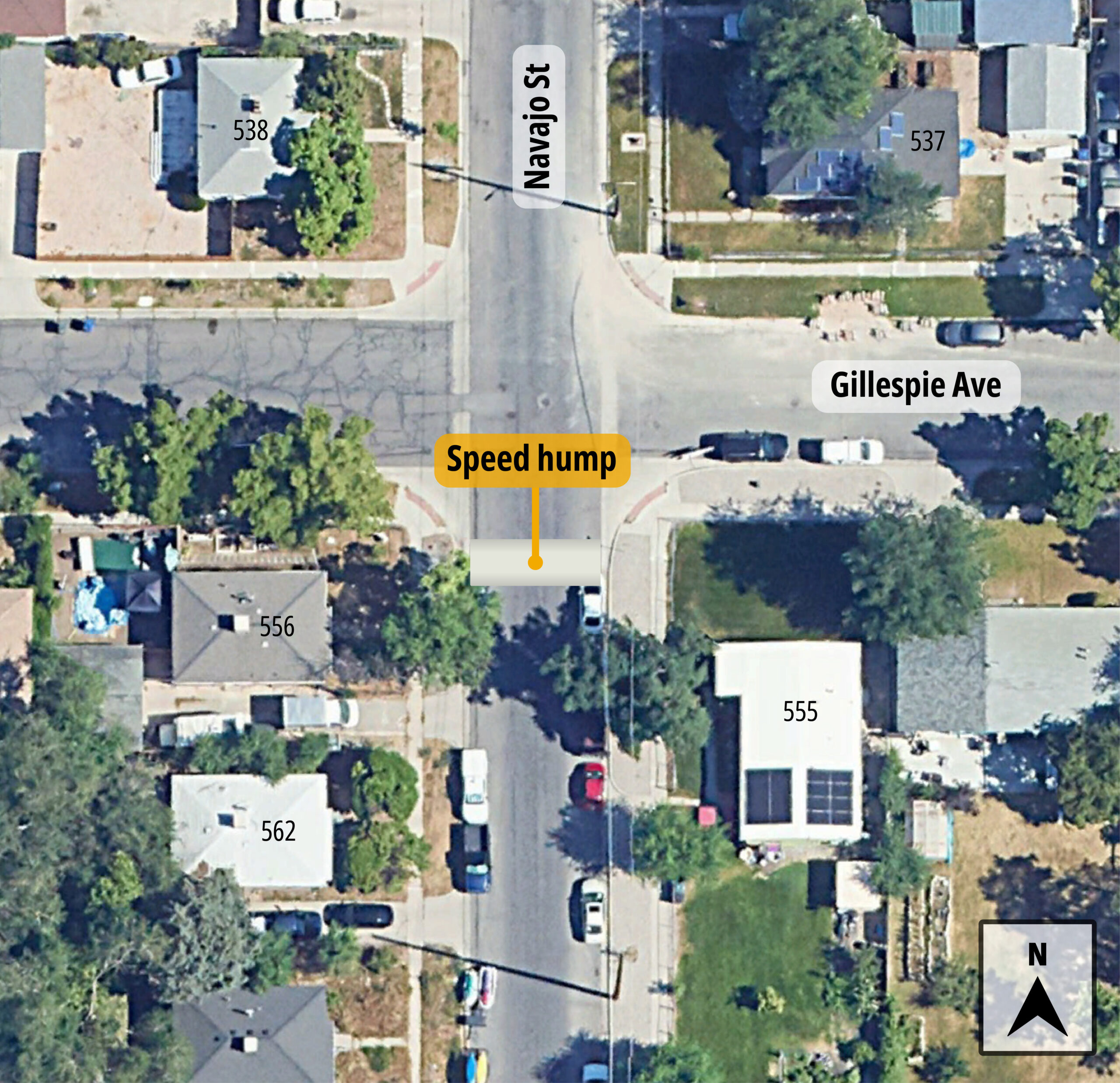
- Speed hump near Iola Avenue
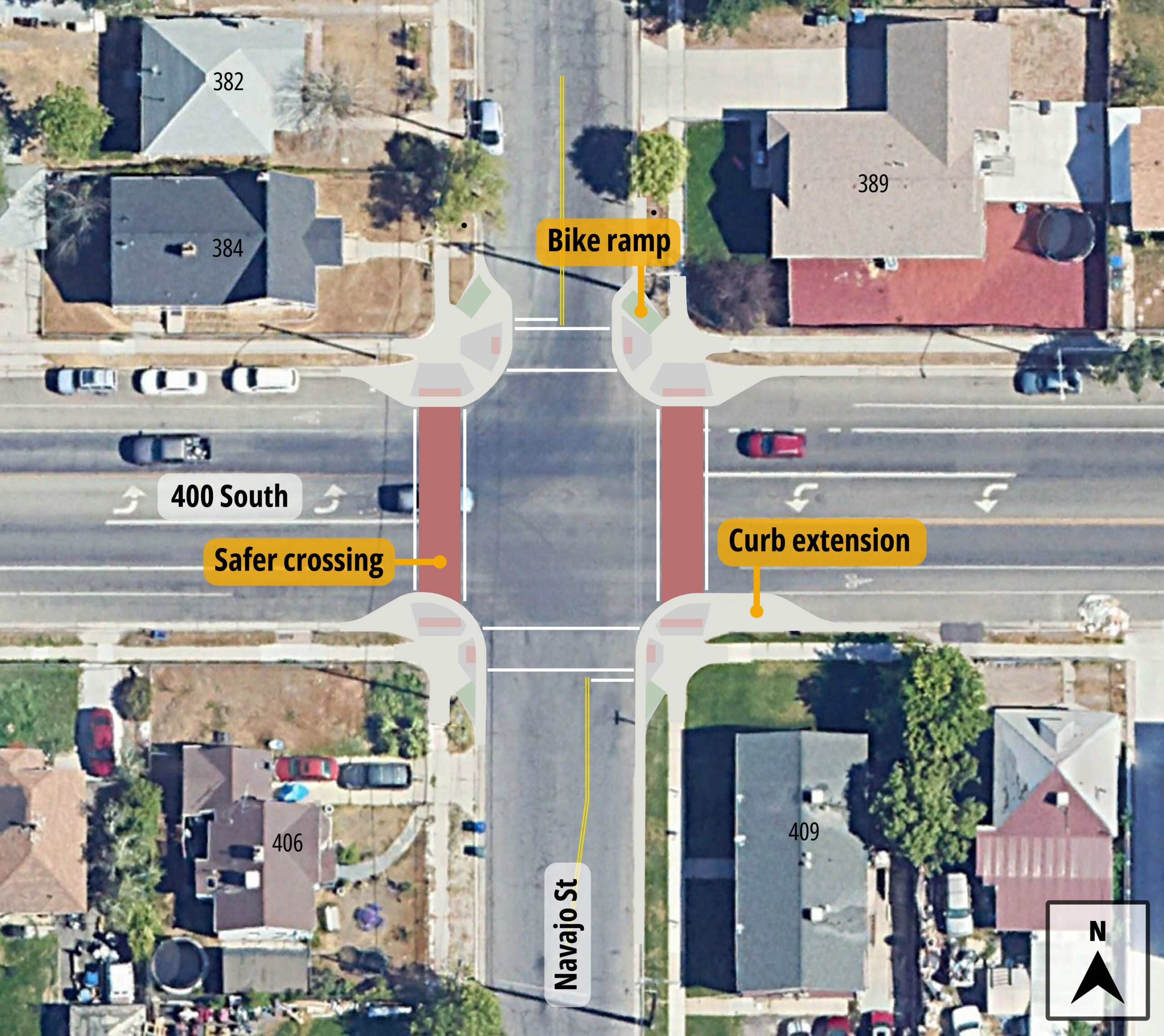
- 400 South crosswalk improvements
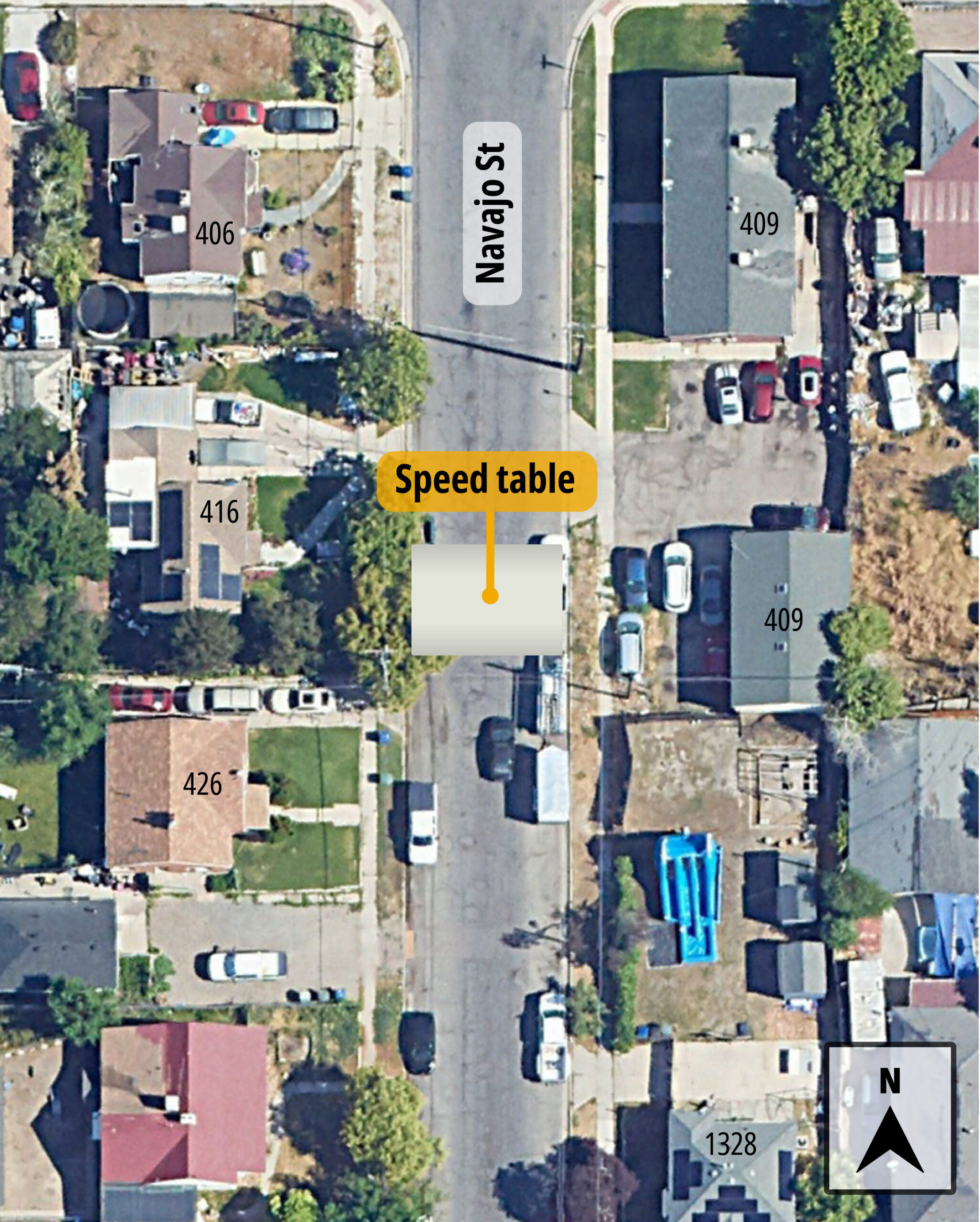
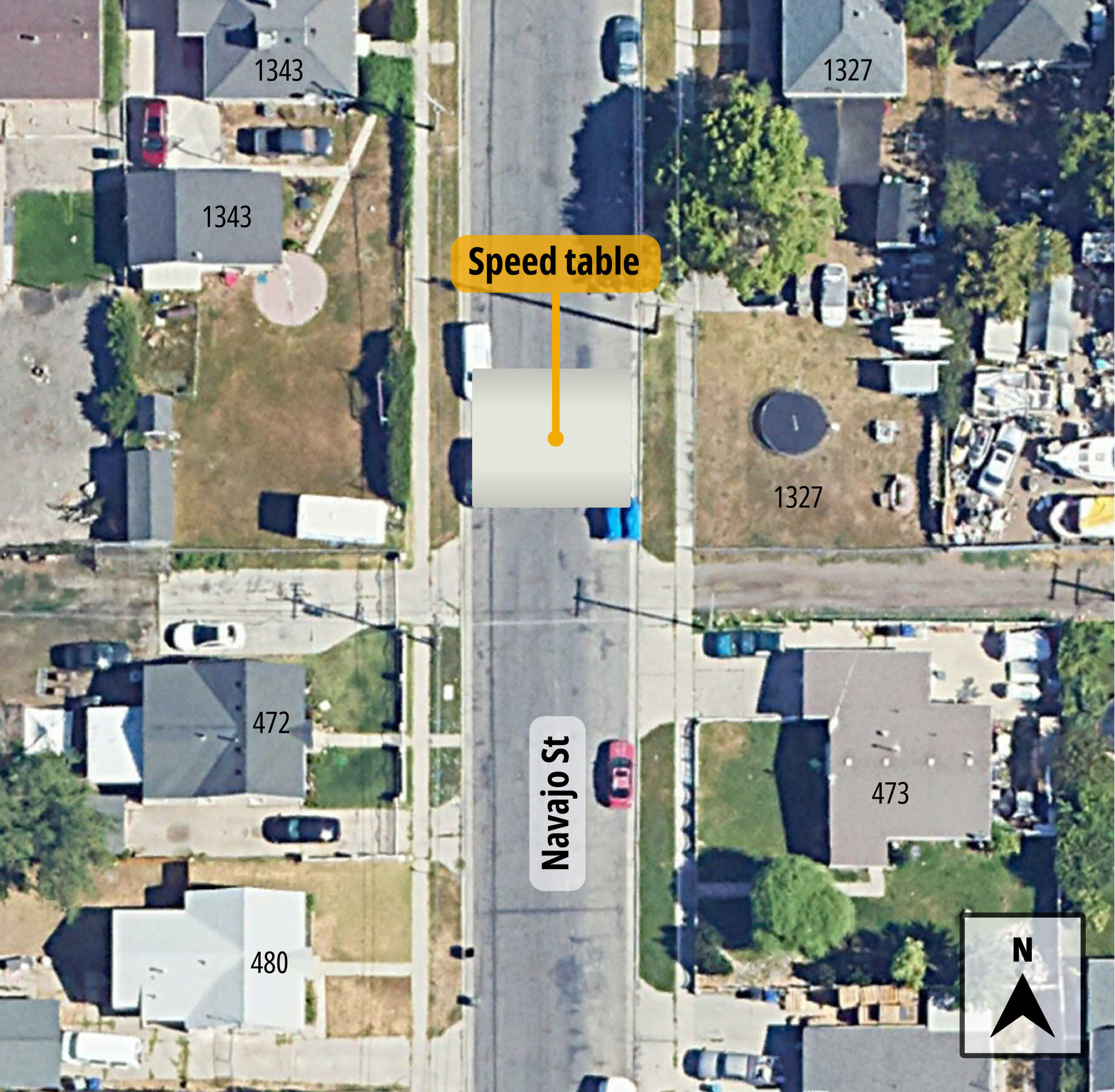
- Speed table near 425 South
- Speed table near 475 South
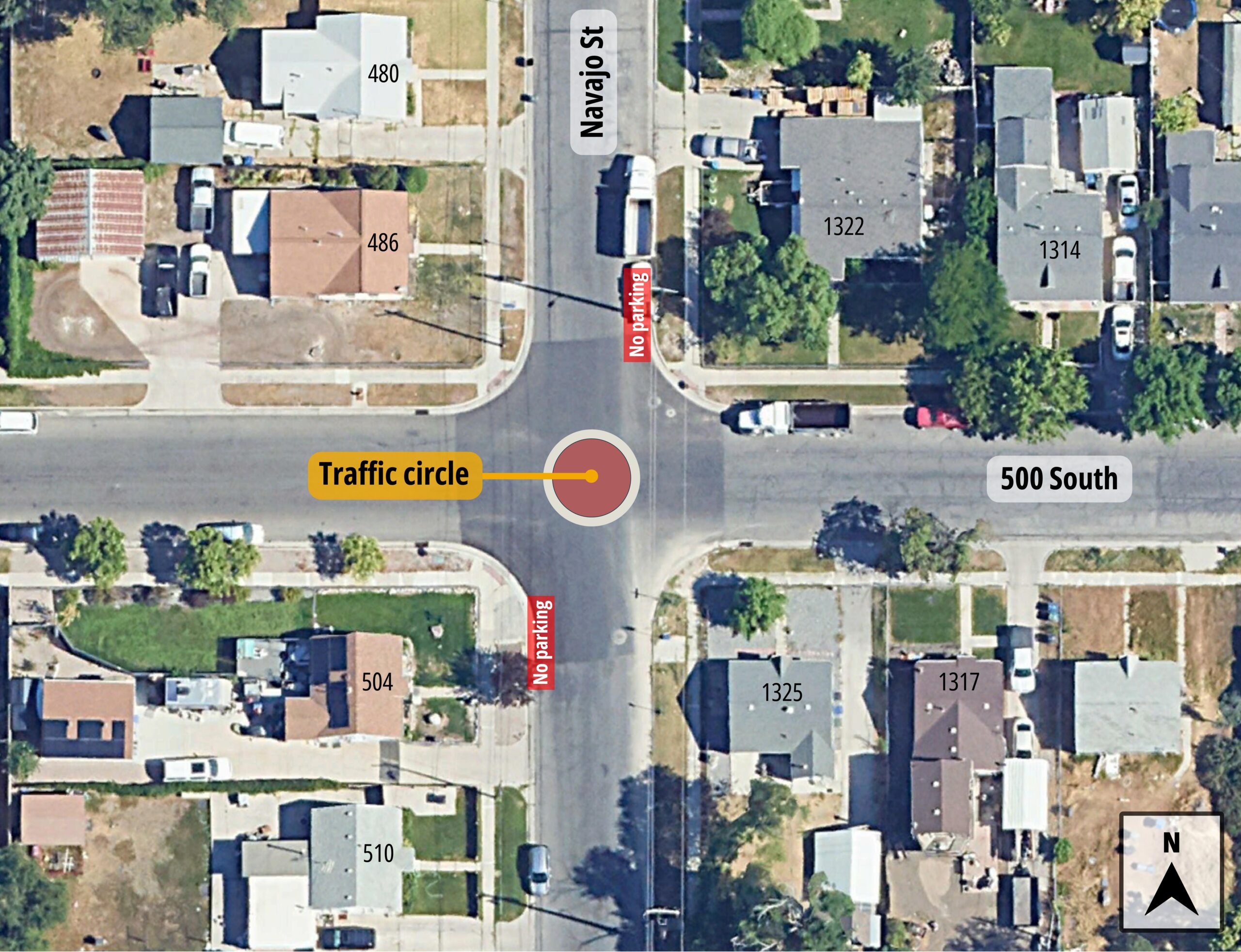
- Traffic circle at 500 South
- Speed hump near Gillespie Avenue
These improvements are part of the Salt Lake City Neighborhood Byways, a growing network of calm streets designed to be safe and pleasant for people walking, biking, and rolling through the Poplar Grove neighborhood. Learn more about Neighborhood Byways.
What these improvements do
Speed humps and tables
What are speed humps and speed tables?
Speed humps and speed tables are raised sections of concrete that help slow drivers on neighborhood streets. Speed humps are shorter and slightly more pronounced, while speed tables are longer and flatter, creating a gentler transition.
Why are we using both on Navajo Street?
Both features help reduce speeding and support the 20 mph speed limit on Navajo Street. Speed tables are used in locations where a gentler design is needed, such as along the UTA bus route, making them more comfortable for buses and other large vehicles while still slowing traffic.
Parking on speed humps and speed tables
There are no changes to on-street parking associated with speed humps or speed tables. People may park on them just like anywhere else along the street.
Traffic circles
What is being added to Navajo Street?
A traffic circle will be installed at the intersection of Navajo Street and 500 South. The intersection will operate as an all-way yield, helping traffic move through the intersection more smoothly while encouraging lower speeds.
Why is a traffic circle being added here?
The traffic circle will slow vehicles from all directions and reduce conflict points at the intersection. The intersection will also operate as an all-way yield, meaning drivers yield as they enter the circle, which helps keep traffic moving smoothly while encouraging lower speeds.
Clarifying no-parking near the intersection
To improve visibility and ensure buses and other large vehicles can safely move through the intersection, the City will install signs to clearly mark existing no-parking areas near the corners of the intersection. New no-parking signs will be added on Navajo Street at the northeast and southwest corners of 500 South.
In Salt Lake City, parking is already restricted near intersections to keep sight lines clear, with limits of 30 feet on the approach and 20 feet on the exit. Clearly marking these areas follows a safety practice known as daylighting, which keeps corners clear so everyone approaching the intersection can see each other more easily.
Safer crosswalks
What does the safer 400 South crosswalk include?
The crosswalk at 400 South and Navajo Street will be upgraded with curb extensions on all four corners. New curb ramps will be added at each corner to improve access for people riding bicycles. Crosswalk markings will also be upgraded to be more visible.
Why these crosswalk upgrades matter
The curb extensions at 400 South and Navajo Street shorten the distance people need to cross the street and help keep corners clear of parked vehicles. This improves visibility so people crossing and approaching traffic can see each other more easily. By narrowing the roadway at the intersection, curb extensions also help slow vehicles turning from busy 400 South onto Navajo Street, which is a local, slow-speed residential street.
New bicycle-friendly curb ramps make it more intuitive and comfortable for people riding bicycles to cross 400 South using the crosswalk and continue along the Navajo Street Neighborhood Byway.
Upgraded crosswalk markings will make the crossing more visible to drivers traveling along 400 South, helping draw attention to where people are crossing and reinforcing that this is a shared space.
Why is this crosswalk being improved?
This crosswalk is located where Navajo Street meets 400 South, a busy arterial street that carries higher traffic volumes through the Poplar Grove neighborhood. Navajo Street is a Neighborhood Byway, meaning it is intended to be a calm and comfortable place for people to walk, bike, and roll as an alternative to nearby busier streets.
Improving this crosswalk helps people safely cross 400 South as they travel along Navajo Street, including people walking to and from Sherwood Park. Similar crosswalk improvements have already been made farther south on Navajo Street at Indiana Avenue, and this upgrade continues those safety improvements along the corridor.
What to expect during construction
During construction, residents can expect temporary closures and detours. Updates will be shared as work progresses.
In addition to work on Navajo Street, 600 South from Cheyenne Street to the Jordan River Trail will also be rebuilt in 2026, with construction expected to begin later in the spring. Learn more about the 600 South street reconstruction.
Contact us
Questions or concerns?
Email: [email protected]
Map