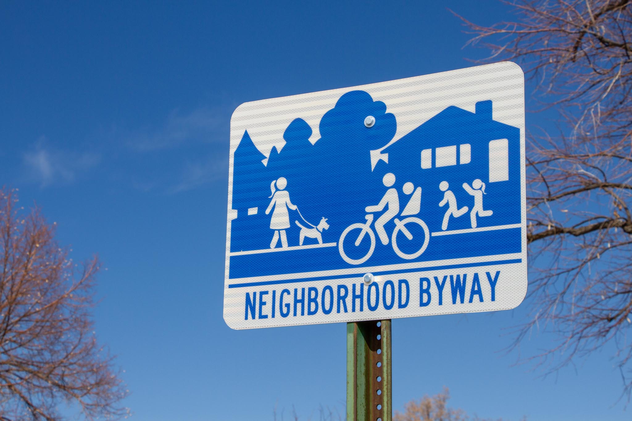
What’s a Neighborhood Byway?
Salt Lake City is making it safer and more inviting for people of all ages and abilities to walk, bike, and roll through their neighborhoods.
Streets that work for everyone
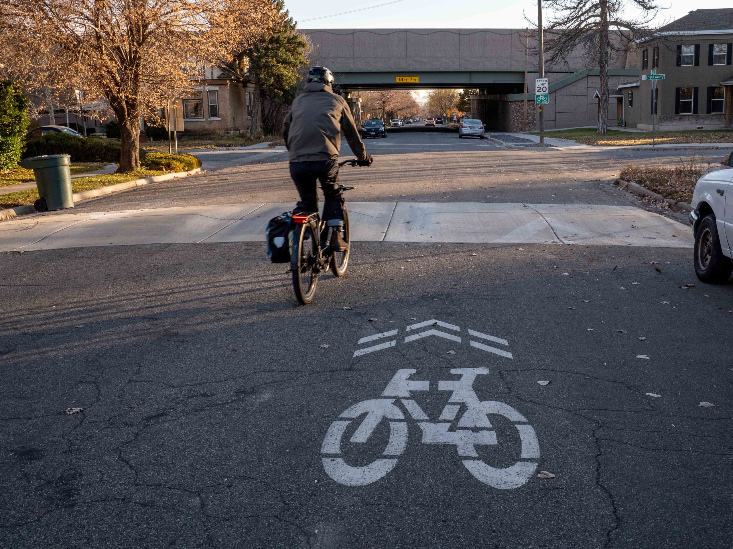
Bike lanes often run along busy streets where high speeds, traffic noise, and exhaust make cycling uncomfortable. Sidewalks on these roads can be loud and stressful for walking with children or pets. Neighborhood Byways offer a calm and pleasant alternative by turning quiet neighborhood streets into comfortable places for active transportation.
Features that make the difference
- Safer crossings of busy streets
- 20 mph speed limit and traffic calming where needed
- Bicycle-friendly curb ramps at key locations
- Wayfinding signs and pavement markings for navigation
- Improved connections to destinations and existing walking and biking routes
- Trees for shade and comfort
Building a connected network
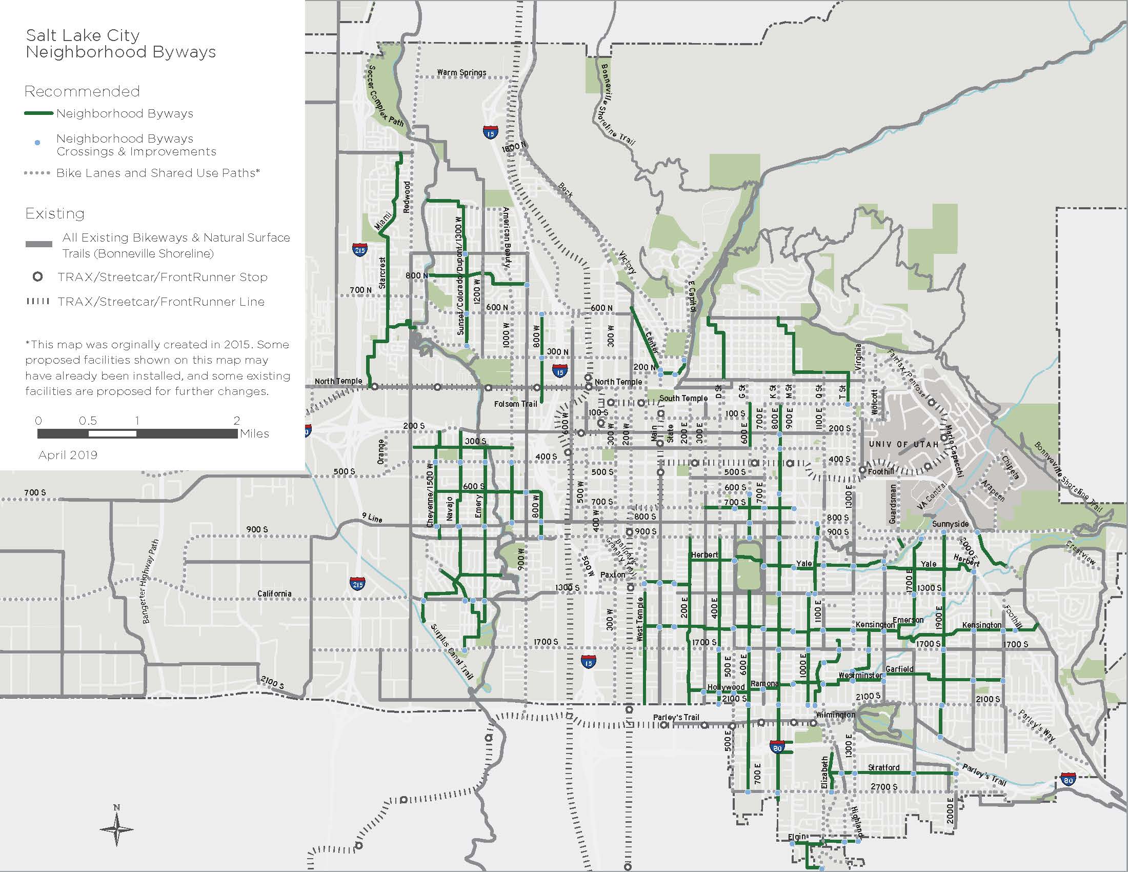
Salt Lake City is building a network of people-friendly streets that makes active transportation a real choice for everyday trips—not just recreation. Ready to explore? Check out the routes and map below.
- 600 East
- 800 East
- Kensington Avenue
- Poplar Grove
- Rose Park and Fairpark
- Westminster to Sunnyside
- Westpointe and Jordan Meadows
Salt Lake City Neighborhood Byways map
Learn more
Frequently asked questions
What changes are considered along these routes?
Street changes along these routes will be evaluated through a planning and public engagement process. Improvements may include:
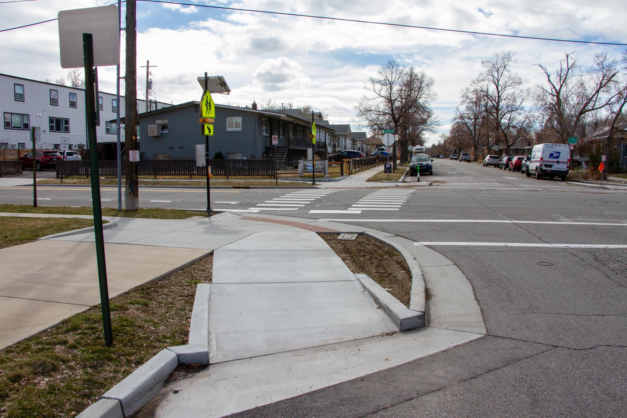
- Crossing upgrades ranging from flashing signs to traffic signals, based on traffic speed, volume, and safety needs
- Traffic calming features like speed humps, traffic circles, and chicanes to reduce speeding and discourage cut-through traffic
- Curb extensions (or bulb-outs) at intersections to shorten crossing distances and slow turning vehicles
- Curb ramps designed for bicyclists to easily access pedestrian push buttons at signalized crossings
- Wayfinding signs and pavement markings to guide people along the route
- Greening elements, such as trees, landscaped medians, or planters, to enhance comfort
How is a street chosen to be a Neighborhood Byway?
Neighborhood Byways are identified in the Salt Lake City Pedestrian and Bicycle Master Plan and are commonly located along streets with the following characteristics:
- Narrow residential streets with low to modest vehicle traffic speeds and volumes
- Direct connections between parks, schools, businesses, and other community destinations
- Greening along the route such as shade trees
Will this affect access to my home?
You’ll still be able to easily reach your home. Neighborhood Byways make streets safe and comfortable for walking, biking, and rolling with children or pets. This may require traffic calming measures and minor street changes to slow vehicle speeds and reduce cut-through traffic, but access to your property will remain unchanged.
Can I drive my car on a Neighborhood Byway?
Yes, vehicles are allowed, but Neighborhood Byway routes are improved for active modes of transportation such as walking and biking.
Will bike lanes be added?
No. Byways use traffic calming, signage, and pavement markings to create a shared street space rather than painted bike lanes.
Will this affect on-street parking?
Byways typically have little to no impact on parking. In some locations, parking restrictions may be added within 30 feet of a crosswalk or stop sign to improve visibility—an approach known as “daylighting.” While parking is already prohibited in these areas by law, it’s often not signed or enforced. Daylighting helps everyone see and be seen at intersections, making the street safer for all users.
Will emergency vehicles, garbage trucks, and snow plows be able to use the street?
Yes. Neighborhood Byways maintain full access for emergency vehicles and city services. When traffic calming is needed, we use speed cushions instead of traditional speed humps. These raised sections have cutouts wide enough for fire trucks and emergency vehicles to pass through at normal speed, while still slowing passenger cars.
Byway Design Guide
The Salt Lake City Neighborhood Byways Design Guide shows how to make local streets safer and more enjoyable for walking and biking. The guide focuses on quiet, slow streets and includes ideas for choosing routes, improving intersections, and slowing traffic. Our goal is to create connected, livable neighborhoods where walking and biking are easier for everyone.
While we work to follow this guide, real-world challenges may limit what we can do in some locations.

Contact us
Have a question or want to stay connected?
Email: [email protected]
Subscribe to the SLC Moves newsletter to get email updates.