You are viewing archived content. This content is no longer updated and links may not work.
Overview
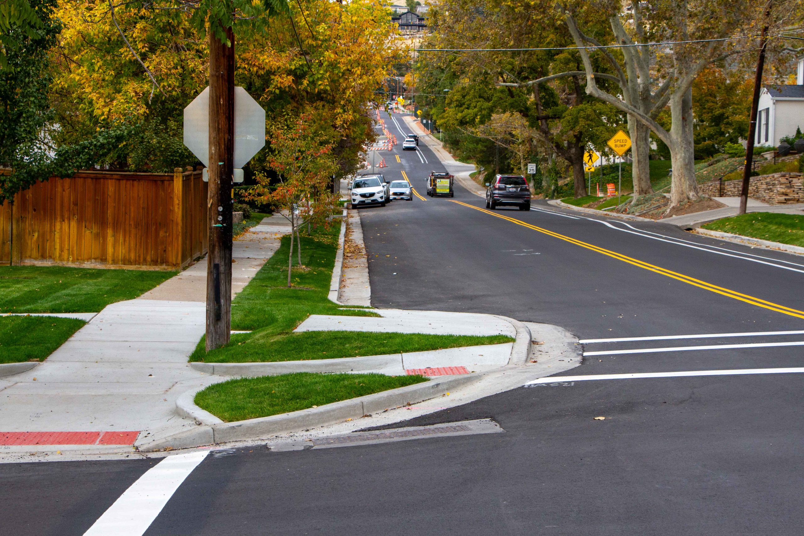
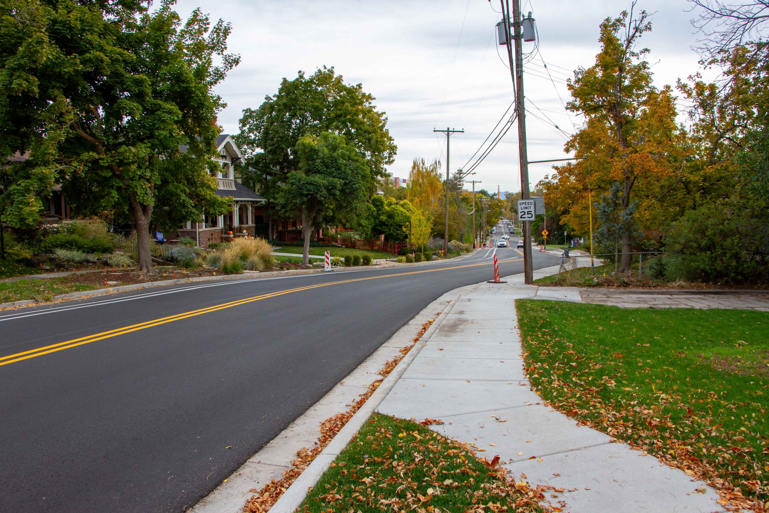
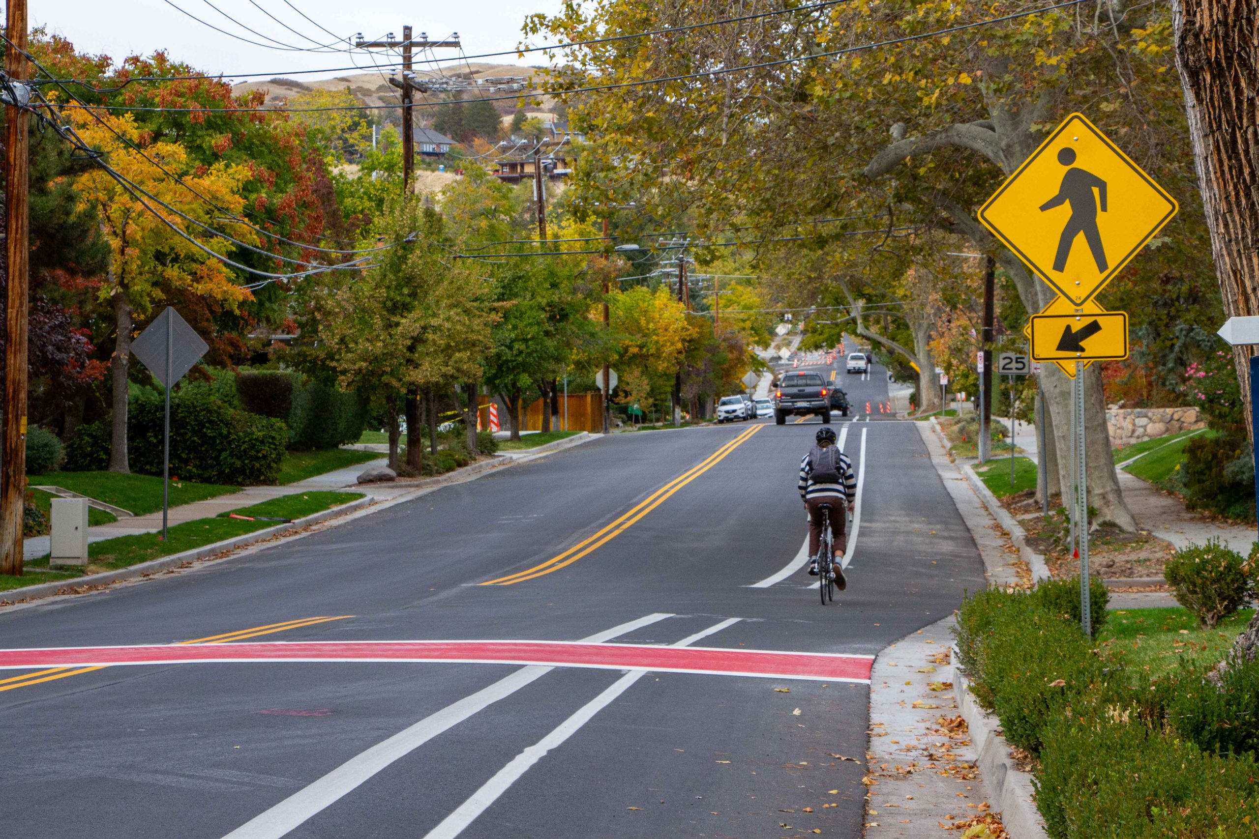
The Virginia Street reconstruction project from South Temple to 11th Avenue improved safety and accessibility with new pavement, speed cushions, bulb-outs, and an uphill buffered bike lane. The project also filled in missing sidewalk sections and adjusted crosswalks at key locations to improve pedestrian mobility.
Timeline
March to July 2022: Community input and existing conditions study
December 2022: Draft conceptual design available for community input
Early 2023: Final design available to the public
Spring to fall 2024: Construction
More info
Final concept design
Final concept design
It is common for the concept design to be modified slightly during the design phase. Adjustments to the concept can occur for a variety of reasons, such as incompatibility with another entity’s infrastructure and prioritizing project elements based on limited funding. In addition, project elements may be added and removed as Transportation and Engineering refine the design. Every effort is made to remain true to the goals of the project when adding or removing elements.
As of May 31, 2024 the following elements differ from the concept design:
- Addition of a crosswalk at 4th Avenue with a reduction of the bulb-out sizes.
- Reduction of the bulb-out size at Crestline Circle.
- Relocation of the northbound bus stop at 3rd Avenue to further south of the intersection.
- Reduction of the bulb-out size (reduction) on 3rd Avenue.
- Potential adjustment of speed cushion locations, specifically south of 3rd Avenue.
Frequently asked questions
What is being done to slow traffic?
This project will add speed cushions along Virginia Street to help slow vehicles. Speed cushions are a traffic calming measure similar to a speed hump but designed with wheel cutouts specifically to accommodate emergency vehicles like fire trucks. People riding bicycles downhill will also be able to use the wheel cutouts to avoid going over the cushion.
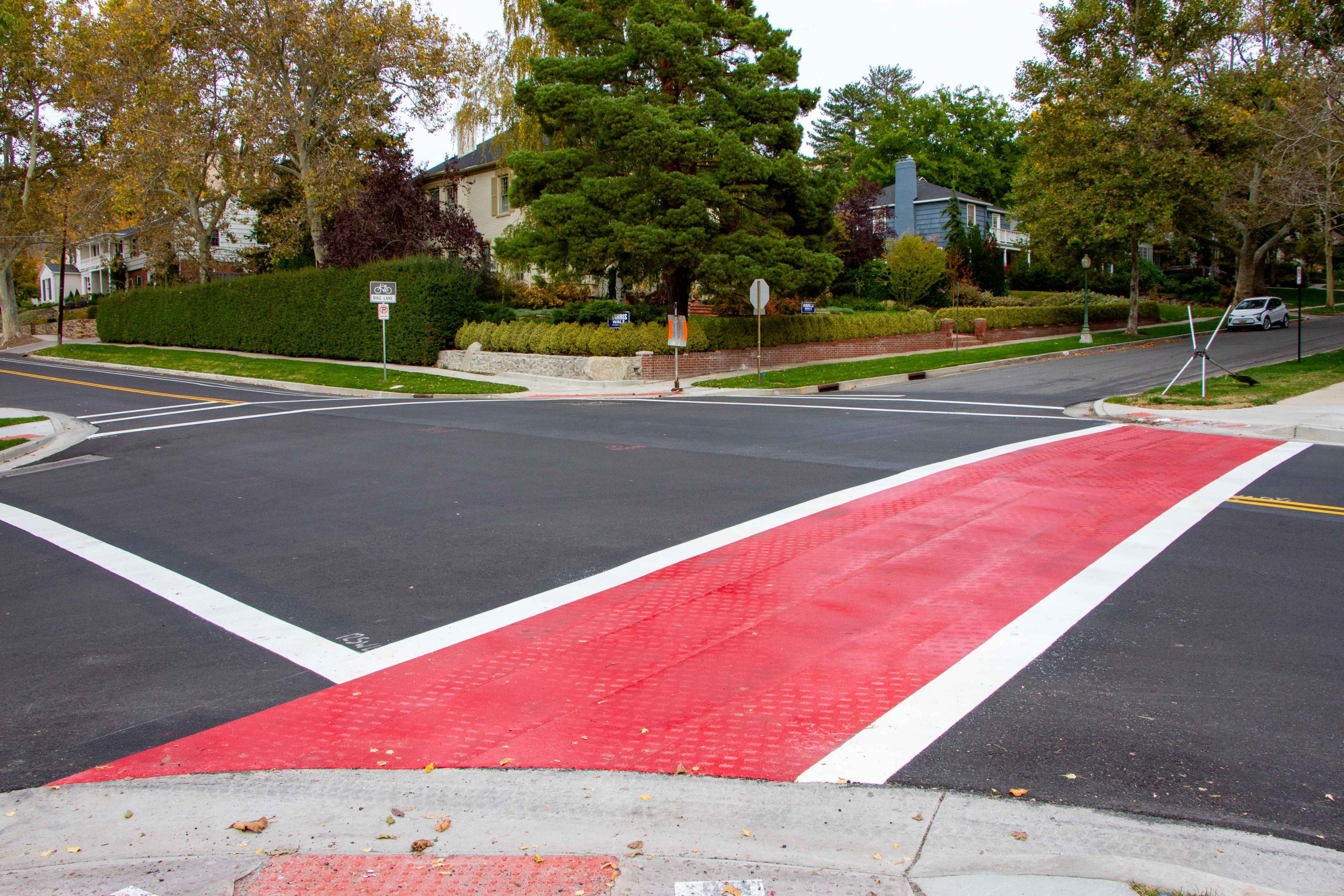
Bulb-outs are also proposed at various locations on the west side of Virginia Street. Bulb outs improve safety by shortening the crossing distance for people walking. Additionally, they provide a visual narrowing of the road that tends to slow drivers.
Are you connecting the missing pieces of sidewalk on the west side?
Yes!
Why aren’t you adding park strips between the sidewalk and travelway?
The project is not adding park strips, the landscaped areas between the road and sidewalk, because Virginia Street does not have consistently wide enough space to add them.
What are the proposed widths for the sidewalk, bike lane, and travel lanes?
Travel lane widths will vary between 10 and 12 feet. The bike lane widths will be between 7 and 8 feet, including a striped buffer. And sidewalk widths are expected to be 5 feet.
Why is a bike lane being added on such a steep road?
A bike lane will provide people riding bicycles uphill with a dedicated space to ride and will add consistency and predictability for people driving as they won’t need to navigate around people riding bicycles uphill.
The Pedestrian and Bicycle Master Plan, which is used to guide the implementation of bikeways in the City, identifies a buffered bike lane as the recommended bikeway type for Virginia Street. Virginia Street is one of many routes in the area identified as future bikeways. To learn more, click the link above.
Download the Virginia Street Strava Report as a PDF.
Why aren’t you installing a physical barrier between the bike lane and vehicle travel lane?
Virginia Street is not wide enough to install a physical barrier, like a curb, between the bike lane and travel lane.
Are more crosswalks being added?
Yes, the project adds new crossings at 1st Avenue and Federal Heights Drive. Crosswalks will be striped across Virginia Street at 3rd Avenue and 11th Avenue.
Please note that the crosswalk at the church (approximately 275 North Virginia Street) will be removed and relocated to Federal Heights Drive because it does not meet standards in its current location as it leads pedestrians into driveways.
Will on-street parking be allowed on Virginia Street?
East Side: All on-street parking on the east side of Virginia Street will be removed. The road is not wide enough to maintain east-side on-street parking and the other elements of the project.
West Side: Some on-street parking will remain on the west side of Virginia Street, mostly in locations where the road is wider.
However, no parking will be allowed on two blocks where new sidewalk connections will be made and the right-of-way is narrow: South Temple to 1st Avenue and 1st Avenue to 2nd Avenue. There isn’t sufficient width in these blocks to provide both on-street parking and the other roadway elements included in the project.
How this decision was made: During concept design the transportation team conducted a parking evaluation, recording the number of parked vehicles during multiple hours of the day. This was compared to the existing parking supply and the demand for parking was found to be low.
Funding
Funding
The reconstruction of Virginia Street is one of the projects funded through the 2018 voter-approved Funding Our Future bond, part of the Funding Our Future initiative.
Fall 2022 public input
Fall 2022 public input
This report includes a detailed summary of the feedback we received during our public engagement efforts in the fall of 2022.
November 2022 event
November 2022 event
Thank you to all the residents that showed up in the cold and rain to provide feedback at our pop-up event at Reservoir Park on November 5th!
The responses we heard have helped our team explore the positives and negatives of our preliminary design solutions/recommendations. We are currently refining these solutions, incorporating the issues that were identified and plan to have a draft concept ready for comment by early December.
Here are some highlights of the feedback we received at the event:
- A variety of responses on bike lanes from residents: some responses in support, some responses against because of realistic need, and some neutral responses.
- Most residents were in favor of the reduction in on street parking along the corridor. Some residents were opposed to the reduction in parking, in lieu of bike lanes.
- Medians along the corridor create issues with the crown of the road.
- More stop signs were requested with LED flashers included.
- Deer crossing sign near the intersection with 5th Avenue.
- Speed feedback sign installation before construction starts.
- Mid-block speed cushions between 3rd and 4th Avenues.
- Install traffic calming treatments in adjacent neighborhoods during construction.
- Tighten the southbound turn from 11th Avenue onto Virginia Street.
- Install Rectangular Rapid Flashing Beacons (RRFBs) if feasible.
Our team looks forward to hearing your comments on the draft concept and that will be available on this page once the details are finished. Thank you for all of your support and input. It will help this project reflect the neighborhood vision and create a coherent corridor for all users.
Spring 2022 public input
Spring 2022 public input
Thank you to all the residents that took our survey this past April and May!
Common issues identified by survey respondents were speeding, traffic noise, poor walking experience, missing sidewalks and too few places to cross the street, a variety of problems related to the curve in the street between 1st and 2nd Avenue, lack of bike lanes, inconsistent stop signs, and some poor sight lines at corners.
Almost 250 residents and neighbors completed our survey. 40 survey respondents indicated they live on Virginia Street itself. Of these:
- 68% walk frequently on Virginia Street
- 40% bicycle on Virginia Street
- 18% take the 223 or F11 buses
- Most own their homes
- 2.5% are 22-30 years old, 7.5% are 31-40, 30% are 41-50, 12.5% are 51-60, and 45% are over 60
For the remainder of the respondents:
- Half of them walk or bike on Virginia
- They are demographically identical to respondents to this survey as a whole
Frequently cited issues from everyone include:
- Speeding, especially downhill traffic
- Traffic noise
- Poor walking experience due to missing or narrow sidewalks and too few places to cross Virginia Street
- Dangerous driving conditions when roads are slick from snow, at the curve between 1st and 2nd Avenues, and at the 11th Avenue intersection (no uphill stop)
- Lack of (at least uphill) bike lanes
- Poorly maintained and seemingly ineffective median islands
- Poor sight lines and overgrown vegetation at some intersections
Your comments and ideas will make the project so much better. Over the next few months, the City’s Transportation and Engineering Divisions will work on developing design solutions/recommendations for the issues that you identified.
Photo gallery