You are viewing archived content. Please note that this content is no longer updated and links may not work.
Background
The intersection of 900 West and California Avenue, located within the Glendale neighborhood, underwent a significant redesign to enhance safety for all users, particularly pedestrians and cyclists. This area is characterized by its residential surroundings, with numerous nearby parks, schools, and community centers, resulting in high foot and bike traffic. Recognizing community concerns about safety, the City implemented a series of improvements.
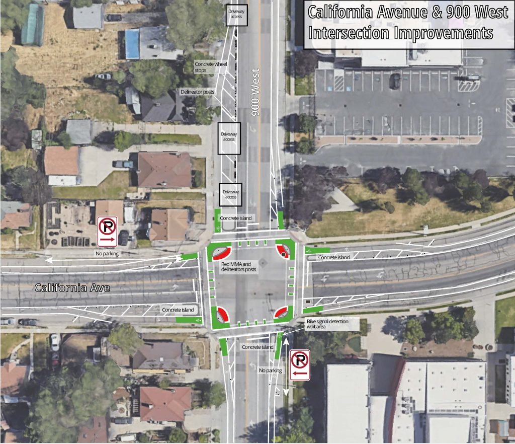
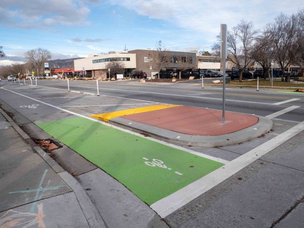
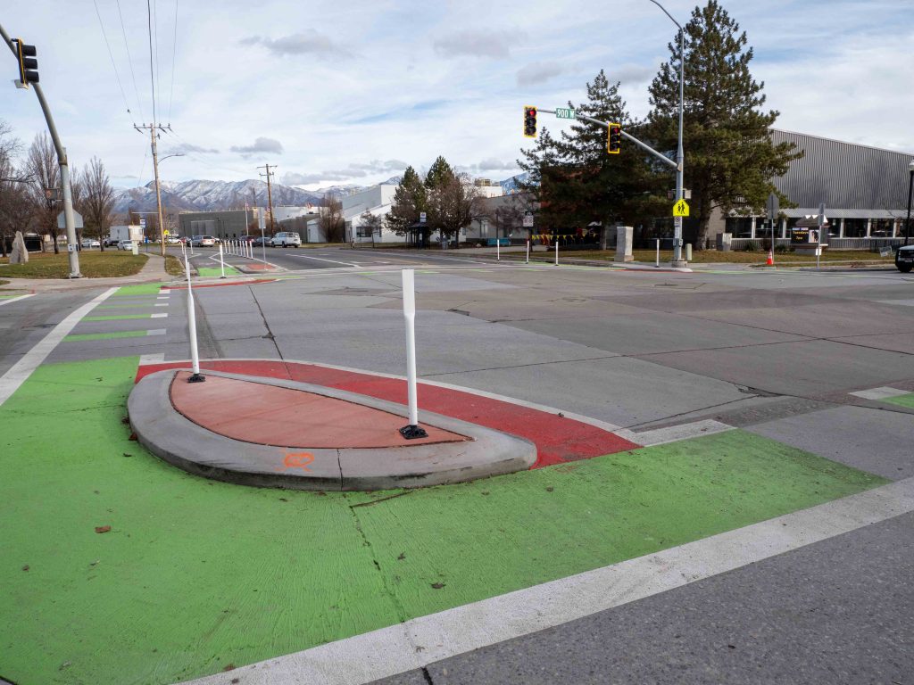
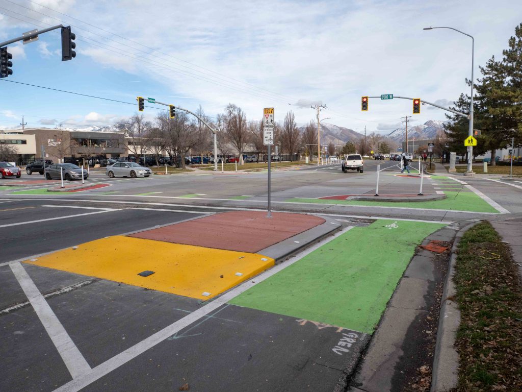
The redesigned intersection now features pedestrian safety islands, which provide safe waiting areas for people crossing the street, and corner turning islands that help reduce vehicle speeds and enhance visibility. Additionally, intersection crossing markings were added to guide pedestrians and cyclists, ensuring they are clearly visible to motorists. These design elements work together to shorten crossing distances, create protected queuing areas, and slow down turning vehicles, significantly improving safety for families and children traveling to local destinations.
Project information
Public Input
Public Input
Below you’ll find a summary report from our first round of public input, the new report on the concept design, letters of support from Glendale Community Council and other resources.
Frequently Asked Questions
What changes are being proposed?
Reducing vehicle speeds and improving safety for people walking and riding bikes, especially children and families, are priorities for this project. To address this, the City is proposing to add pedestrian safety islands and corner islands that separate vehicle traffic from all others at the intersection – a design also referred to as a protected intersection. We are also exploring the use of paint and posts to aid the functionality of this design. See the proposed concept design for details.
How will these changes improve safety at this intersection?
The new design proposes to add pedestrian safety islands, corner turning islands, and intersection crossing markings. These new elements help to shorten crossing distances, create additional protected queuing areas for people walking and biking, and slows turning vehicles while improving motorists’ line of sight with people using the crosswalk and bike crossing. Intersection crossing markings for bikes provide directional guidance and help visually indicate to motorists where bikes will be crossing.
Will this project impact current vehicle lanes?
To add the pedestrian/bicycle safety islands, we need to remove existing dedicated right turn lanes and wide shoulders at the intersection. Right turns will be made from the through-lane, similar to other intersections in the City where separate right turn lanes aren’t provided. To better understand the impact of this change to motorists, the City reviewed traffic operations at the intersection (using pre-COVID traffic information). The project team found that motorists traveling during the busiest times of the day may experience a small increase in delay with removal of the right turn lanes.
Will this project improve vehicle delays or add left-turn arrows?
The goal of this project is to improve safety for everyone, particularly those most vulnerable. It was not funded or intended to address pre-existing vehicle traffic delays. However, the intersection was studied before changes were finalized in ordered to understand the impacts. Like many intersections throughout the city, the study showed that there was moderate delay during the busiest times of the day. We also studied the impacts of removing the right-turn lanes which was needed for this project. Because they are not a controlling movement, removing right-turn lanes had only a slight impact on how the overall intersection operates. However, the study showed that adding left-turn arrows would significantly increase overall delay to this intersection and likely create additional delays in the surrounding area. This is because adding left-turn arrows adds more time for the signals to complete their full cycle. Once the project is completed and people have had an opportunity to adjust their travel behaviors (typically this takes 3-6 months) we’ll continue to monitor this intersection and look for opportunities to improve operations.
Will there be other changes made to the traffic signals?
In summer of 2020, the City installed new traffic monitoring devices at this intersection and have been actively working to optimize traffic operations and pedestrian crossing safety. The vehicle detection technology installed at this signal now allows the City’s signal team to better optimize signal timings with the measured traffic volumes. With this new technology in place, the City will continue to monitor and analyze this intersection to determine if/what additional changes may be needed in the future.
Will the street be reconstructed?
No. Existing pavement, curbs, and sidewalk will not be replaced.
How did community input inform the proposed changes?
To better understand people’s experience using this intersection, the City surveyed residents in September 2020 and received over 200 responses. The project team also met with the Glendale Community Council and residents at the intersection to discuss the project. Feedback we received helped guide the changes being proposed.
Please see the community engagement section of the website for project survey reports and other community input we received.
Are speed reduction or other changes being made to other areas of California Ave or 900 West?
This project is focused on safety improvements at the intersection. However, feedback and analysis from the project may help inform plans and projects at other locations in the future.
How will this project be funded?
Funding for this project will come from the City’s Capital Improvement Program.
Will greenery/landscaping be incorporated into the design?
This project would not create additional park strip area. However, we are exploring opportunities to incorporate planters where possible. It’s likely that any greening and other aesthetic improvements would come later in coordination with the Public Lands Division who maintains landscaped areas.
How will emergency and maintenance vehicles access the intersection?
The proposed design changes to this intersection will be reviewed by all appropriate parties to ensure that maintenance and emergency vehicle access is not an issue.
Timeline
Timeline
Spring 2020: Project announcement
Fall 2020: Draft design
Fall 2022: Final design
August 2023: Construction begins
November 2023: Construction complete


