Overview
Each year, Salt Lake City resurfaces about 120 lane miles of road. This helps roads last longer and delays the need for full reconstruction. Resurfacing also protects the city’s investment in our streets and helps keep costs down.
Visit this webpage to see a map of this year’s planned resurfacing projects and to learn more about how the different treatments work.
2026 street resurfacing map
View the interactive map of planned 2026 resurfacing projects, including overlays, slurry seal, and chip seal locations across the city. This schedule is subject to change.
Learn about surface treatments
Surface treatments help keep Salt Lake City roads in good condition by protecting them from water damage and everyday wear. Depending on the road, these treatments can extend its life by many years at a much lower cost than replacing the road.
The Streets Division uses three main types: overlays, slurry seal, and chip seal.
Pre-treatment
Before any surface treatment, crews fix cracks and replace damaged spots on roads that are in fair condition. This prep work happens in the fall or spring before summer treatments begin.

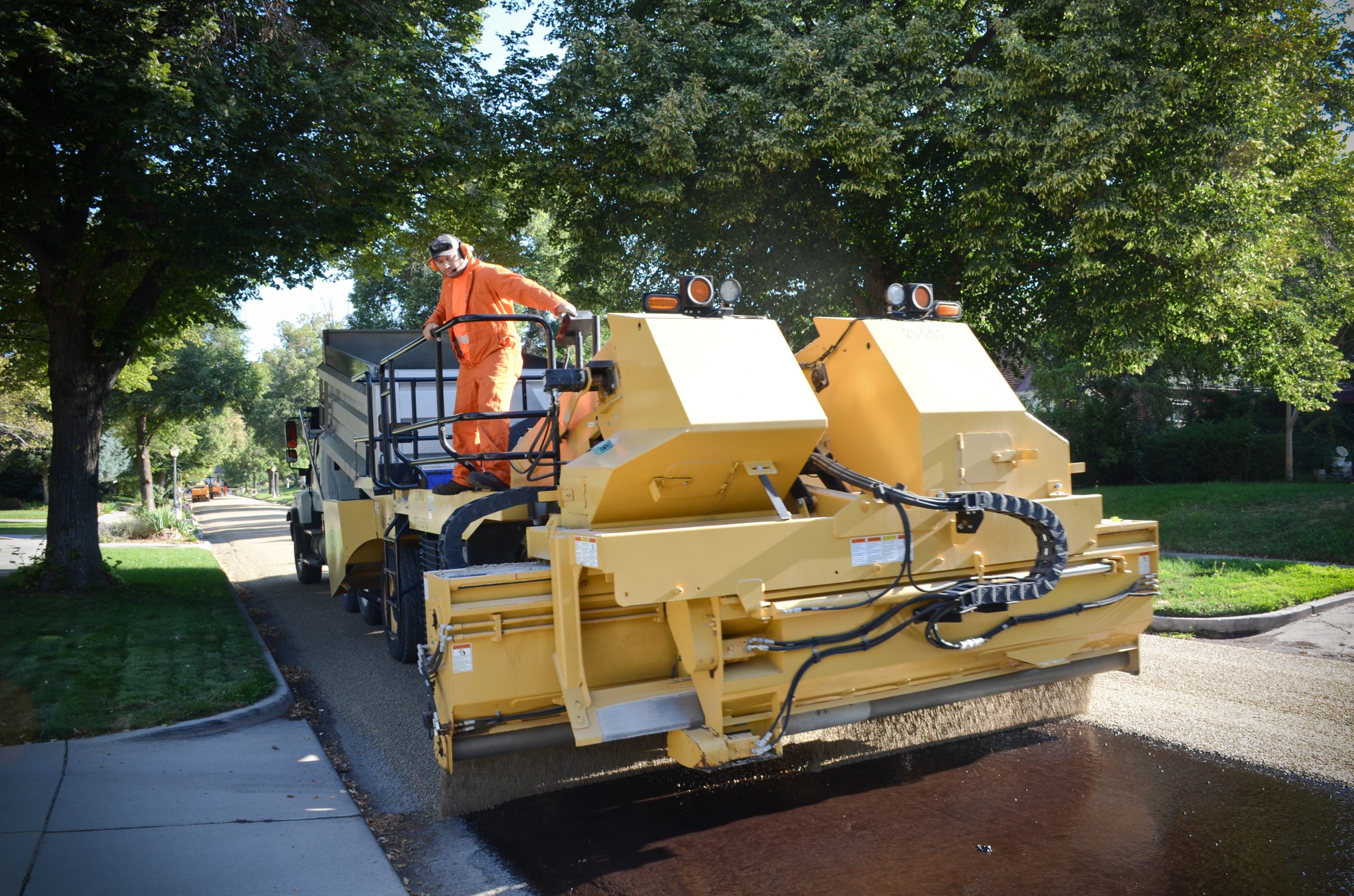
Overlays
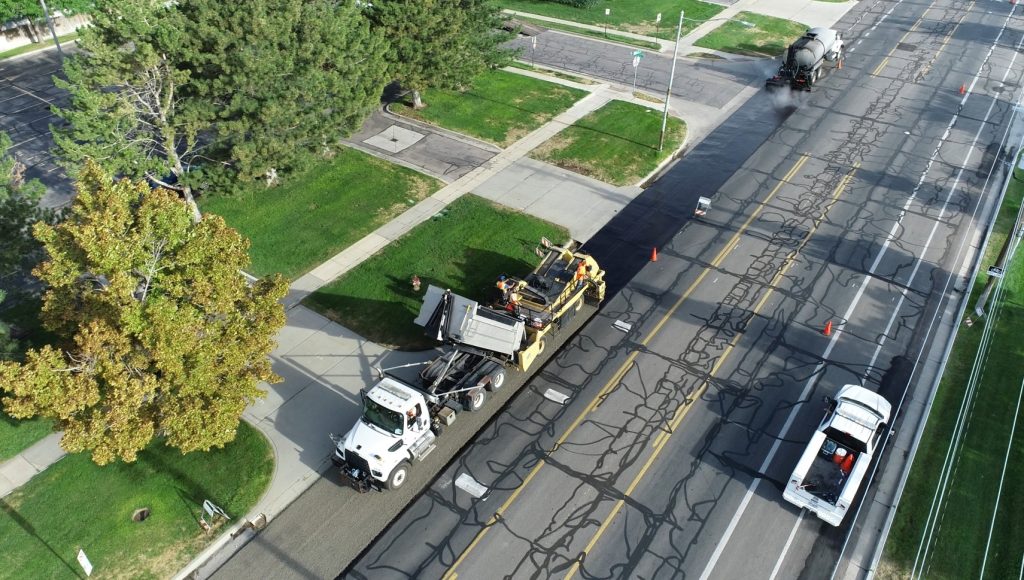
An overlay is when we grind off the top two inches of old asphalt and replace it with a new layer of asphalt.
Some streets in Salt Lake City are in such poor shape that we can’t use slurry or chip seal anymore, but they don’t yet need a full reconstruction. Without maintenance, these roads would quickly get worse and require costly rebuilding. The mill and overlay program lets the Streets Division repair these roads, preventing or delaying expensive reconstructions.
This improves roads enough that they can later receive chip or slurry treatments, helping them last much longer. It saves taxpayer dollars while improving the safety and quality of our streets.
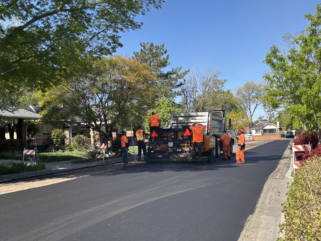
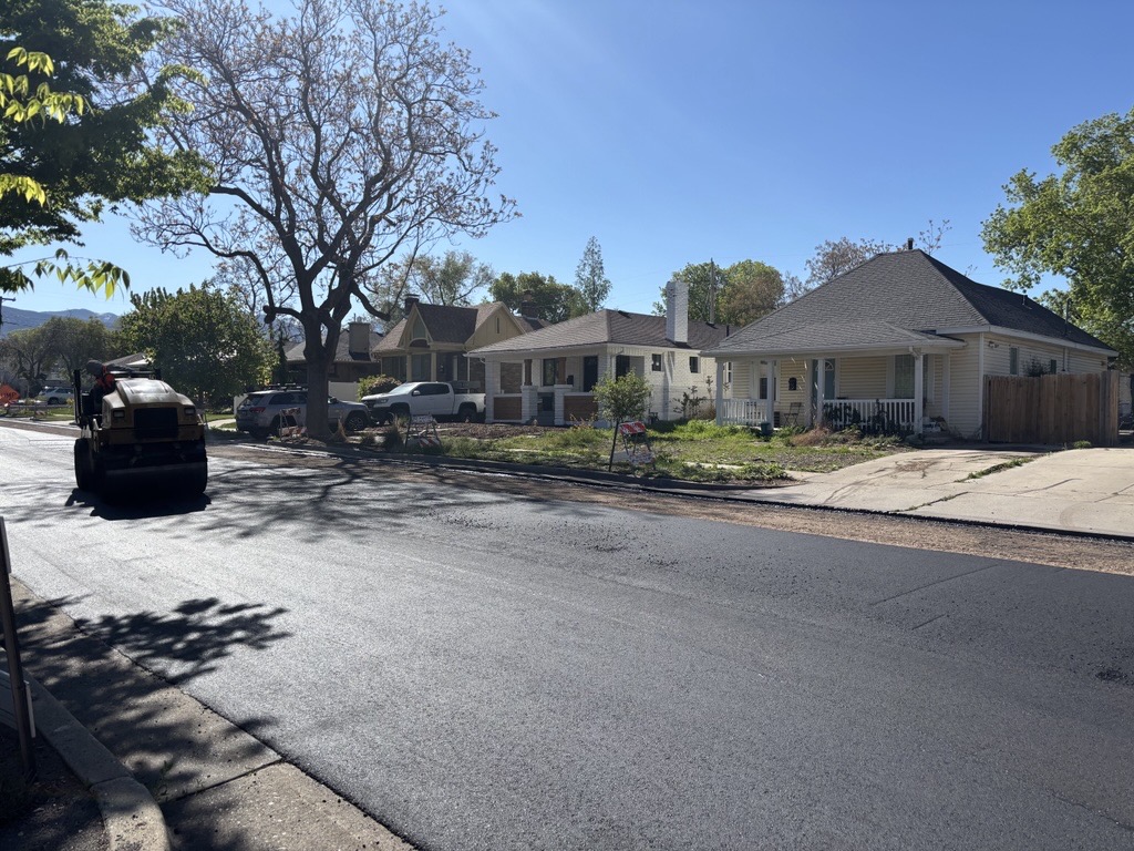
Overlay process
Overlay projects take about two days to complete. Roads are chosen a year in advance through the City’s selection process.
Day 1: Milling
- Residents and businesses get a 24-hour notice with the date and details of the work.
- “No Parking” signs are posted the day before.
- On the day of work, Cartow moves any vehicles left on the street to a nearby area.
- Crews set up traffic control signs.
- The top two inches of asphalt are milled off from curb to curb.
- The street is swept clean, and crews blow out gutters and driveways.
Day 2: Paving
- Traffic control signs are set up again.
- The road surface is prepped with tack.
- Fresh asphalt is laid down when it arrives.
- A roller follows to compact the asphalt.
- The surface is left to cool.
- Crews remove traffic control signs and clean up the area.
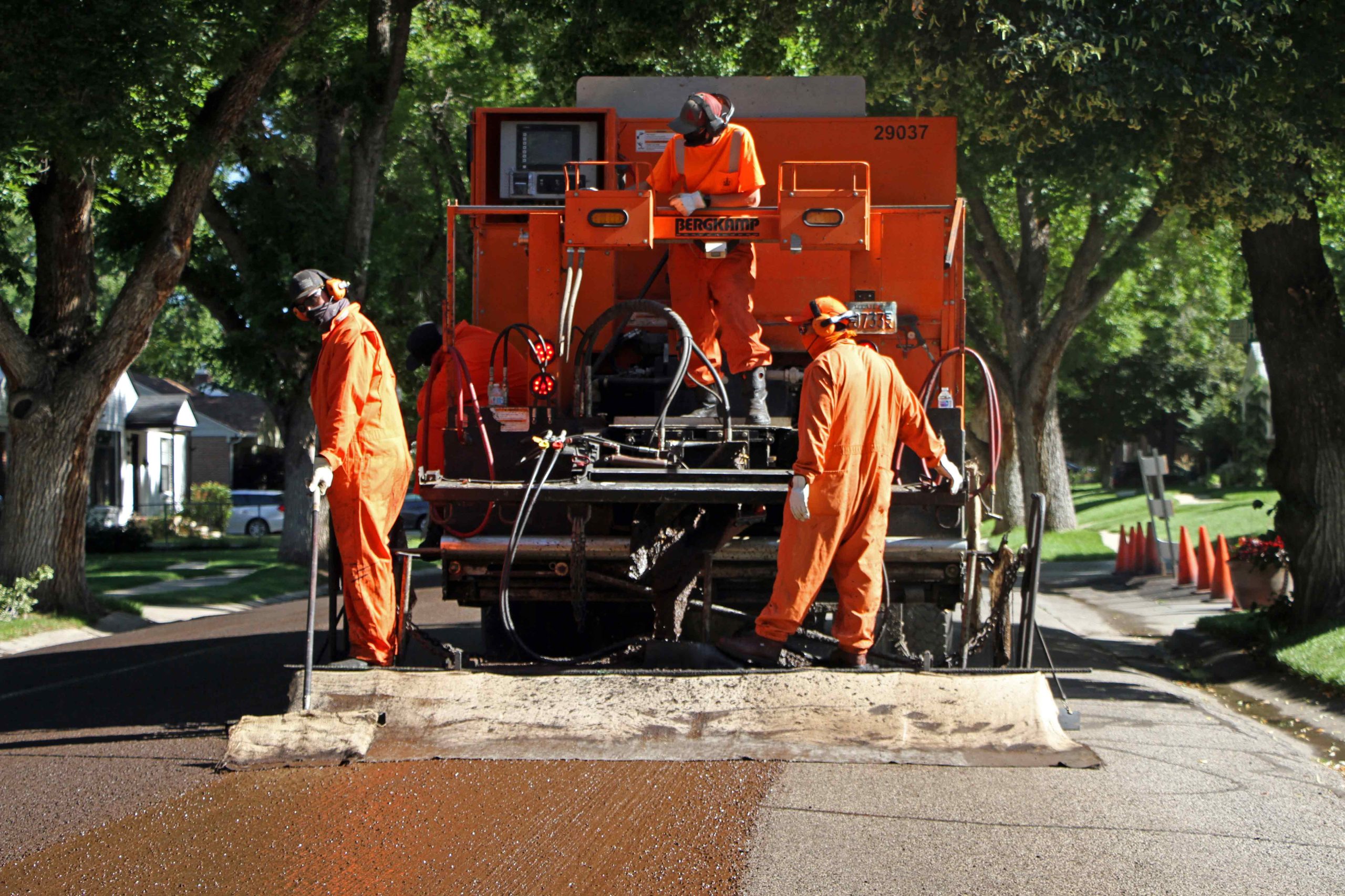
Slurry seal
A slurry seal is a thin layer made of water, emulsifiers, crushed rock, and other materials that is spread over the road surface. It is usually applied about three years after new asphalt is installed to help the road last longer.
Slurry seal process
- Residents and businesses get a 24-hour notice with the date and details of the work.
- “No Parking” signs are posted the day before.
- On the day of work, Cartow moves any vehicles left on the street to a nearby area.
- The road is closed and cleaned with street sweepers.
- A special truck applies the slurry mixture across the road.
- The surface dries in just two to four hours, so the whole project is usually done in one day.
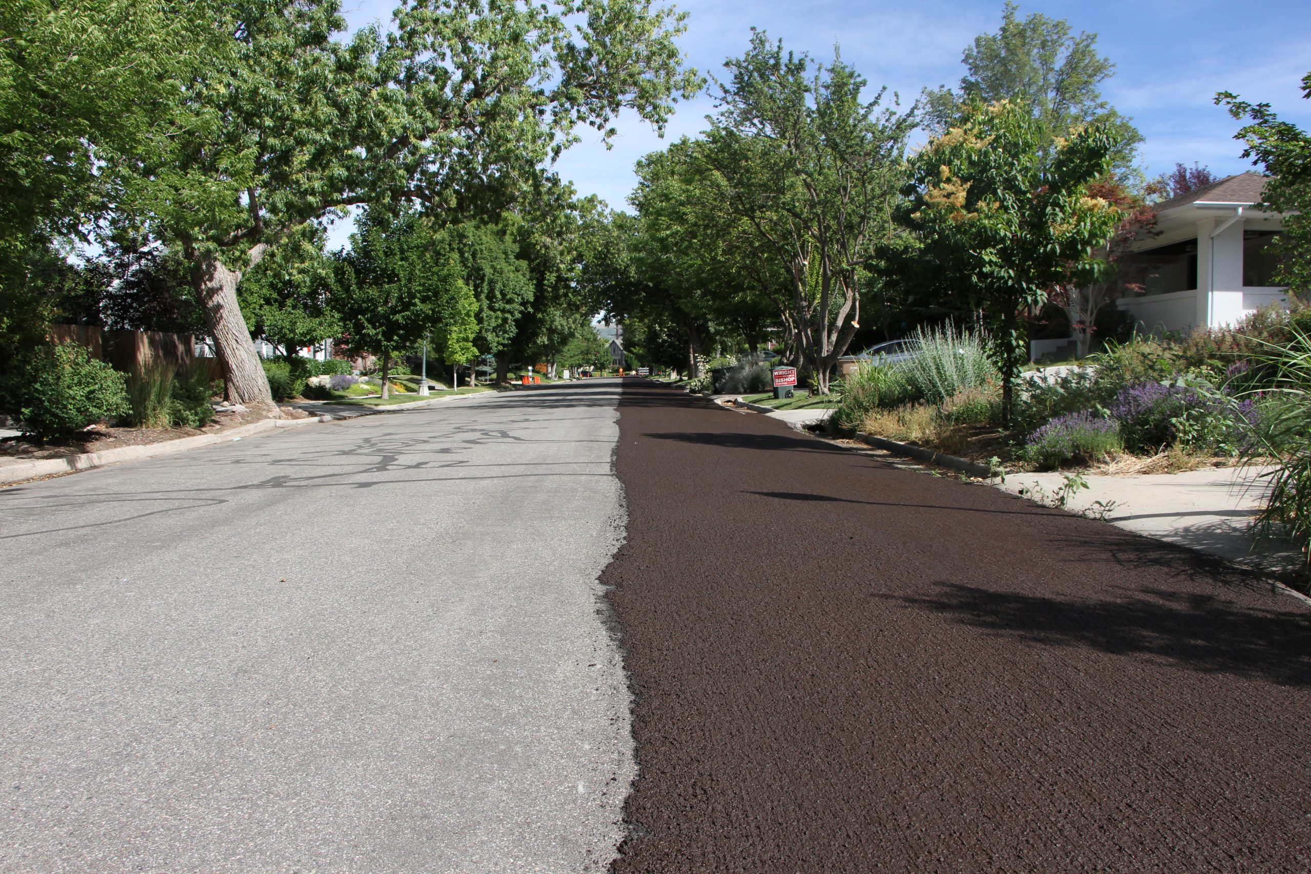
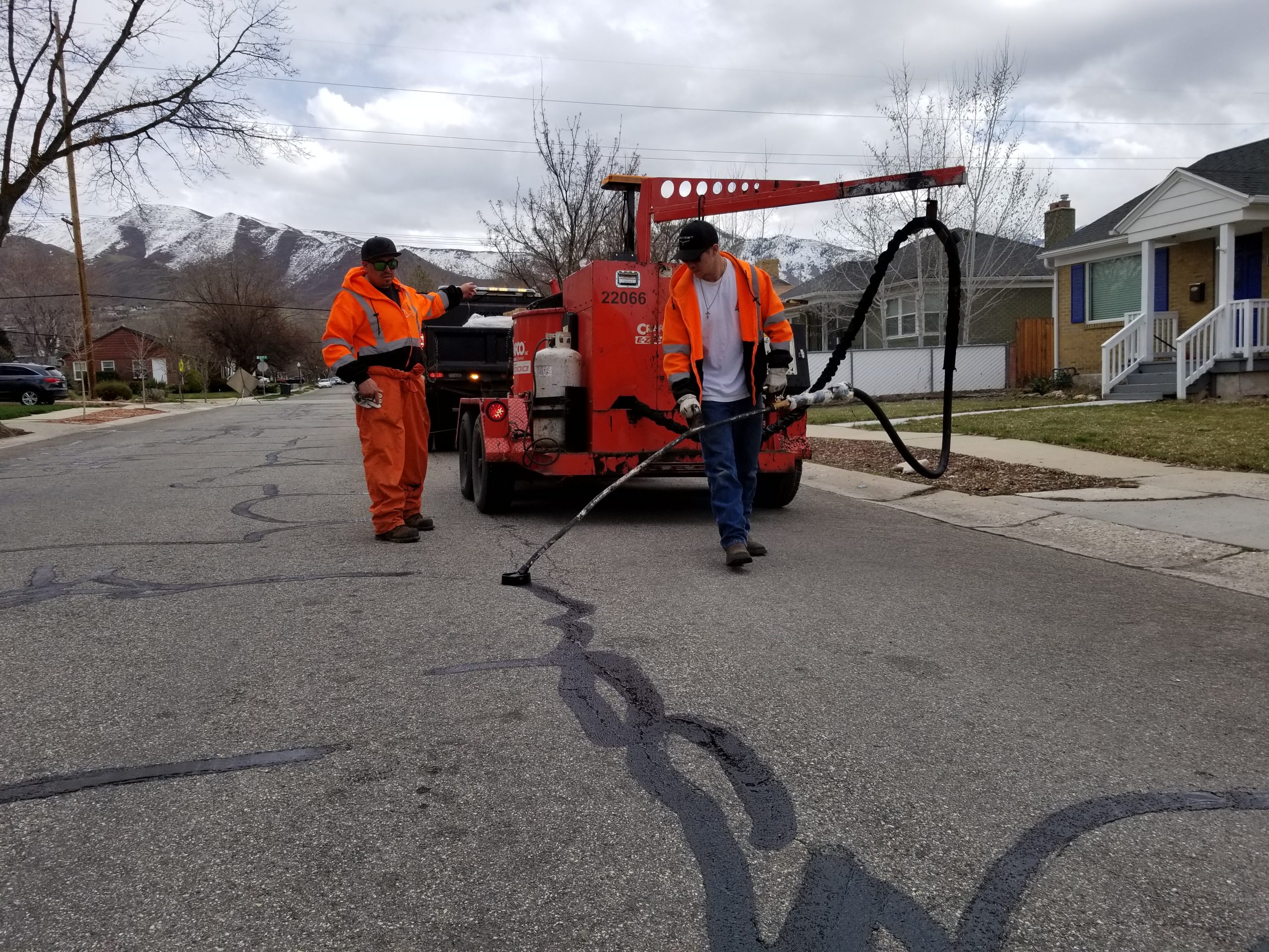
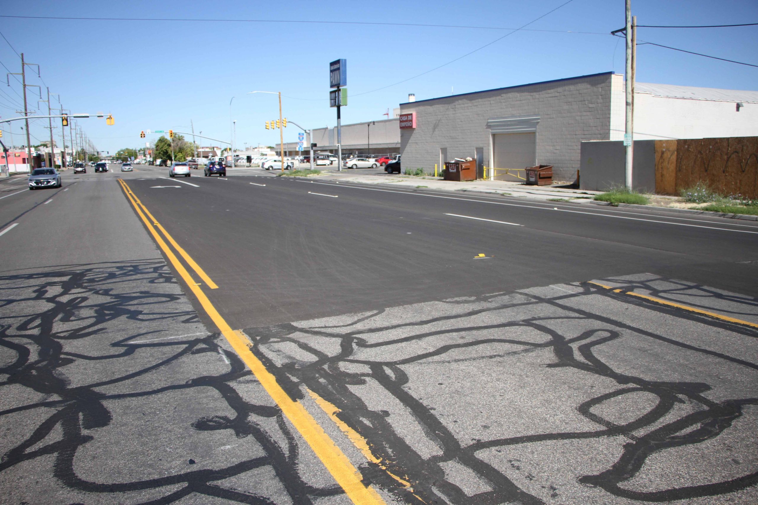
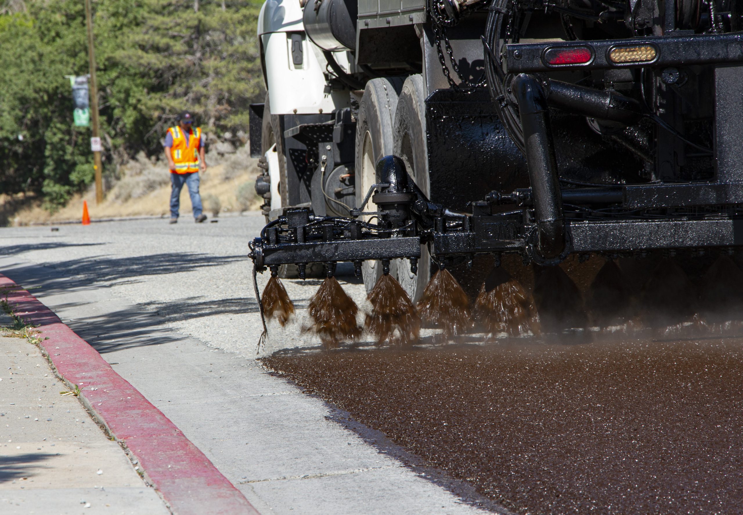
Chip seal
Chip seal is a two-day process that combines a layer of asphalt with a layer of fine aggregate.
Chip seal process
Chip seal is a road treatment that takes a few days and involves several steps:
- Residents and businesses get a 24-hour notice with the date and details of the work.
- “No Parking” signs are posted the day before.
- On the first day, Cartow moves any vehicles left on the street to a nearby area. The road is then swept clean.
- A truck sprays oil onto the road surface.
- Another truck spreads small gravel (“chips”) over the oil.
- Rollers press the gravel into the road.
- Sweepers clean up any loose gravel.
- The road is reopened while the treatment sets for one to two days. During this time, please drive 15 MPH.
Then comes the fog seal:
- The road is closed again, and another thin coat of oil is added. This helps the chip seal last longer and gives the road a clean, black finish.
- Once dry, the road reopens to traffic.
Final steps
After treatment, new road markings are painted. Most are replaced as they were, but sometimes the Transportation Division updates the striping to improve safety or traffic flow.
Frequently asked questions
Expand to view questions and answers
What are my responsibilities during a surface treatment?
- Do not park on the street from 7 a.m. to 3 p.m. until the “No Parking” signs are taken down.
- Turn off sprinklers so they don’t water the street on the day of the surface treatment.
- Stay out of the construction zone.
- Follow temporary speed limit signs, if posted.
My vehicle was towed off of my street. How can I find it?
If a vehicle is still parked on the street the morning a surface treatment is scheduled, it will be towed to a nearby street so the work can happen. We record the vehicle’s location and give the information to the police so it isn’t reported as stolen. To find out where your vehicle was moved, call 801-535-2345.
Will this interfere with my weekly trash pick up?
The Streets Division schedules the timing of the surface treatment with the Waste and Recycling Division. This will not interfere with weekly waste and recycling service.
How long will my street be closed?
This depends on the type of surface treatment, weather, and how complex the road is.
For slurry seal, which is a quicker, one-day process, the road usually closes at 7 a.m. and reopens in the early afternoon. Please don’t walk or drive on the fresh surface until it’s officially reopened—this helps prevent damage to your vehicle, your property, and the new road.
Chip seal takes place over several days, but the road will only be fully closed twice: once for the chip seal and once for the fog seal. Each closure starts at 7 a.m. and ends in the early afternoon. Between those two phases, the road stays open, but it may have loose gravel. During this time, please drive slowly—15 MPH or less—to stay safe and protect your vehicle.
Will I have access to my driveway during the surface treatment?
Streets will work to minimize disruption to residents and businesses and you will be notified in advance if access will be restricted. If you have special needs, please call 801-535-2345.
Will you be reconstructing the street?
No, a surface treatment is not the same as a full road reconstruction. Surface treatments are used to extend the life of the existing road. This helps delay the need for a full rebuild.
A full reconstruction is much more expensive and takes a lot more time. It involves removing and replacing all the asphalt—and sometimes even the road base, curbs, gutters, and sidewalks. Surface treatments are quicker, more affordable, and less disruptive for drivers.
If my street is receiving a surface treatment this year, does that mean it’s going to be reconstructed soon?
Probably not. If your street is in good enough shape to receive a surface treatment, then it’s likely that it isn’t near the top of the list for a full reconstruction.
My street looks to be in really poor condition. Will it be resurfaced soon?
Probably not. If a street is in really bad shape, it will eventually need a full reconstruction. Putting a surface treatment on a street with severely damaged asphalt doesn’t help much and won’t extend its life. It would also waste public money since the surface treatment would be removed when the road is rebuilt anyway.
Why are surface treatments rescheduled?
Surface treatments are usually rescheduled for one of two reasons: bad weather or equipment problems. These treatments need warm, dry weather to work properly, but sometimes a summer storm can delay the work. Other times, our equipment may break down. If either of these happens, we’ll leave a notice on your door and let you know when the work will be rescheduled.
Why does the City use three different types of surface treatments?
Overlay, slurry seal, and chip seal are used for different types of roads based on their condition and usage factors. If the road is in really bad shape, the City is sometimes able to do overlay rather than a road reconstruction. The City uses a chip seal if it’s in poor to decent shape. For roads that are in fair or good condition, a slurry seal is a better choice.
My road was reconstructed last year. Why is the City already working on it again?
The best time to apply a surface treatment is one to two years after a road is built. This helps seal the road and keep water out, which can damage the asphalt over time. Doing this early on gives the road the best chance to last longer.
How does the City determine what roads receive a surface treatment?
The City picks streets for surface treatment based on several factors, including their condition (called the Overall Condition Index), the type of road (major, minor, or neighborhood), how cost-effective the treatment is, and whether the road is a good fit for it.
Funding

Increased pavement maintenance is one of the projects funded through Funding Our Future sales tax.
Contact us
Contact the Streets Division by:
Phone: 801-535-2345
Report a pothole by selecting the button below: