Overview
Livable Streets is a community-driven program that helps calm traffic on Salt Lake City’s neighborhood streets so they’re safer, quieter, and more enjoyable.
Background
The City created a data-driven, equitable process to prioritize areas most in need. Salt Lake City was divided into 113 zones, ranked by crashes, traffic speeds, access to community resources, and socioeconomic factors. This analysis identified 403 miles of candidate streets—City-owned streets with three or fewer lanes and speed limits of 30 MPH or less.
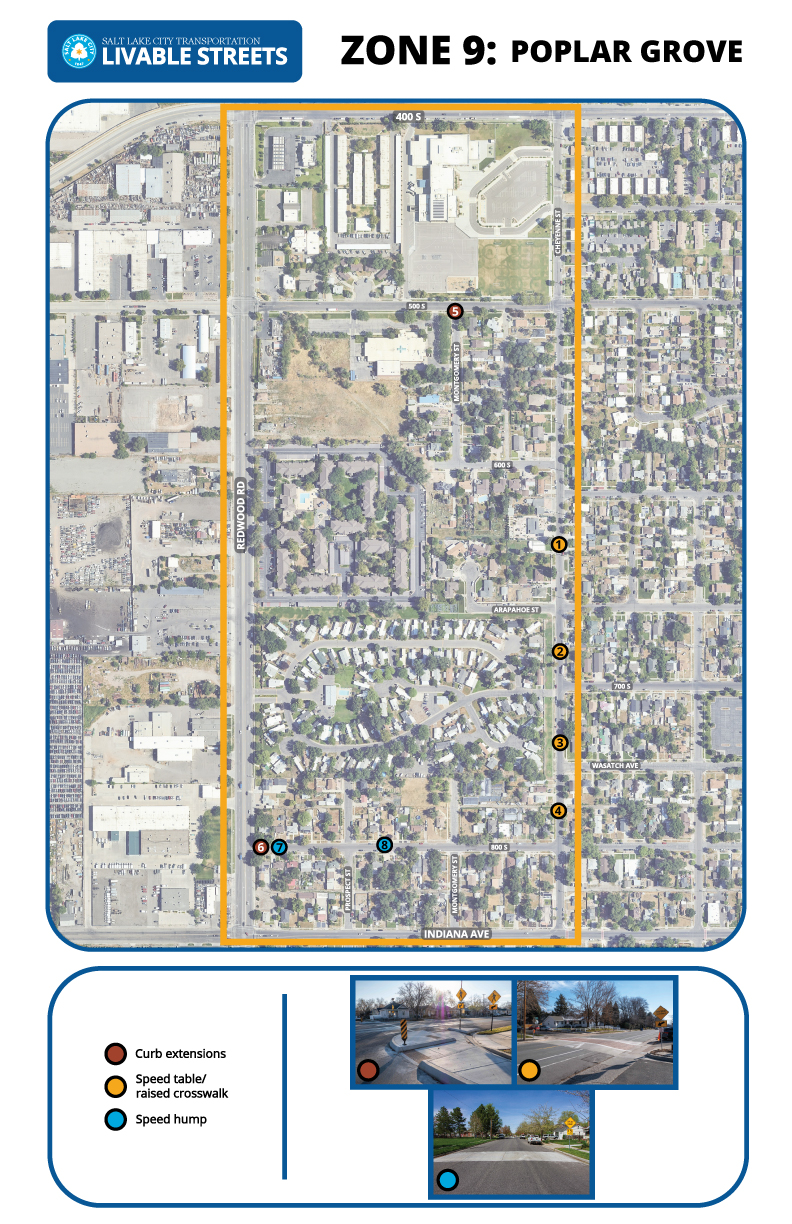
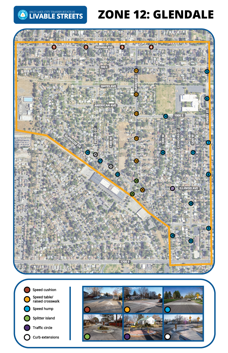
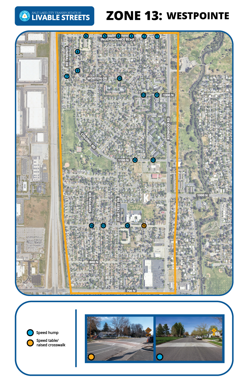
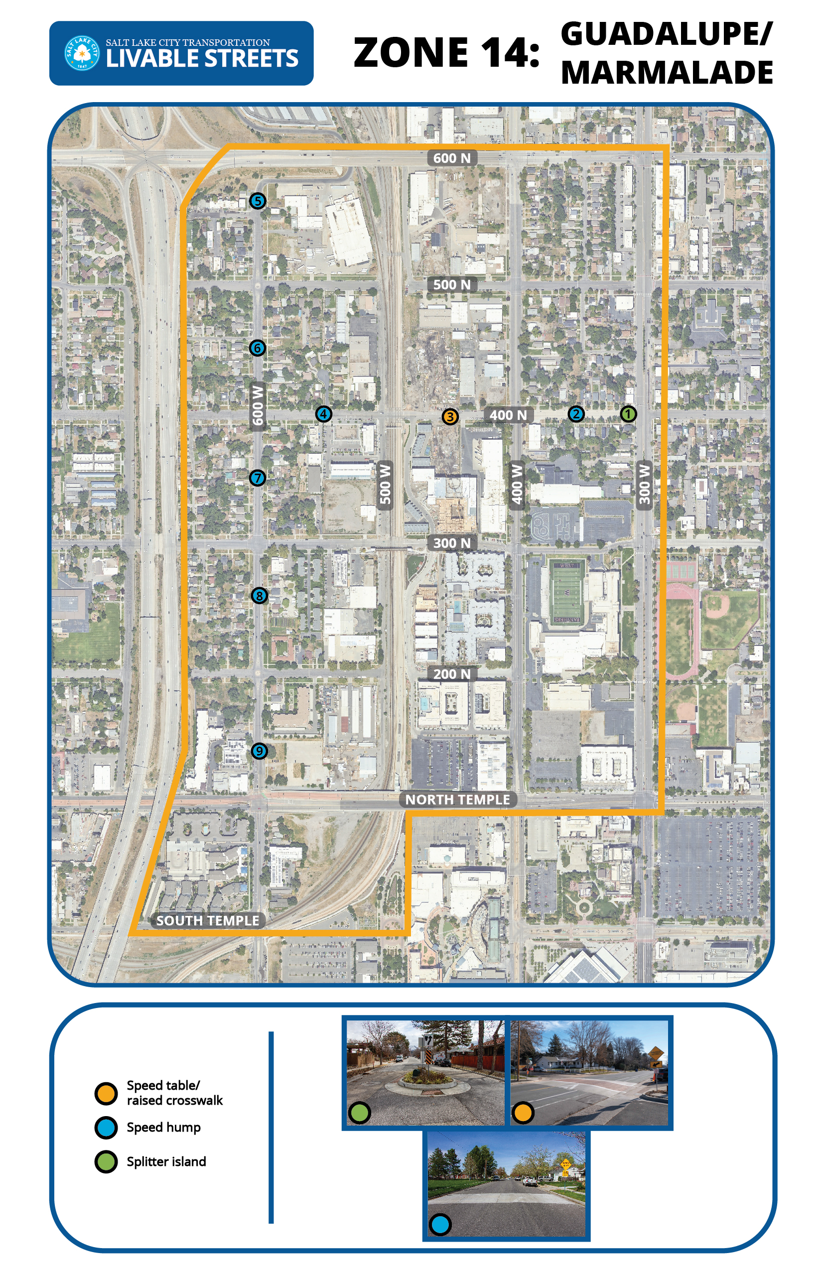
Traffic calming helps slow down cars and improve safety using tools like speed humps, traffic circles, and curb extensions, as shown in the City’s traffic calming toolkit.
Community input is key to developing effective plans. We focus on gathering feedback from a wide range of residents to ensure each plan reflects neighborhood needs and concerns.
Zones under construction
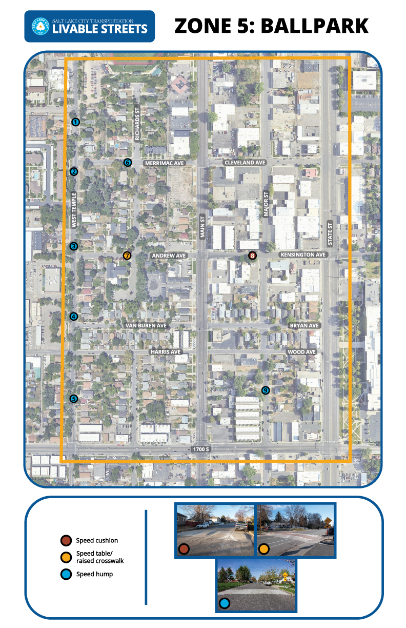
Zone 5: Ballpark
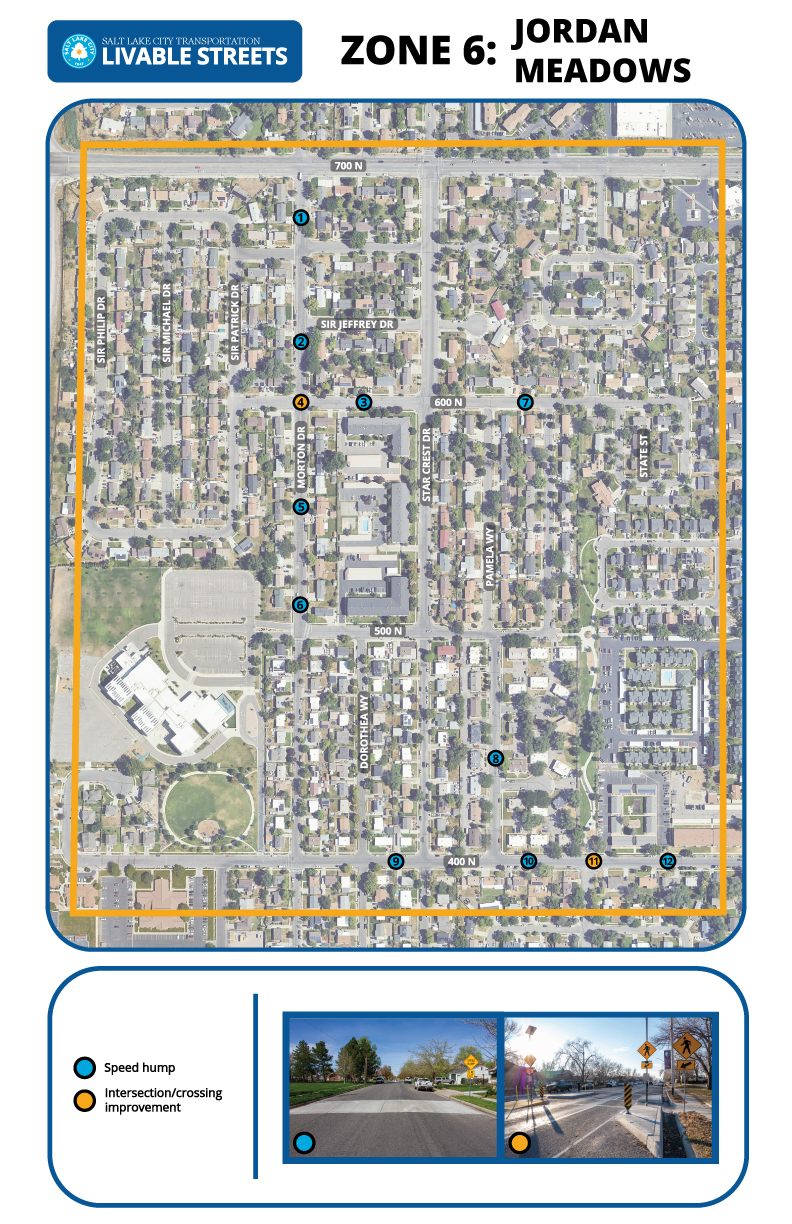
Zone 6: Jordan Meadows
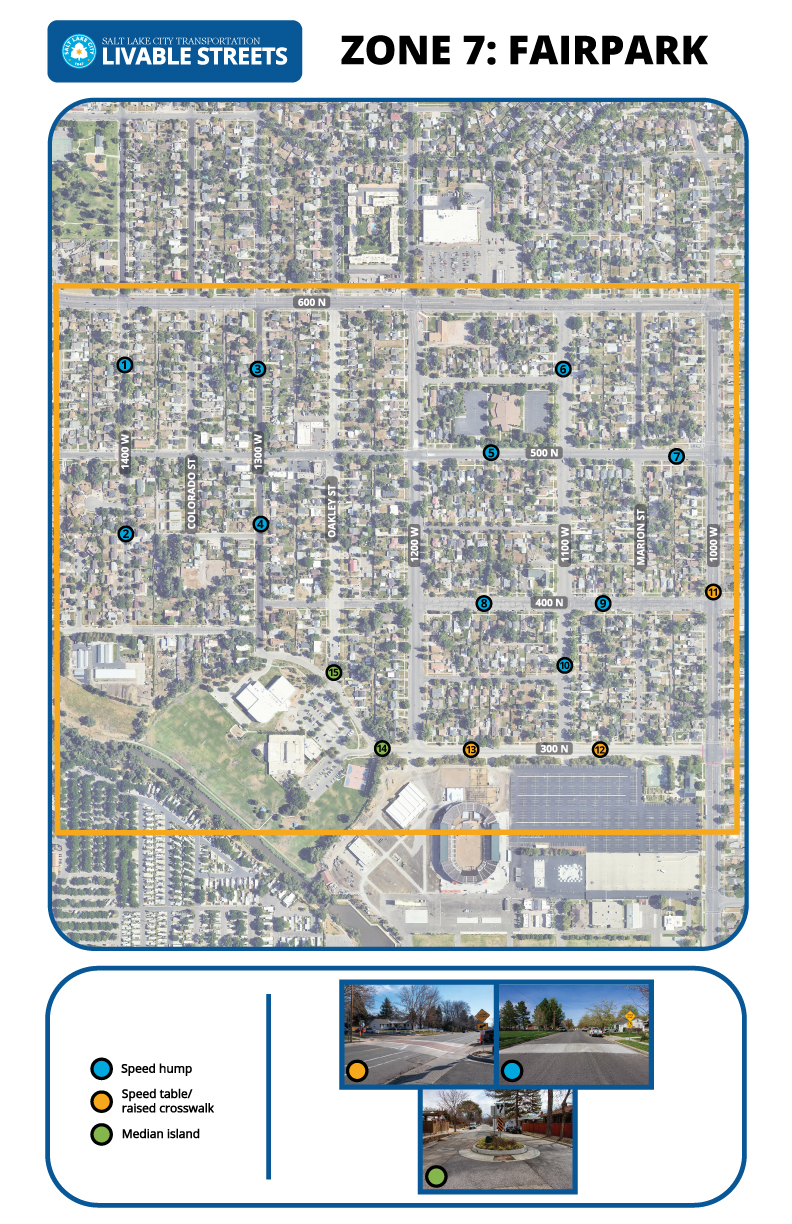
Zone 7: Fairpark
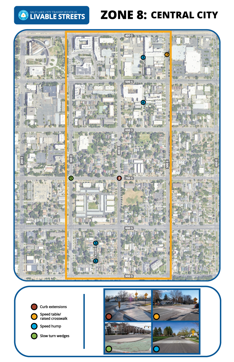
Zone 8: Central City
Zone 9: Poplar Grove
Draft neighborhood traffic calming plans
Zone 12: Glendale
Zone 13: Westpointe
Zone 14: Guadalupe/Marmalade
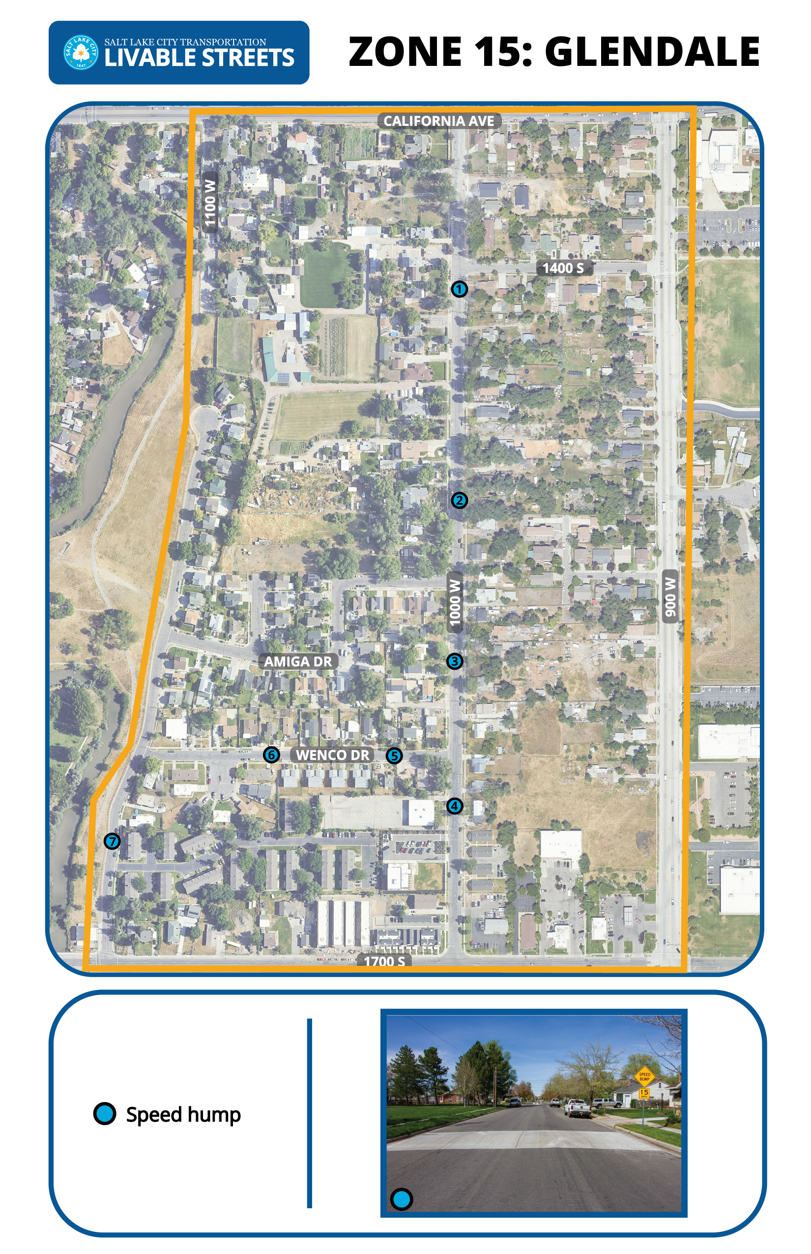
Zone 15: Glendale
Zone 16: Fairpark

More information
How to provide feedback
How to provide feedback
The success of the Livable Streets program relies on public participation. Your feedback will guide us to identify areas of concern and help us implement traffic calming measures that align with the needs of Salt Lake City residents. There are a variety of ways to provide input:
- Take the Livable Streets survey.
- Email [email protected]. Please provide a specific address in your email.
- Leave a voicemail at 801-535-6412.
- Attend community council meetings. When we’re working in your neighborhood, we’ll present at the community council. This is a great opportunity to talk with the team in person.
Frequently asked questions
What is traffic calming and livability?
Traffic calming is the deliberate slowing of traffic in residential areas through physical design. It is tool to combat speeding and other unsafe behaviors of drivers and aims to encourage safer, more responsible driving. Visit our traffic calming toolkit webpage to see examples of existing traffic calming around Salt Lake City.
We define livability as the factors that can contribute to a neighborhood’s increased quality of life. It can include both built and natural elements of the environment, community safety, accessibility, connectivity to goods and services, and the equitable distribution of all of these factors.
Is my street a candidate for traffic calming?
The Livable Streets Program identified 403 miles of candidate streets throughout Salt Lake City that meet the following criteria:
- Have a posted speed limit of 30 mph or less
- Are owned and maintained by Salt Lake City
- Have three or fewer travel lanes
- Are not part of a university campus or contained within a public park
- Are not slated for improvements through any other funded program
- Are adjacent to areas with a residential land use component
If your street meets these criteria, it is likely a candidate for traffic calming!
When will I see traffic calming implemented on my street?
Traffic calming plans will be developed for each zone in the order established in the Livable Streets program document. The City was prioritized into 113 zones and it is currently not known how many zones can be addressed by Transportation staff each year. We’re a small team and we’re working as fast as we can.
How and why were the zones prioritized?
The zones were prioritized based on crash, speed, and demographic data (the number of households within each zone, and the percent of those households recorded as living below the federal poverty line, identifying as Hispanic and/or non-white, and not having access to a car according to the most recent 2016 American Community Survey). They were prioritized to promote equitable distribution of transportation investment on neighborhood streets where it is most needed. For more information see the Livable Streets program document.
What are examples of “traffic calming measures?”
Examples of traffic calming measures include roundabouts, speed bumps, traffic circles, speed feedback signals and curb extensions. For a more in-depth review of the traffic calming measures we use, check out the Traffic Calming Toolkit webpage.
How is the Livable Streets program funded?
During 2022, the City Council approved $2M of Capital Improvement Program (CIP) funds for this program.
What is the background of this program?
For more background, read the Salt Lake City Traffic Management Program Document from 2003 or the University of Utah Effectiveness of Traffic Calming Measures in Salt Lake City document from 2019.
Who can I contact if I have questions?
Email [email protected] to ask questions or to provide feedback on any of the projects within the Livable Streets program
Livable Streets map
Click the zone information button to access individual zone webpages.