You are viewing archived content. This content is no longer updated and links may not work.
Overview
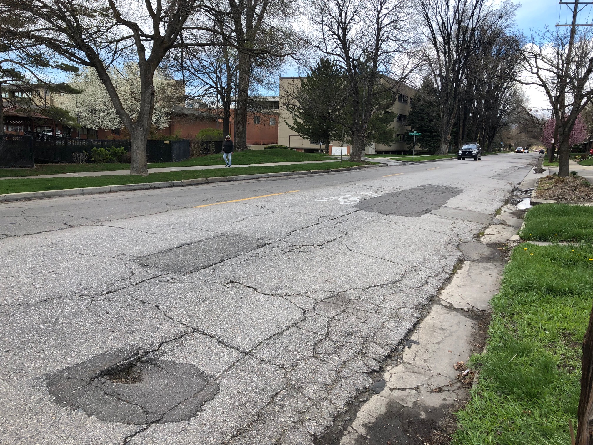
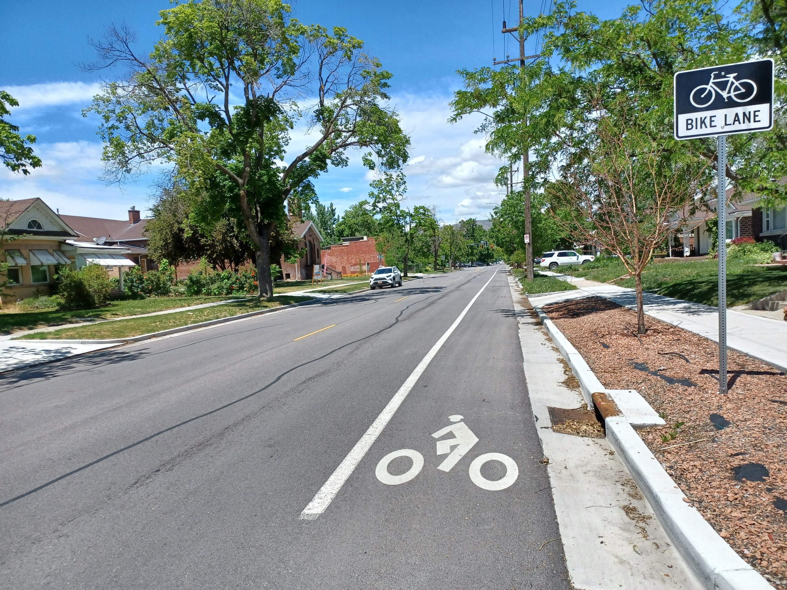
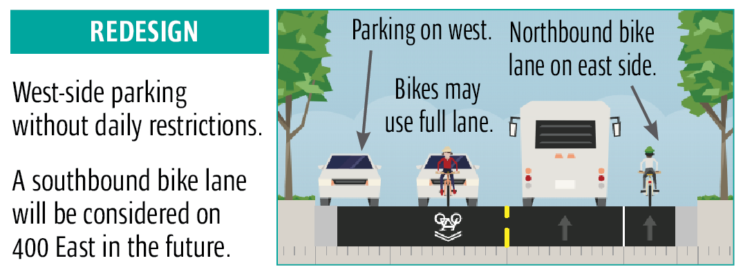
In 2020, 500 East from 1700 South to 2100 South underwent reconstruction, including pavement, sidewalks, and gutters. The project added a northbound bike lane, improved and consolidated bus stops, and introduced raised crosswalks. The design followed Salt Lake City’s Complete Streets Ordinance and incorporated public input. Bus stops were made ADA accessible, and shelters or benches will be installed. Construction concluded in November 2020.
Check it out!
The final engineering design was approved in December 2019. You can see what was designed for at specific locations along the street.
- 500 East engineering drawings
- Sidewalk sections to be replaced
- Driveway approaches to be replaced
- Location of 42″ aqueduct
- Raised crosswalks
- Bus stop concrete pads
- 500 East striping drawings
- Pavement markings (bike symbols, stripes, etc.)
- No parking locations
- Bus shelters, benches, trash cans, etc.
Street design
This is the same configuration as 500 East just to the north, between 1300 S and 1700 S.
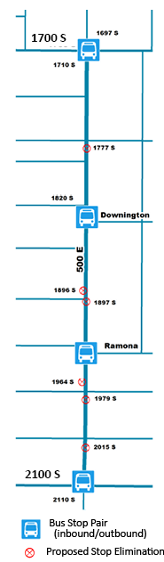
Bus stops
Bus stops were consolidated for faster service. All stops were made ADA accessible, with concrete pads and no curbside parking to block passengers from boarding. All stops will receive shelters or benches. Drawings of each bus stop show which stops are getting what. View a map of the bus stop location adjustments.
Raised crosswalks
Raised, brick-look concrete crosswalks now link bus stop pairs across 500 East. The crosswalks are designed for 30 mph travel, fire trucks, buses, and snowplows.
Raised crosswalks received about 70% support from our survey participants who live on the street, live nearby, commute on the street, etc. About 20% neutral, and around 10% strongly opposed – this same profile across demographics.
Unlike speed bumps, raised crosswalks are designed to be driven over without slowing — if you’re going the speed limit!
Additional information
April to May 2019: Community input on current street design. Read our report about what we heard or view the raw survey data. Spring 2019: Data collection and complete streets assessment. Crash reports, parking use, traffic volumes, master plan recommendations. May to June 2019: Community input on conceptual design. Read our report about what we heard or view the raw data. August 2019: Final conceptual design announcement. August to October 2019: Engineering drawings based on the conceptual design. Late Fall 2019: Final draft design available for viewing. See what the street will look like. December 2019: Final design. Spring 2020 to Fall 2020: Construction and completion of the project.Project history and timeline
Project history & timeline
This project is part of the Funding Our Future streets reconstruction bond approved by voters in 2018. Funding
Funding Our Future
Contact us
Email: [email protected]