You are viewing archived content. This content is no longer updated and links may not work.
Overview
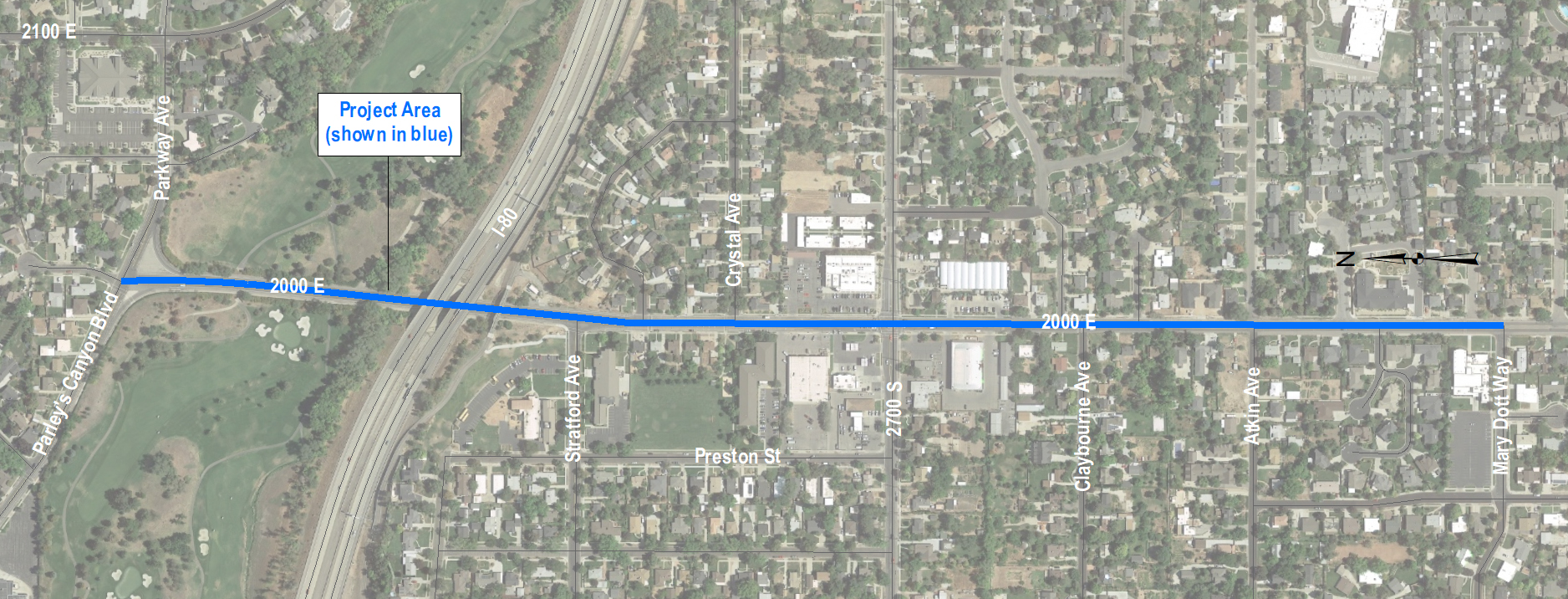
In 2020, Salt Lake City reconstructed 2000 East from Parleys Canyon Boulevard to the city limit with Millcreek. The pavement surface, sidewalks, curb, and gutter were upgraded, and a new street design to improve travel conditions for people walking and biking was also implemented.
Project map
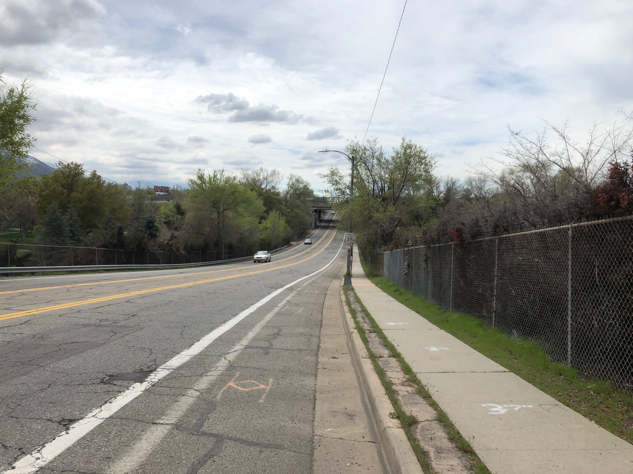
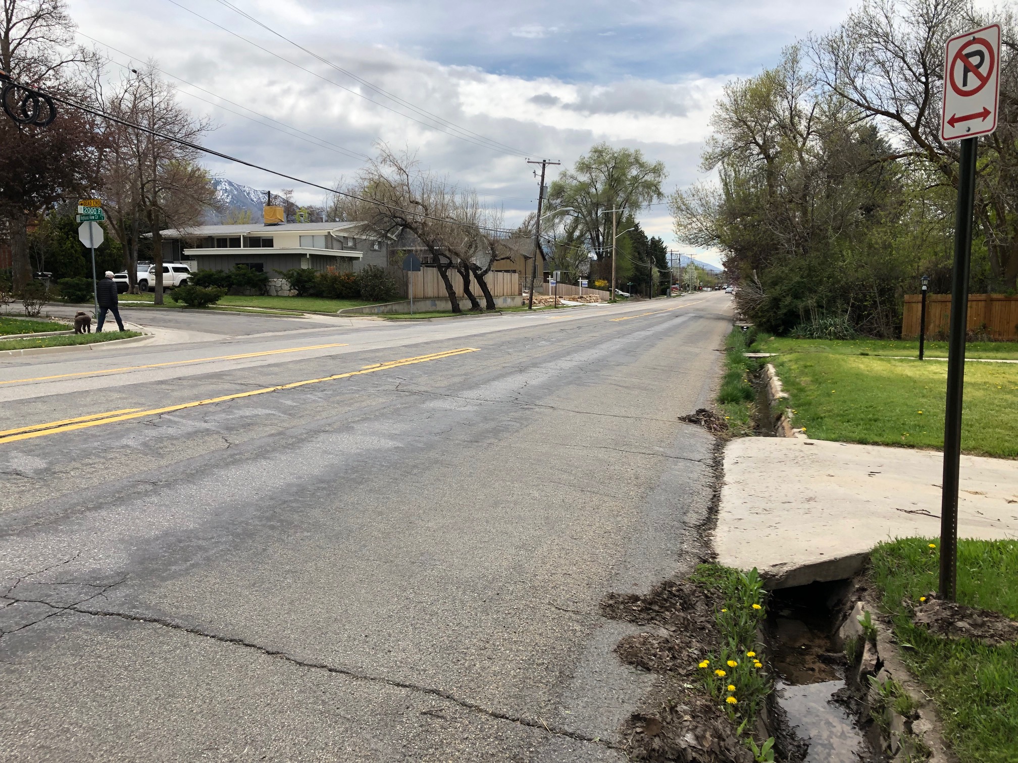
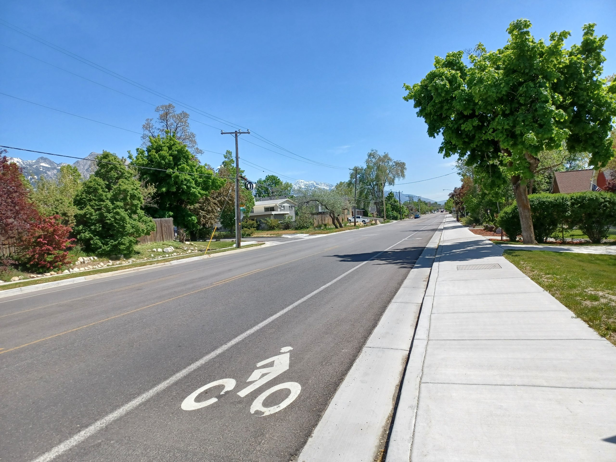
Before and after
Public input
Thanks to everyone who participated in the project survey and shared their ideas and comments on how to build the best possible project! The selection of the final street design was based on the following criteria:
- The Complete Streets Ordinance
- The Bicycle & Pedestrian Master Plan
- The City’s Climate Positive 2040 Plan
- Technical analysis
- Results of the project survey
- Sugar House Community Council presentation (August 7, 2019)
On the weekend of March 7, 2020, our team posted door-to-door notices for adjacent residents informing them about the upcoming project. A postcard was mailed to a larger geographic area to also inform residents in the surrounding neighborhoods.
Learn more
Intersection design options
Intersection design options
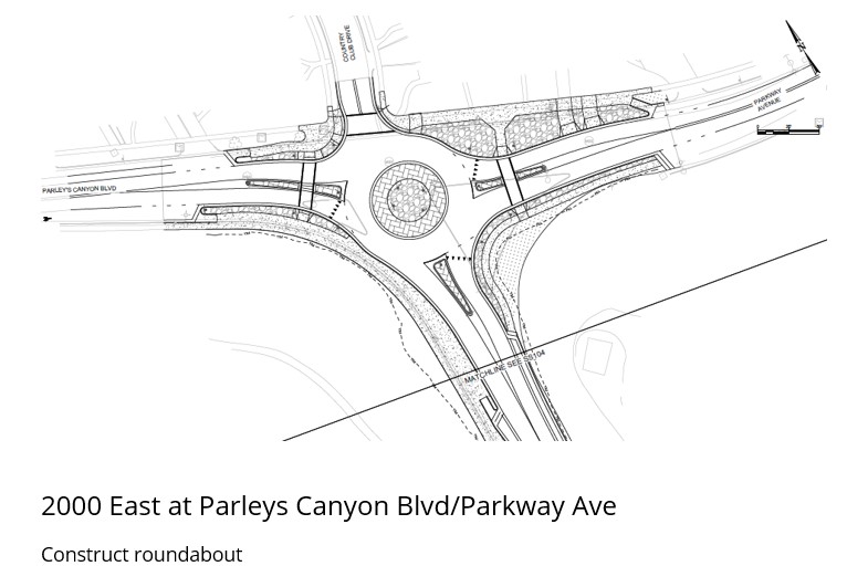
Thanks in part to the community feedback we received, the roundabout design was selected at the intersection of Parleys Canyon Boulevard and 2000 East as shown below.
Option A – Roundabout (selected for construction).
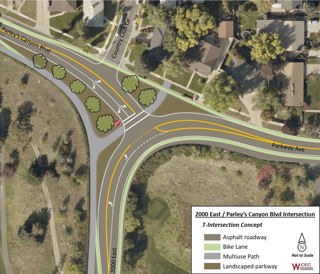
Option B – Realigned ‘T’ intersection (not selected).
Option C – No Change (not selected).
Roadway design options
2000 East northern segment (Parley’s Canyon Blvd to Stratford Ave)
Option A – Sidewalk Improvements and Buffered Bike Lanes (not selected).
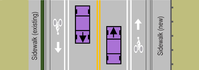
Option B – Parley’s Connector Trail (selected for construction).

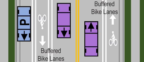
Central Segment (Stratford Ave to 2700 South)
Option A – Buffered Bike Lanes and On-Street Parking on the Westside of the street (selected for construction).
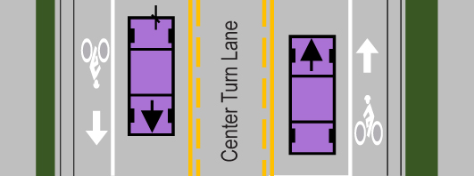
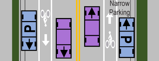
Southern Segment (2700 South to Mary Dott Way)
Option A – Center Turn Lane and No On-Street Parking (selected for construction).
Option B – Parking on One Side of the Street with Buffered Bike Lanes (not selected).
Option C – Narrow Parking on Both Sides of the Street with Narrower Bike Lanes (not selected).
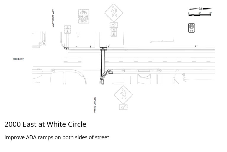
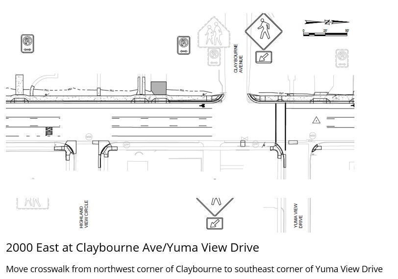
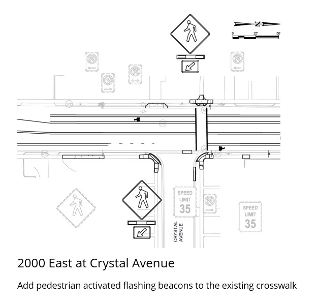
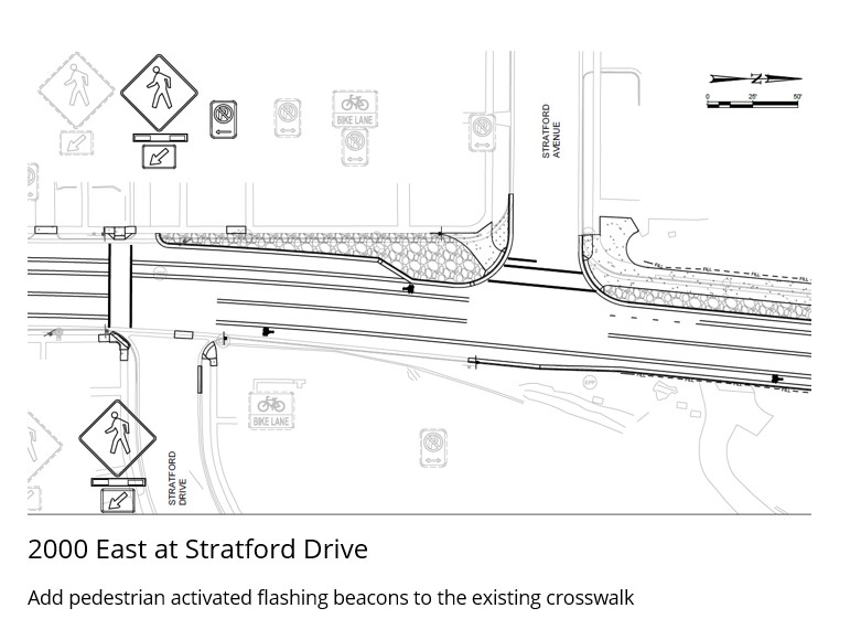
Final intersection improvements
Final intersection improvements
Funding
This $3 million investment was funded via impact fees and the 2018 voter-approved Funding Our Future Streets Reconstruction Bond.
Timeline
Summer 2019: Draft concept designs made available for public input
Fall to Winter 2019: Project team develops final engineering plans based on public input, safety data, and technical analysis
Early Spring 2020: Final design
Spring to Winter 2020: Construction
Contact us
Email: [email protected]