What’s a Neighborhood Byway?
Neighborhood Byways are quiet residential streets designed for safe and comfortable walking, biking, and rolling. With safer crosswalks, traffic calming, bicycle-friendly design, wayfinding signs, and better connections to destinations, these routes offer a pleasant alternative to busy roads.
Salt Lake City is building a network of people-friendly streets that makes active transportation an easy choice for everyday trips. Discover all the routes and learn more on the byways home page.
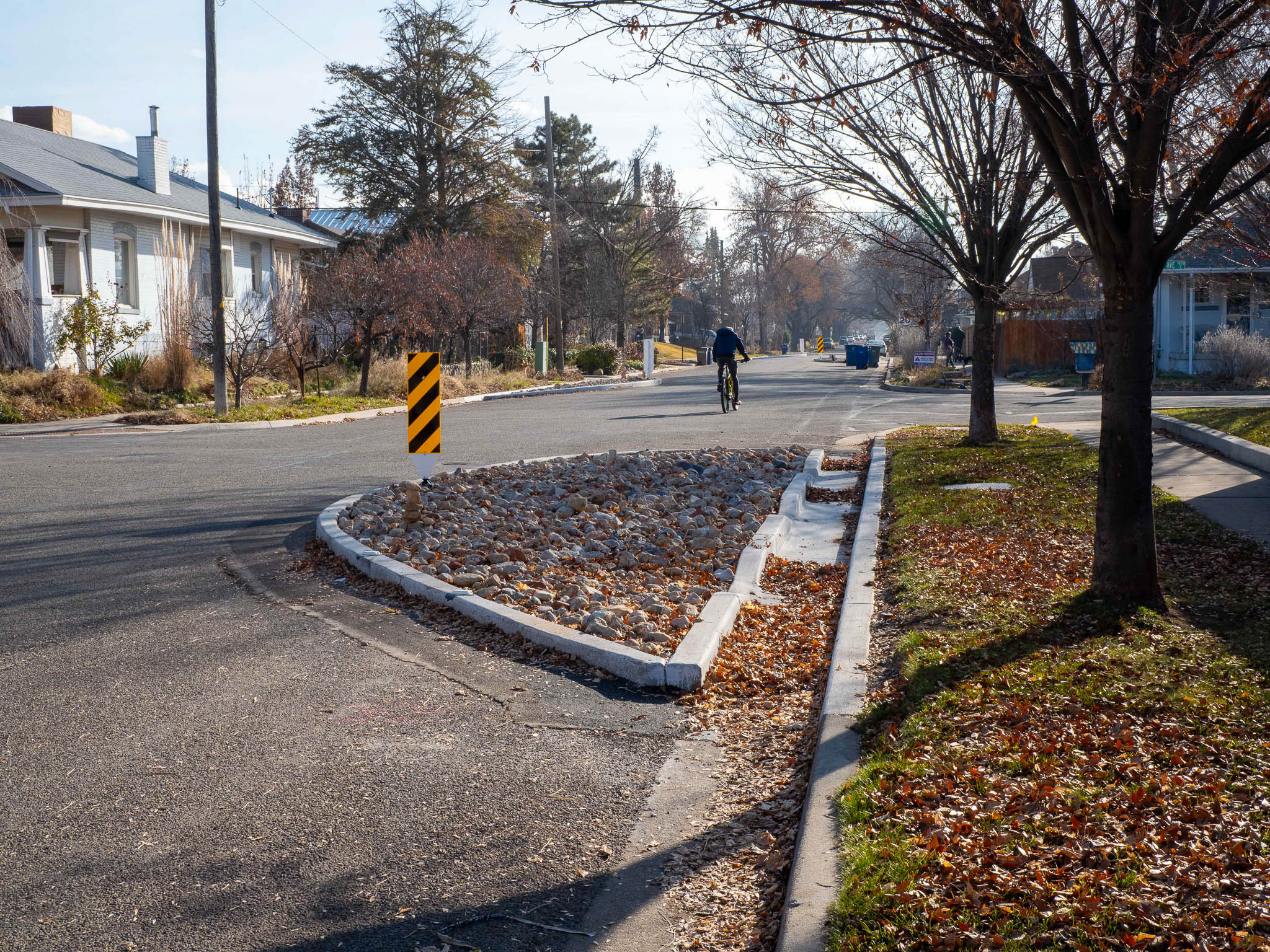
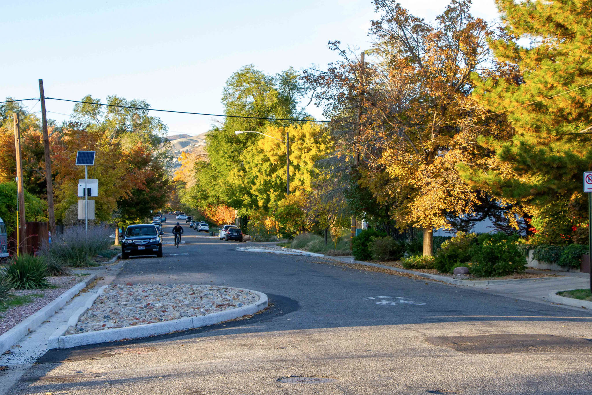
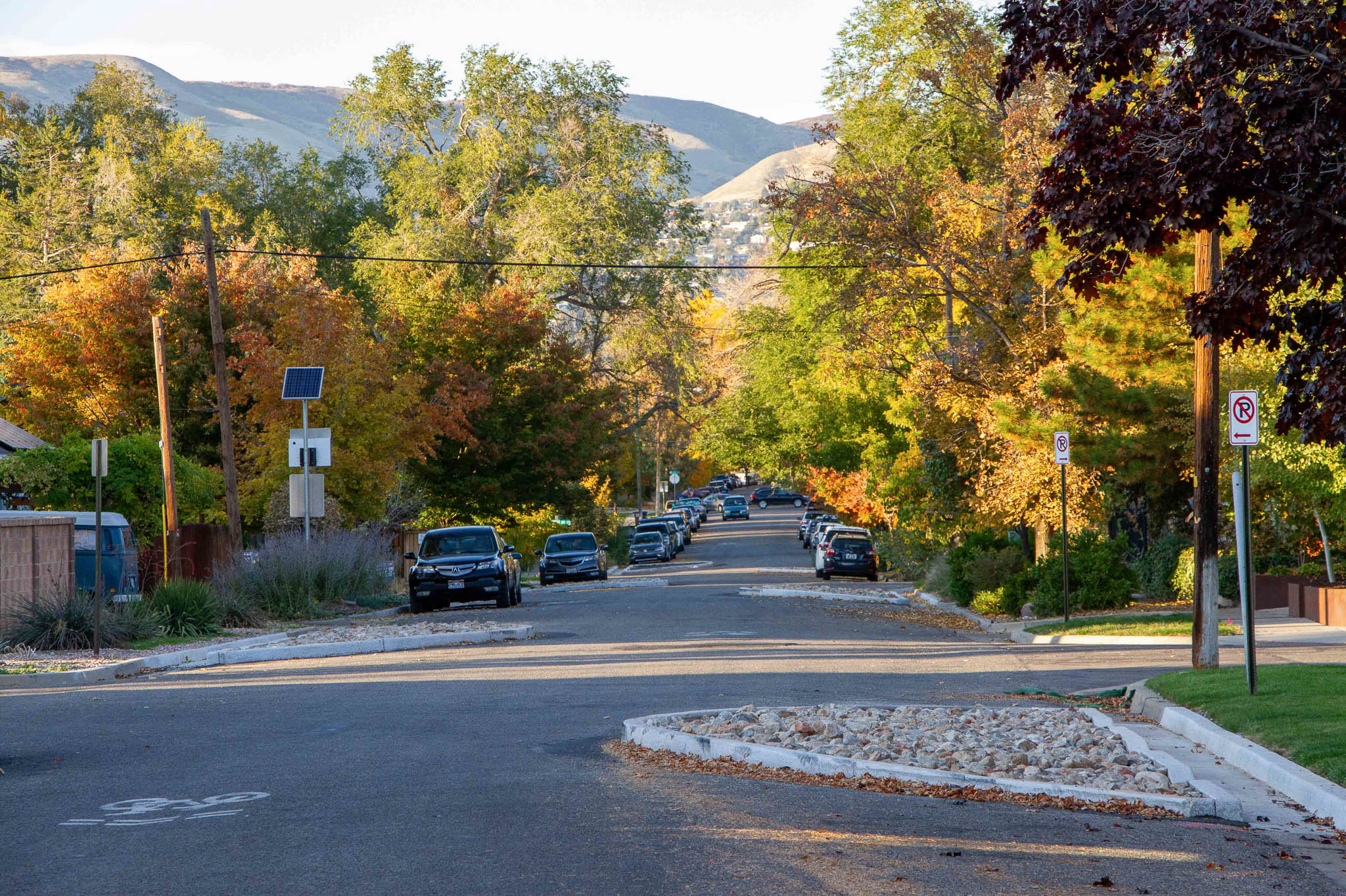
800 East
The 800 East Neighborhood Byway will run from 800 South to Salt Lake City’s southern boundary, connecting community destinations and the active transportation network.
In spring 2020, Salt Lake City launched the Stay Safe, Stay Active program, opening neighborhood streets for recreation during COVID-19. 800 East, from 800 South to 1700 South, was one of the most popular locations. This success highlighted the opportunity to transition temporary features into permanent improvements, supported by residents and the broader community, as part of the planned Neighborhood Byway.
Phase one of the Byway, from 1300 South to 1700 South, was completed in late 2023. It includes paired bulb-outs, traffic circles, and wayfinding signs.
Learn more
Street changes along these routes will be evaluated through a planning and public engagement process. Improvements may include: Neighborhood Byways are identified in the Salt Lake City Pedestrian and Bicycle Master Plan and are commonly located along streets with the following characteristics: You’ll still be able to easily reach your home. Neighborhood Byways make streets safe and comfortable for walking, biking, and rolling with children or pets. This may require traffic calming measures and minor street changes to slow vehicle speeds and reduce cut-through traffic, but access to your property will remain unchanged. Yes, vehicles are allowed, but Neighborhood Byway routes are improved for active modes of transportation such as walking and biking. No. Byways use traffic calming, signage, and pavement markings to create a shared street space rather than painted bike lanes. Byways typically have little to no impact on parking. In some locations, parking restrictions may be added within 30 feet of a crosswalk or stop sign to improve visibility—an approach known as “daylighting.” While parking is already prohibited in these areas by law, it’s often not signed or enforced. Daylighting helps everyone see and be seen at intersections, making the street safer for all users. Yes. Neighborhood Byways maintain full access for emergency vehicles and city services. When traffic calming is needed, we use speed cushions instead of traditional speed humps. These raised sections have cutouts wide enough for fire trucks and emergency vehicles to pass through at normal speed, while still slowing passenger cars.Frequently asked questions
What changes are considered along these routes?
How is a street chosen to be a Neighborhood Byway?
Will this affect access to my home?
Can I drive my car on a Neighborhood Byway?
Will bike lanes be added?
Will this affect on-street parking?
Will emergency vehicles, garbage trucks, and snow plows be able to use the street?
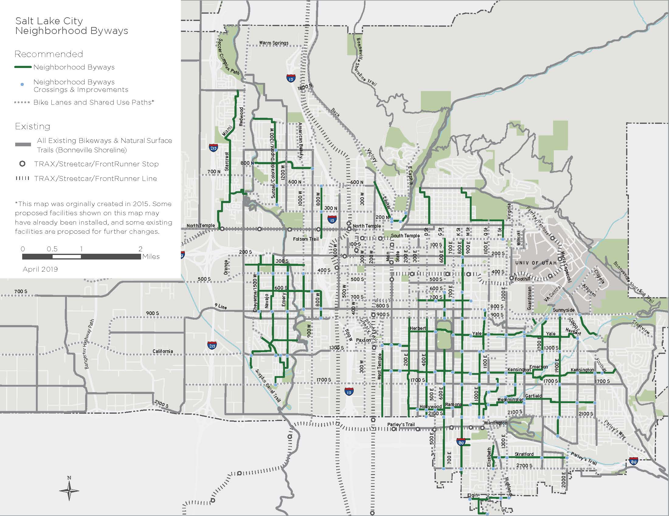
The following Byway routes were identified in Salt Lake City’s Pedestrian and Bicycle Master Plan in 2015.Citywide Byways Map
A better street for everyone
Take a closer look at the traffic calming features and design elements that make 800 East safer and more comfortable for walking, biking, and rolling.

Contact us
Have a question or want to stay connected?
Email: [email protected]
Subscribe to the SLC Moves newsletter to get email updates.