What’s a Neighborhood Byway?
Neighborhood Byways are quiet residential streets designed for safe and comfortable walking, biking, and rolling. With safer crosswalks, traffic calming, bicycle-friendly design, wayfinding signs, and better connections to destinations, these routes offer a pleasant alternative to busy roads. Salt Lake City is building a network of people-friendly streets that makes active transportation an easy choice for everyday trips. Discover all the routes and learn more on the byways home page.
The Kensington Byway
The Kensington Byway runs along Kensington Avenue from West Temple to 1500 East. A future phase—currently unfunded and without a set timeline—will extend the byway east through Wasatch Hollow Park to Foothill Drive. The Utah Department of Transportation (UDOT) recently installed a signalized crosswalk for people walking and biking at the intersection of Foothill Drive and Kensington Avenue. Learn more about the Foothill Drive Safety Project on the UDOT website.
More info
Planning study and public input
The documents below provide a deeper look into how the Kensington Neighborhood Byway came together—from what we heard during community outreach, to what we observed about current street conditions, to how that input shaped the final design. Together, they offer a snapshot of the planning process and the voices that helped guide it.
Timeline
Summer to fall 2022: Gather initial pre-design feedback and study the byway
Fall 2022 to spring 2023: Develop concept designs
Summer 2023: Announce preliminary designs, gather public feedback, and refine concept designs
Fall to winter 2023: Environmental study
Winter to summer 2024: Construction design
Fall 2024: Announce final designs
Spring to summer 2025: Construction
Street changes along these routes will be evaluated through a planning and public engagement process. Improvements may include: Neighborhood Byways are identified in the Salt Lake City Pedestrian and Bicycle Master Plan and are commonly located along streets with the following characteristics: You’ll still be able to easily reach your home. Neighborhood Byways make streets safe and comfortable for walking, biking, and rolling with children or pets. This may require traffic calming measures and minor street changes to slow vehicle speeds and reduce cut-through traffic, but access to your property will remain unchanged. Yes, vehicles are allowed, but Neighborhood Byway routes are improved for active modes of transportation such as walking and biking. No. Byways use traffic calming, signage, and pavement markings to create a shared street space rather than painted bike lanes. Byways typically have little to no impact on parking. In some locations, parking restrictions may be added within 30 feet of a crosswalk or stop sign to improve visibility—an approach known as “daylighting.” While parking is already prohibited in these areas by law, it’s often not signed or enforced. Daylighting helps everyone see and be seen at intersections, making the street safer for all users. Yes. Neighborhood Byways maintain full access for emergency vehicles and city services. When traffic calming is needed, we use speed cushions instead of traditional speed humps. These raised sections have cutouts wide enough for fire trucks and emergency vehicles to pass through at normal speed, while still slowing passenger cars.Frequently asked questions
What changes are considered along these routes?
How is a street chosen to be a Neighborhood Byway?
Will this affect access to my home?
Can I drive my car on a Neighborhood Byway?
Will bike lanes be added?
Will this affect on-street parking?
Will emergency vehicles, garbage trucks, and snow plows be able to use the street?
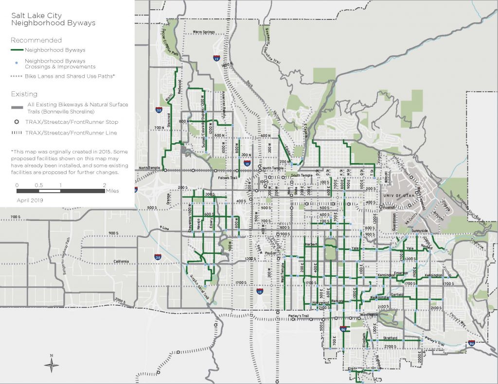
The following Byway routes were identified in Salt Lake City’s Pedestrian and Bicycle Master Plan in 2015.Citywide Byways map
Take a look around
Photos show how this byway improves comfort and safety for people walking, biking, and rolling through the neighborhood.


Contact us
Have a question or want to stay connected?
Email: [email protected]
Subscribe to the SLC Moves newsletter to get email updates.