April 2026 update
Civil engineering design for the byway is currently underway. View the draft byway plans. Please note that construction funding has not yet been secured and no construction timeline has been set.
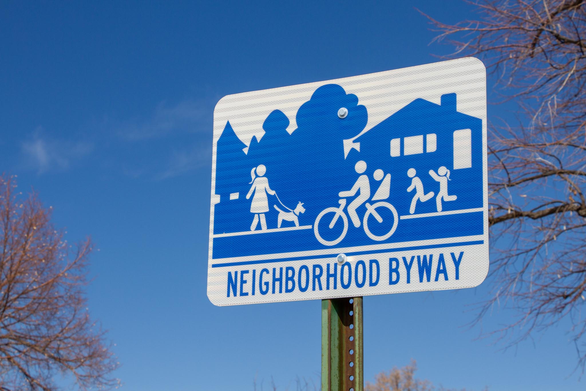
What’s a Neighborhood Byway?
Neighborhood Byways are quiet residential streets designed for safe and comfortable walking, biking, and rolling. With safer crosswalks, traffic calming, bicycle-friendly design, wayfinding signs, and better connections to destinations, these routes offer a pleasant alternative to busy roads. Salt Lake City is building a network of people-friendly streets that makes active transportation an easy choice for everyday trips. Discover all the routes and learn more on the byways home page.
The Westminster to Sunnyside Byway
This route runs from Westminster University to Sunnyside Avenue near Sunnyside Park. It connects to:
- Bike lanes on 1700 South and 1300 East
- The new Kensington Avenue Byway
- 900 South (which becomes the 9-Line Trail to the west)
- Sunnyside Avenue’s shared-use path that goes to The University of Utah and up Emigration Canyon
The route passes schools, parks, natural areas, and local businesses. It provides an easy connection from Sugar House to the Wasatch Hollow, Yalecrest, and Foothill neighborhoods.
Learn more
Timeline
Summer 2022: Project kickoff
Fall 2022 to spring 2023: Gather initial pre-design feedback and study the byway
Winter to spring 2025: Public input on draft design
This project is only funded through the design phase. There is currently no construction timeline.
Frequently asked questions
How is a street chosen to be a Neighborhood Byway?
Neighborhood byways are identified in the Salt Lake City’s Pedestrian and Bicycle Master Plan and are commonly located along streets with the following characteristics:
- Narrow residential streets with low to modest vehicle traffic speeds and volumes
- Direct connections between parks, schools, businesses, and other community destinations
- Greening along the route such as shade trees
Why wasn’t 1500 East or 1800 East chosen as the route?
1500 East
1500 East is an important route for people walking and biking, offering a direct connection to Sugar House Park, multiple schools, and 15th & 15th businesses. However, it is not the best candidate for a Neighborhood Byway due to its higher traffic volumes. That said, improving 1700 East as a Neighborhood Byway does not mean 1500 East cannot also be improved. Our goal is to develop multiple comfortable routes in the neighborhood, each with unique characteristics, so people have choices for how they get around.
1800 East
1800 East was considered, but 1700 East was selected because it’s identified in Salt Lake City’s Pedestrian and Bicycle Master Plan and supports the broader goal of spacing north-south active transportation routes every quarter mile—about every two blocks—along corridors like 1300, 1500, 1700, and 1900 East. Additionally, 1700 East already has a four-way stop at 1300 South. In contrast, using 1800 East would require adding a new stop sign on 1300 South, which carries moderate traffic and would create delays for drivers.
What traffic calming features are planned?
We’re proposing a series of speed cushions, which are similar to speed bumps but with gaps to allow emergency vehicles to pass smoothly. They help reduce speeding while maintaining a comfortable experience for people biking.
Will bike lanes be added?
No. Byways use traffic calming, signage, and pavement markings to create a shared street space rather than painted bike lanes.
Will the Byway affect on-street parking?
Byways typically have little to no impact on parking. In some locations, parking restrictions may be added within 30 feet of a crosswalk or stop sign to improve visibility—an approach known as “daylighting.” While parking is already prohibited in these areas by law, it’s often not signed or enforced. Daylighting helps everyone see and be seen at intersections, making the street safer for all users.
What changes are considered along these routes?
Street changes along these routes will be evaluated through a planning and public engagement process. Improvements may include:
- Crossing upgrades ranging from flashing signs to traffic signals, based on traffic speed, volume, and safety needs
- Traffic calming features like speed humps, traffic circles, and chicanes to reduce speeding and discourage cut-through traffic
- Curb extensions (or bulb-outs) at intersections to shorten crossing distances and slow turning vehicles
- Curb ramps designed for bicyclists to easily access pedestrian push buttons at signalized crossings
- Wayfinding signs and pavement markings to guide people along the route
- Greening elements, such as trees, landscaped medians, or planters, to enhance comfort
These are examples of tools we consider when planning Neighborhood Byways. Not all of these features will be included in every project—final designs are based on community input, technical analysis, and available funding.
Will this affect access to my home?
You’ll still be able to easily reach your home. Neighborhood Byways make streets safe and comfortable for walking, biking, and rolling with children or pets. This may require traffic calming measures and minor street changes to slow vehicle speeds and reduce cut-through traffic, but access to your property will remain unchanged.
Can I drive my car on Neighborhood Byways?
Yes, vehicles are allowed, but Neighborhood Byway routes are improved for active modes of transportation such as walking, biking, and rolling.
Will emergency vehicles, garbage trucks, and snow plows be able to use the street?
Yes. Neighborhood Byways maintain full access for emergency vehicles and city services. When traffic calming is needed, we use speed cushions instead of traditional speed humps. These raised sections have cutouts wide enough for fire trucks and emergency vehicles to pass through at normal speed, while still slowing passenger cars.
Community feedback
Our public engagement followed two phases. In the first phase, we asked the community about existing issues along the street. We used that feedback to develop draft concept designs. In the second phase, we shared those designs and asked for feedback. You can download the full summary reports for both phases below.
- Existing Conditions Report and Phase 1 Community Feedback Summary
- Phase 2 Community Feedback Summary
Phase 1: Understanding the street (Fall 2022)
We asked residents to identify issues with the street and how they felt about walking, biking, and rolling along the proposed route.
Key takeaways included:
- Top concerns were speeding vehicles, limited safe crosswalks, and visibility issues caused by parked cars.
- The community’s main priorities were improving safety at major crossings, discouraging cut-through traffic, and adding better bicycle infrastructure.
- Based on this input, we adjusted the original route to run through Le Grand Street and Michigan Avenue. This change helps avoid high vehicle traffic on 900 South and a tricky intersection at Military Drive.
Phase 2: Reviewing the Draft Designs (Early 2025)
In early 2025, we shared draft designs for the neighborhood byway. We reached out via door-to-door flyers, social media, community council meetings, and coordination with local schools.
What we heard:
- There is strong support for safety measures like bulb-outs and raised crossings to slow down cars and keep pedestrians safe.
- Opinions on speed cushions were split: some see them as highly effective, while others worry they might push traffic onto nearby streets.
- Some neighbors expressed concerns about parking congestion, narrowing roads, and the visual impact of yellow traffic signs on the neighborhood’s historic character.
- Many residents also expressed a long-term desire to expand the bike network to connect with 1500 East, Sugar House Park, and local universities.
Next Steps
The public comment period for the draft plan ended on April 21, 2025. The project team is currently using the community feedback, along with the findings of the study, to finalize the civil engineering designs.
Project documents and downloads
Citywide byways map
The following Byway routes were identified in Salt Lake City’s Pedestrian and Bicycle Master Plan.
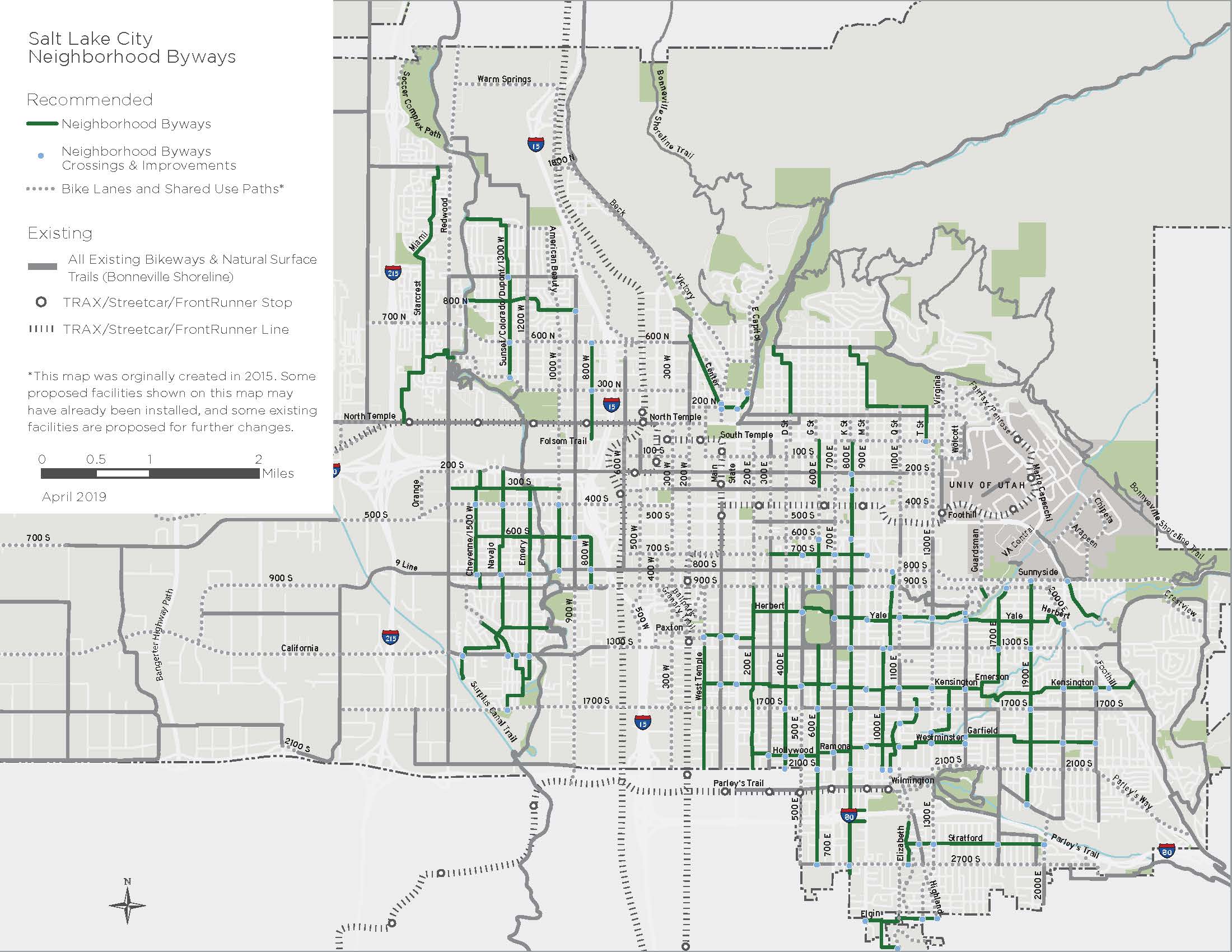
Route map
Launch map full-screen in a new window.
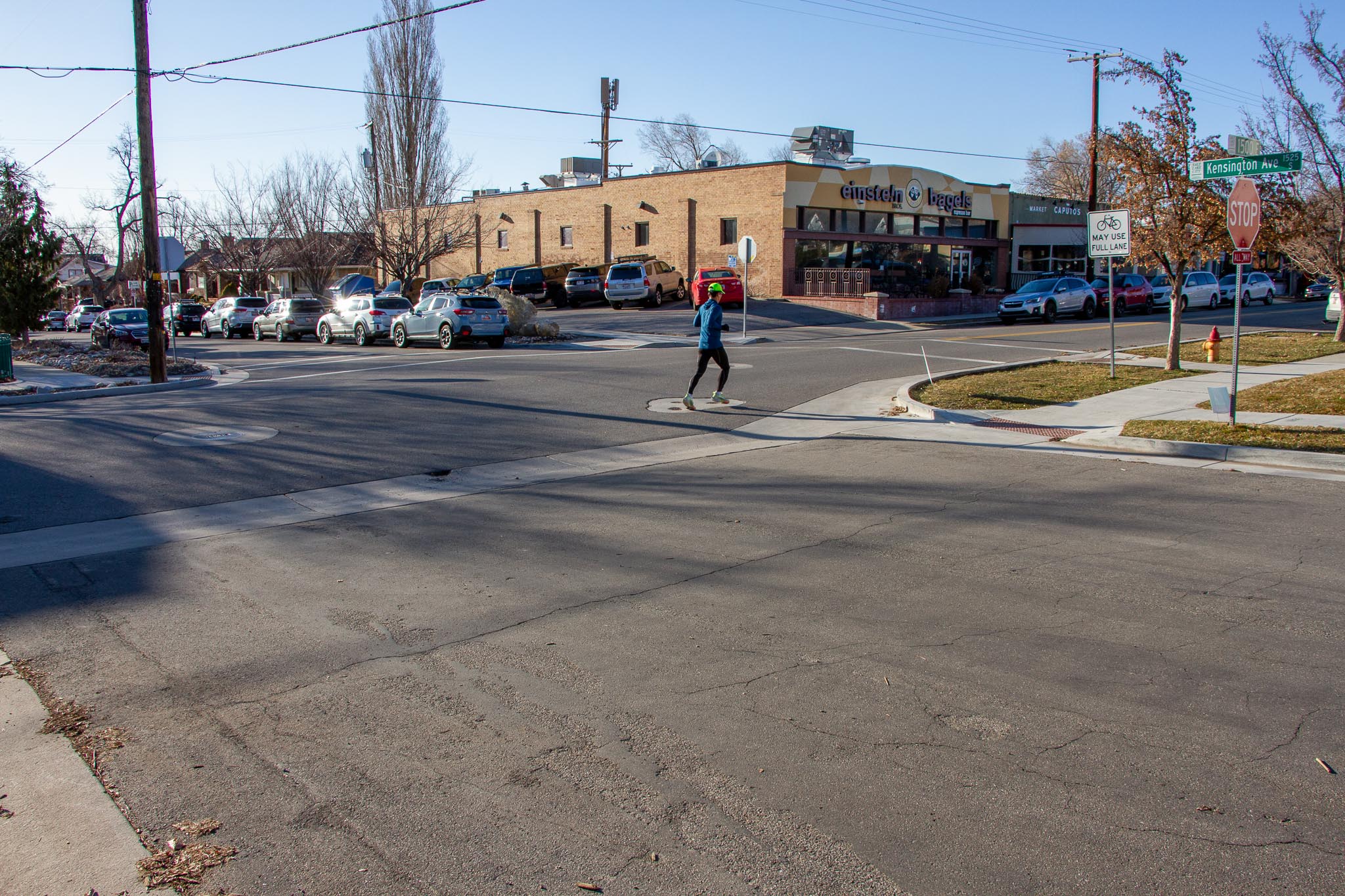
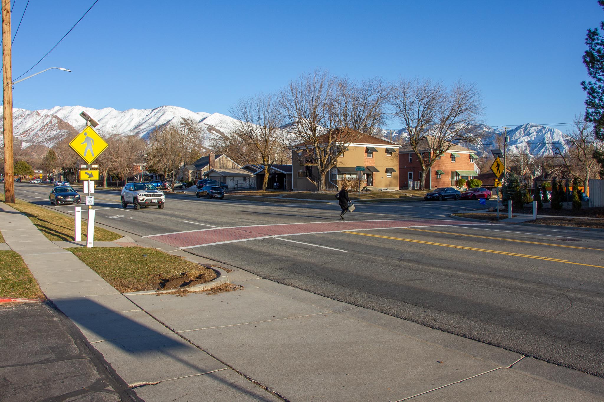
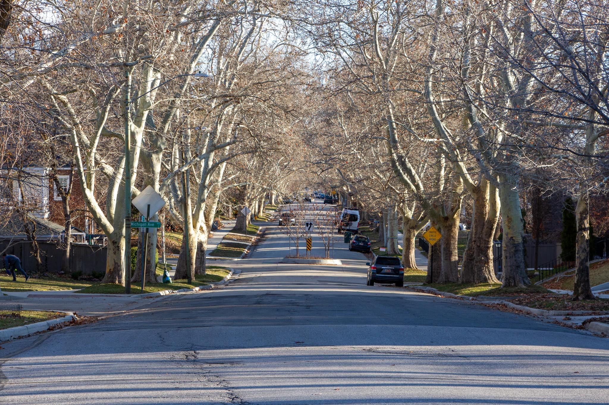
See the street today
These images show the streets, crossings, and neighborhood character where the byway is planned.


Contact us
Have a question or want to stay connected?
Email: [email protected]
Subscribe to the SLC Moves newsletter to get email updates.