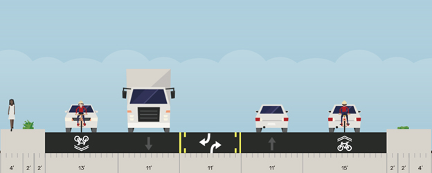
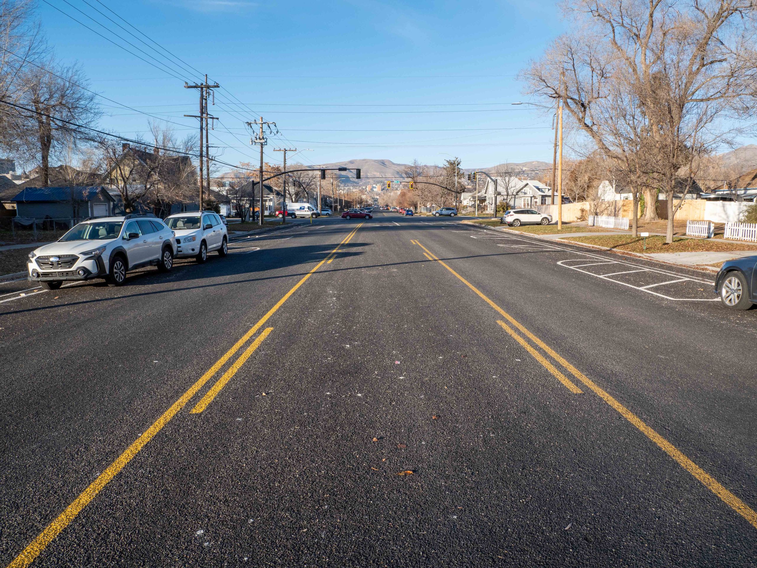
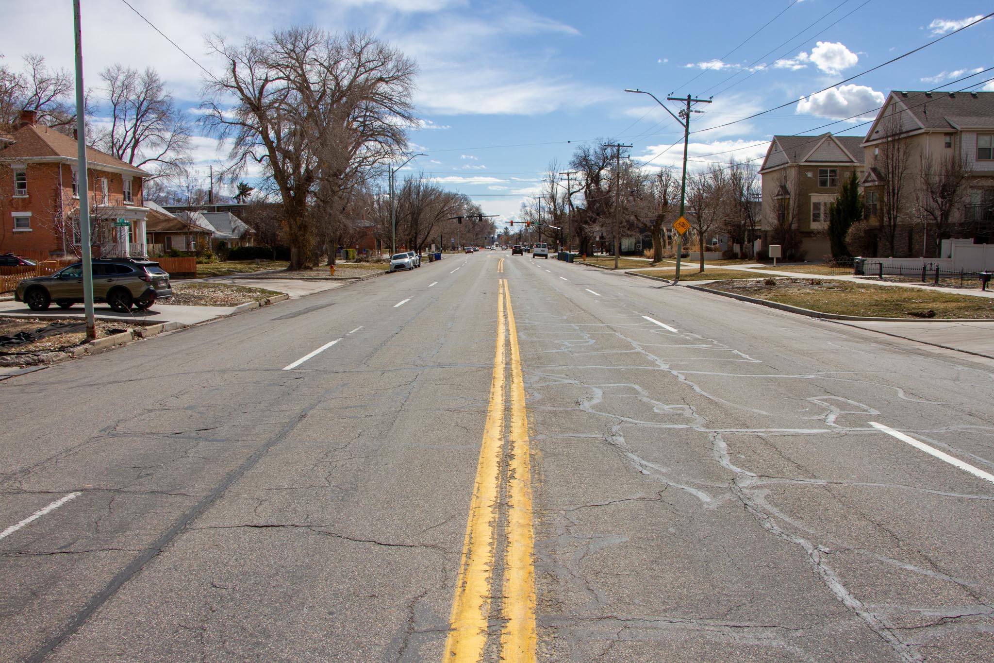
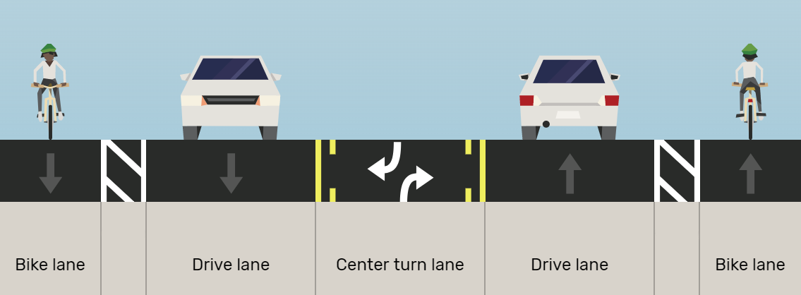
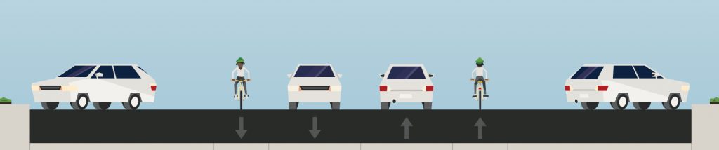
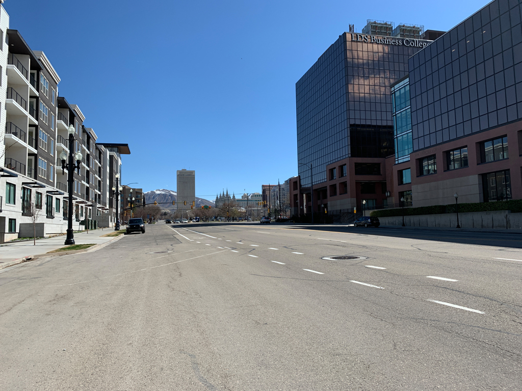
Overview
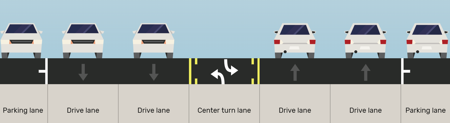
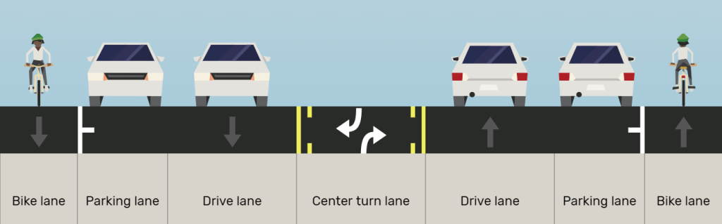
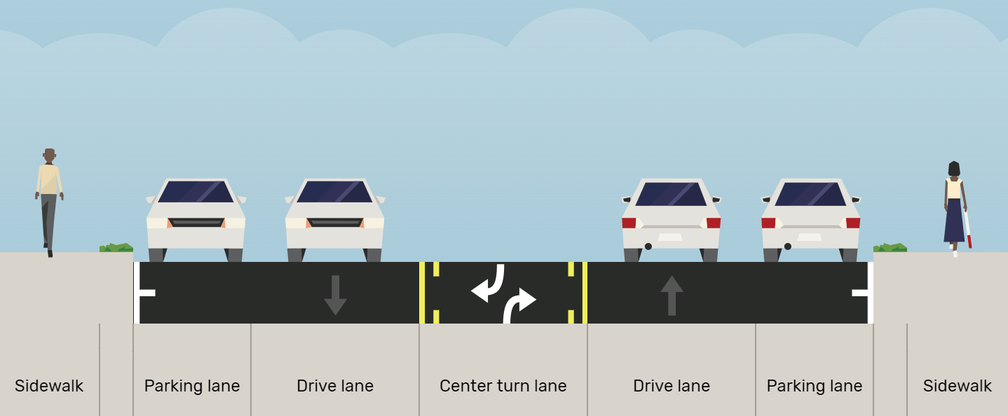
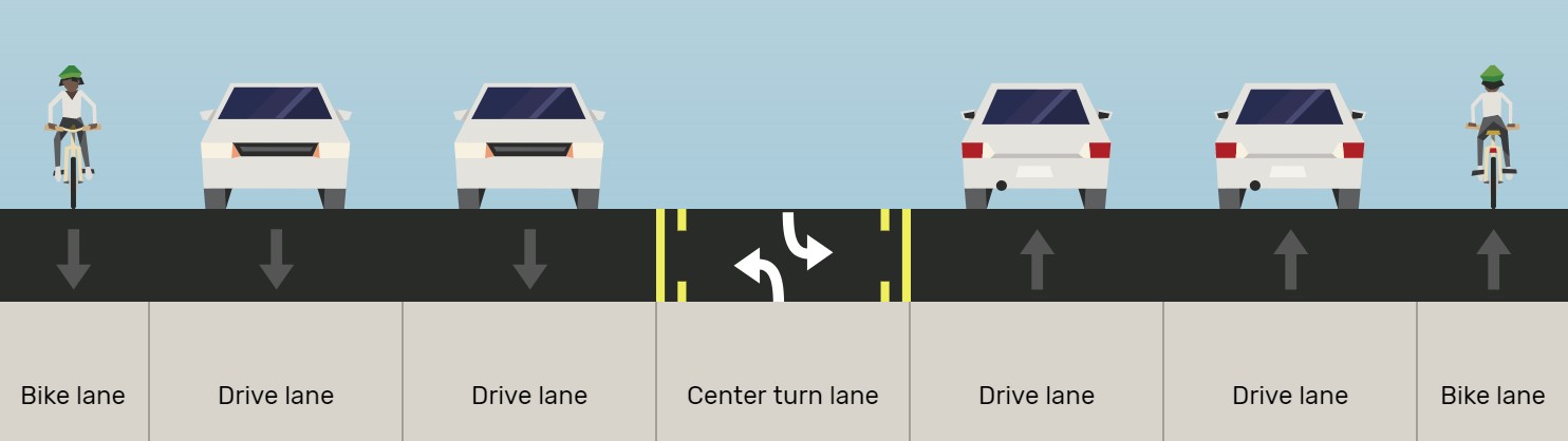
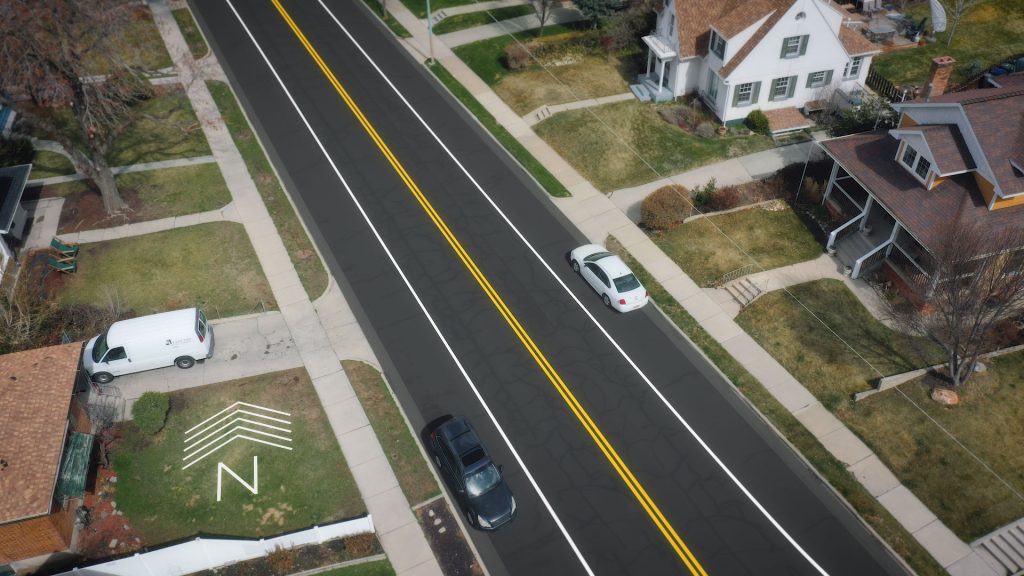
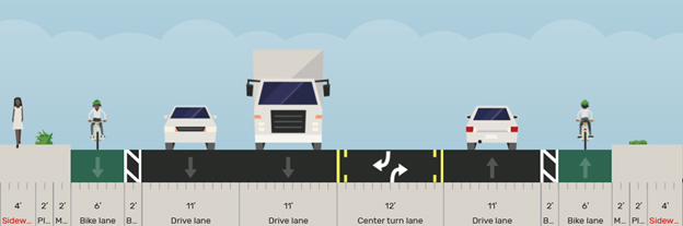
Roadway reconfigurations, also known as road diets, typically involve converting an existing four-lane undivided roadway to a three-lane roadway consisting of two through lanes and a center two-way left-turn lane.

Benefits
Benefits of roadway reconfigurations may include:
- An overall crash reduction of 19 to 47 percent.
- Reduction of rear-end and left-turn crashes due to the dedicated left-turn lane.
- Reduced right-angle crashes as side street motorists cross three versus four travel lanes.
- Fewer lanes for pedestrians to cross.
- The multiple threat pedestrian crash type is essentially eliminated.
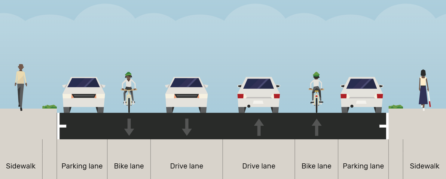
- Opportunity to install pedestrian refuge islands, bicycle lanes, on-street parking, or transit stops.
- Traffic calming and more consistent speeds since the most prudent driver now sets the speed for all drivers to the rear.
- A more community-focused, “Complete Streets” environment that better accommodates the needs of all road users.
A roadway reconfiguration can be a low-cost safety solution when planned in conjunction with a simple pavement overlay, and the reconfiguration can be accomplished at no additional cost. Because of a proven track record for improving safety within communities, the Federal Highway Administration has included Roadway Reconfigurations on their top 20 list of proven safety countermeasures.
Roadway reconfiguration archive
2023
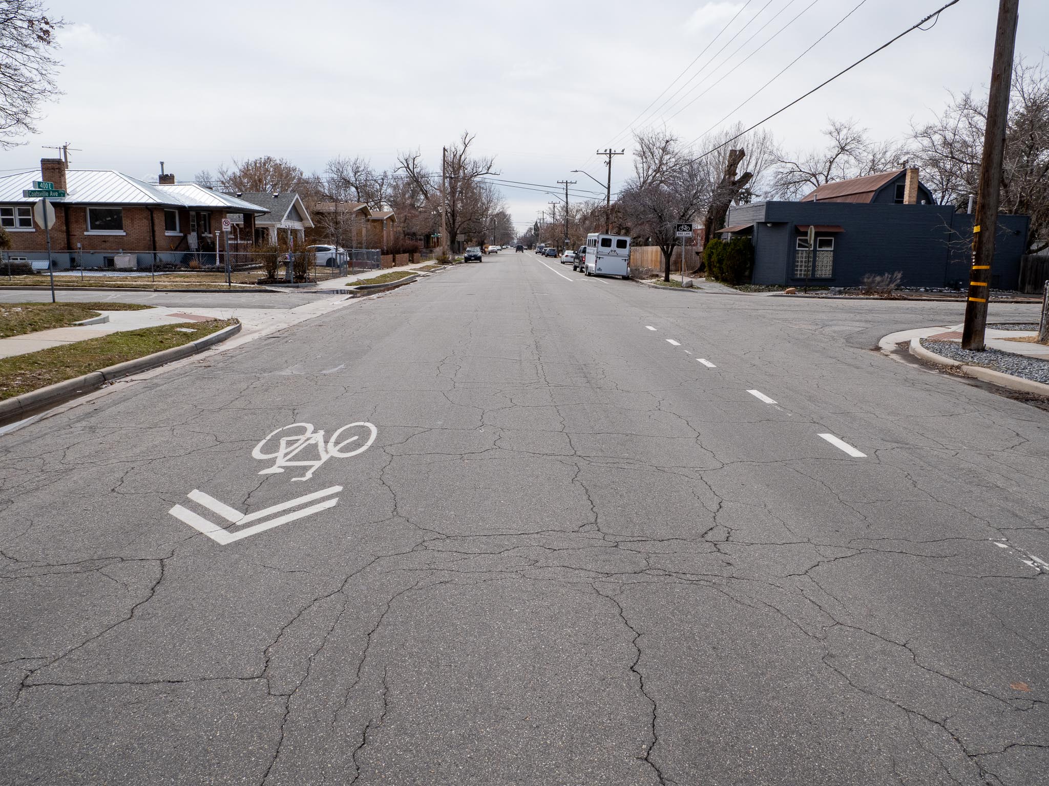
400 East (400 South to 1300 South and 1700 South to 2100 South)
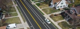
In the summer of 2023, Salt Lake City resurfaced 400 East from 400 South to 1300 South and from 1700 South to 2100 South. 400 East between 400 South and 900 South has relatively low vehicle traffic volumes that can be supported by one vehicle travel lane in each direction. Therefore, one northbound and one southbound vehicle travel lane was removed and parking protected bike lanes were added. This lane reconfiguration has several potential benefits:
- Reduction of rear-end and left-turn crashes due to the dedicated left-turn lane
- Reduced right-angle crashes as side street motorists cross three versus four travel lanes
- Fewer lanes for pedestrians to cross
- Opportunity to install bicycle lanes and future improvements
- Traffic calming effect and more consistent speeds
- A more community-focused, Complete Streets environment that better accommodates the needs of all road users
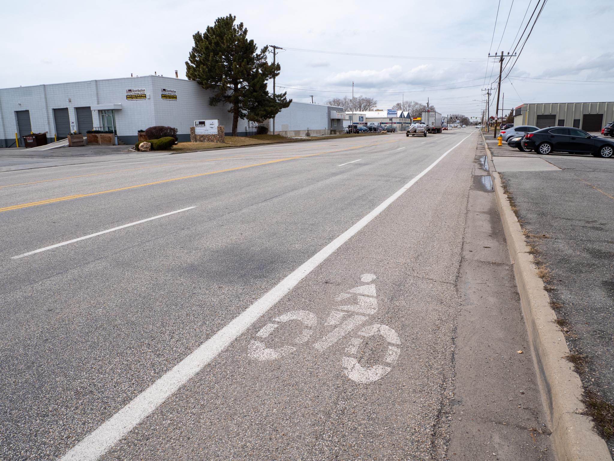
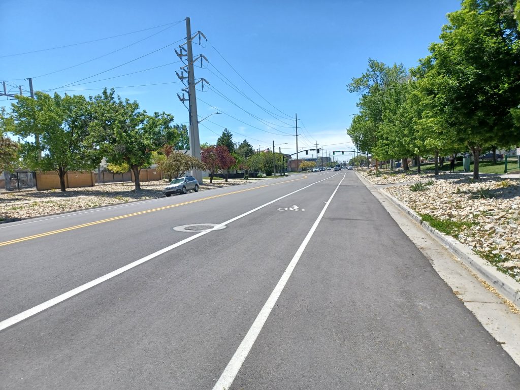
A parking protected bike lane moves the on-street vehicle parking away from the curb and gutter. The bike lane now sits between the curb and the on-street parking. The line of parked vehicles in the roadway act as a physical barrier between moving vehicles and cyclists in the bike lane. This style of bike lane is safer and more comfortable for cyclists compared to a standard painted bike lane. Experienced cyclists can still choose to ride in the vehicle travel lanes if they desire.
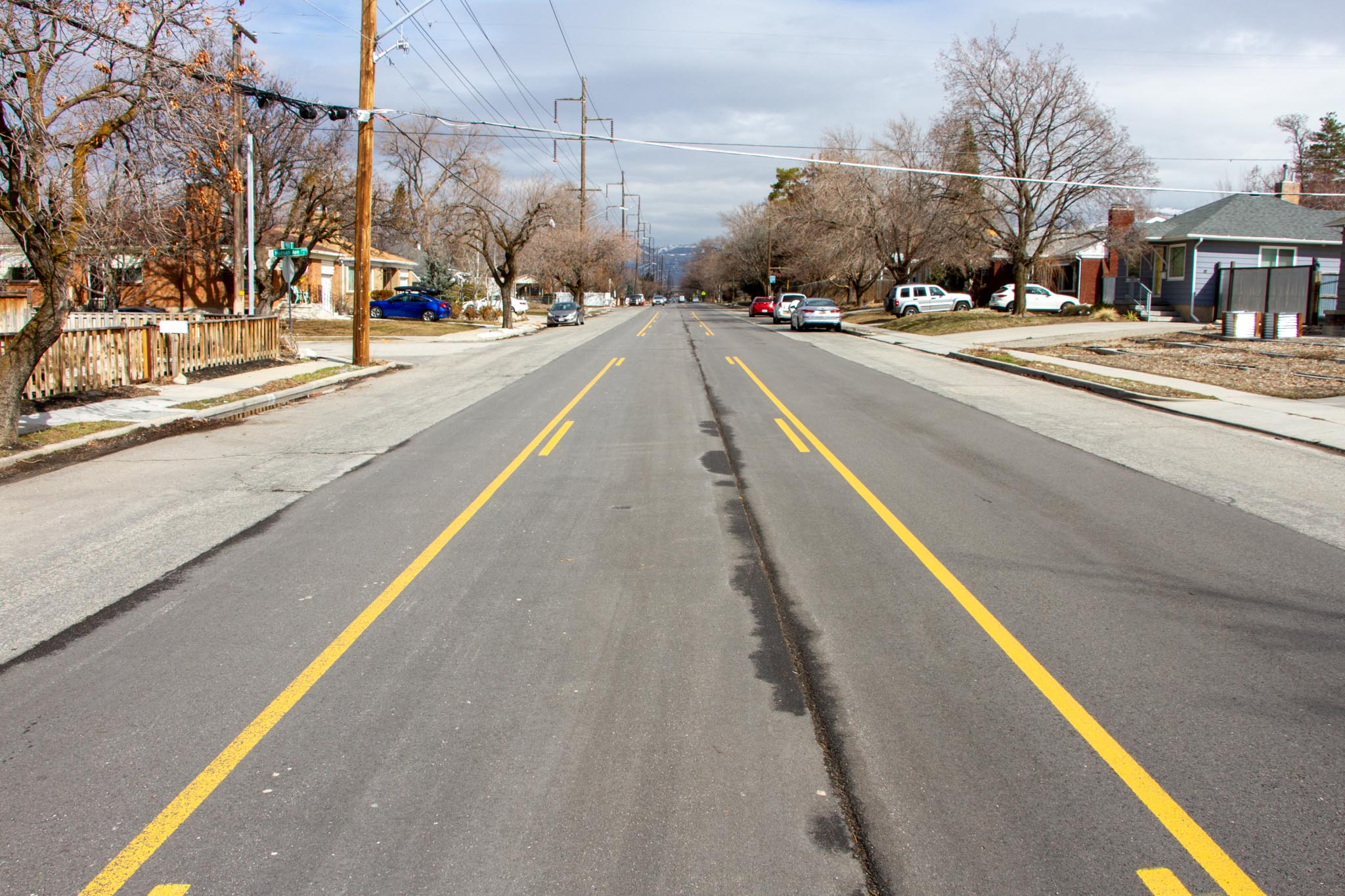
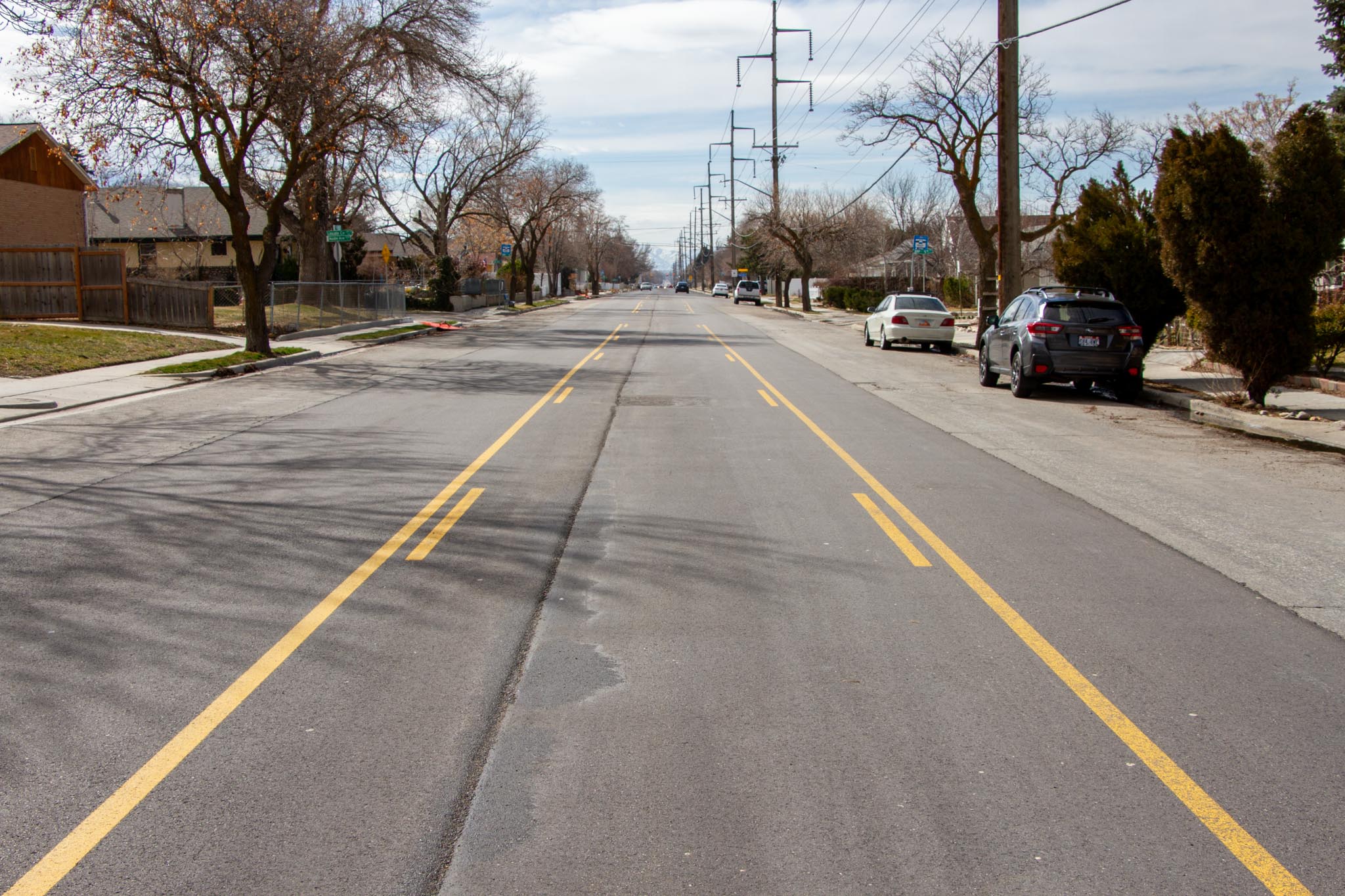
Previous 400 East design between 400 South and 900 South
New 400 East design between 400 South and 900 South with parking protected bike lanes
Before
After
400 East from 1700 South to 2100 South
South of 900 South the roadway is narrower and predominantly lined with single family homes. An on-street bike lane currently exists in the southbound direction with shared lane markings in the northbound direction. The project team will be reviewing this section of roadway to determine if striping changes are applicable as part of this project.
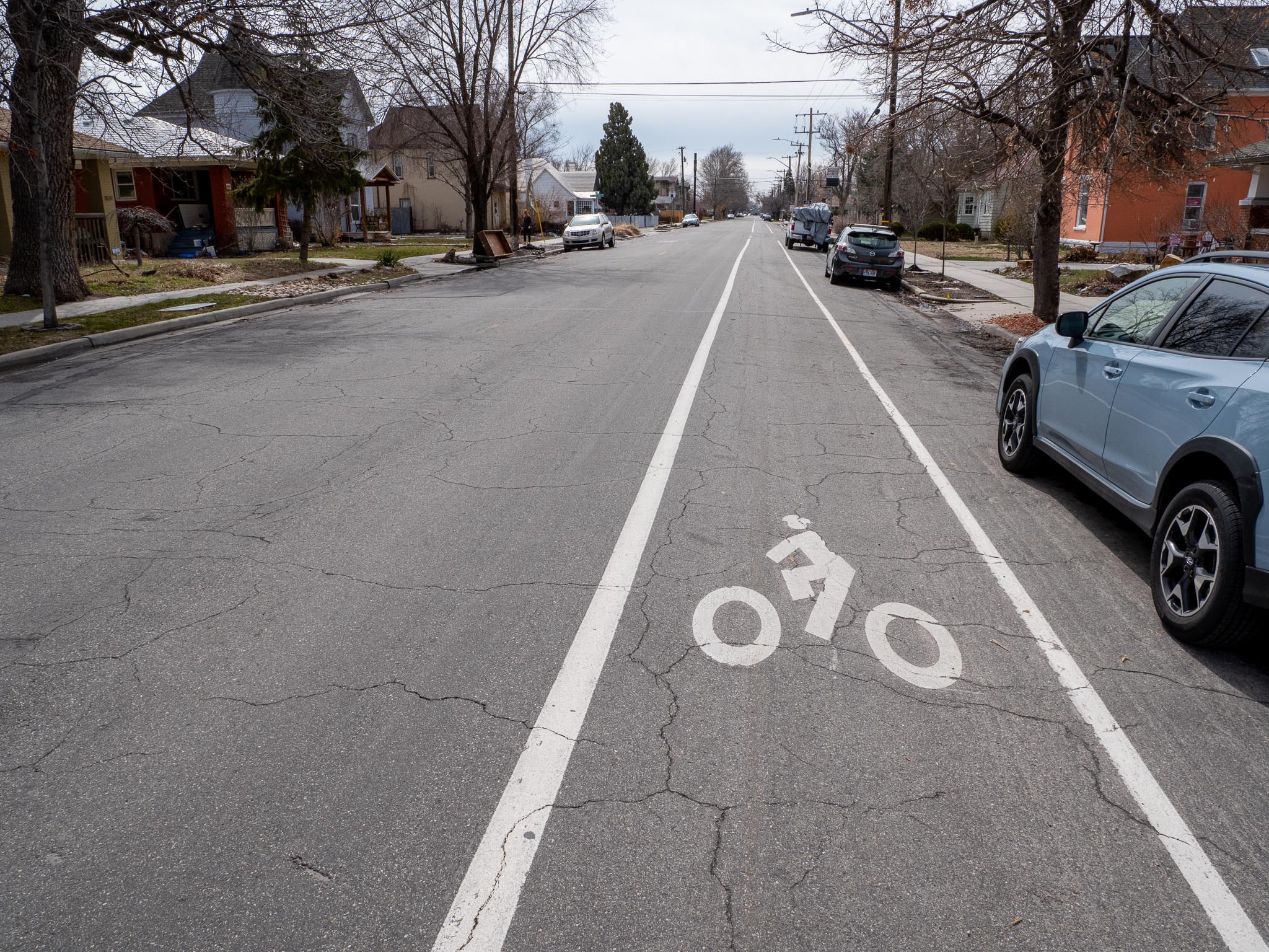
500 East (600 South to 900 South)
In the summer of 2023, Salt Lake City resurfaced 500 East from 400 South to 900 South. The changes included the removal of one northbound and one southbound travel lane and the addition of new buffered bike lanes. This lane configuration matches what currently exists south of 900 South in front of Liberty Park. The Transportation Division is confident that one vehicle travel lane in each direction will comfortably support the relatively low vehicle traffic volume on 500 East, while also making the street more comfortable and safe for all roadway users.
In the area between 400 South and 500 South, only the southbound lanes will be modified to accommodate the change in travel lanes further south. The new striping will consist of one travel lane in each direction with buffered bike lanes and on-street parking. Near the intersections, parking will be restricted to accommodate a left turn pocket. The proposed parking restrictions generally match the existing parking restrictions prior to the striping change.
Previous Lane Configuration
New Lane Configuration
Conditions Before Lane Reconfiguration
900 East (2700 South to Millcreek City Boundary)
In 2023, Salt Lake City restriped 900 East from 2700 South to Millcreek City boundary near Elgin Avenue. Changes included the removal of the center turn lane and the addition of bike lanes. The new configuration consists of one vehicle travel lane and one bike lane in each direction. Minimal changes will be made to the on-street parking. Near the intersection at 2700 South, parking will be restricted to make space for a left turn queue at the traffic signal. This lane configuration will maintain the same level of vehicle traffic and parking while making the roadway more comfortable and safe for all roadway users.
Previous Lane Configuration
New Lane Configuration
Before
After
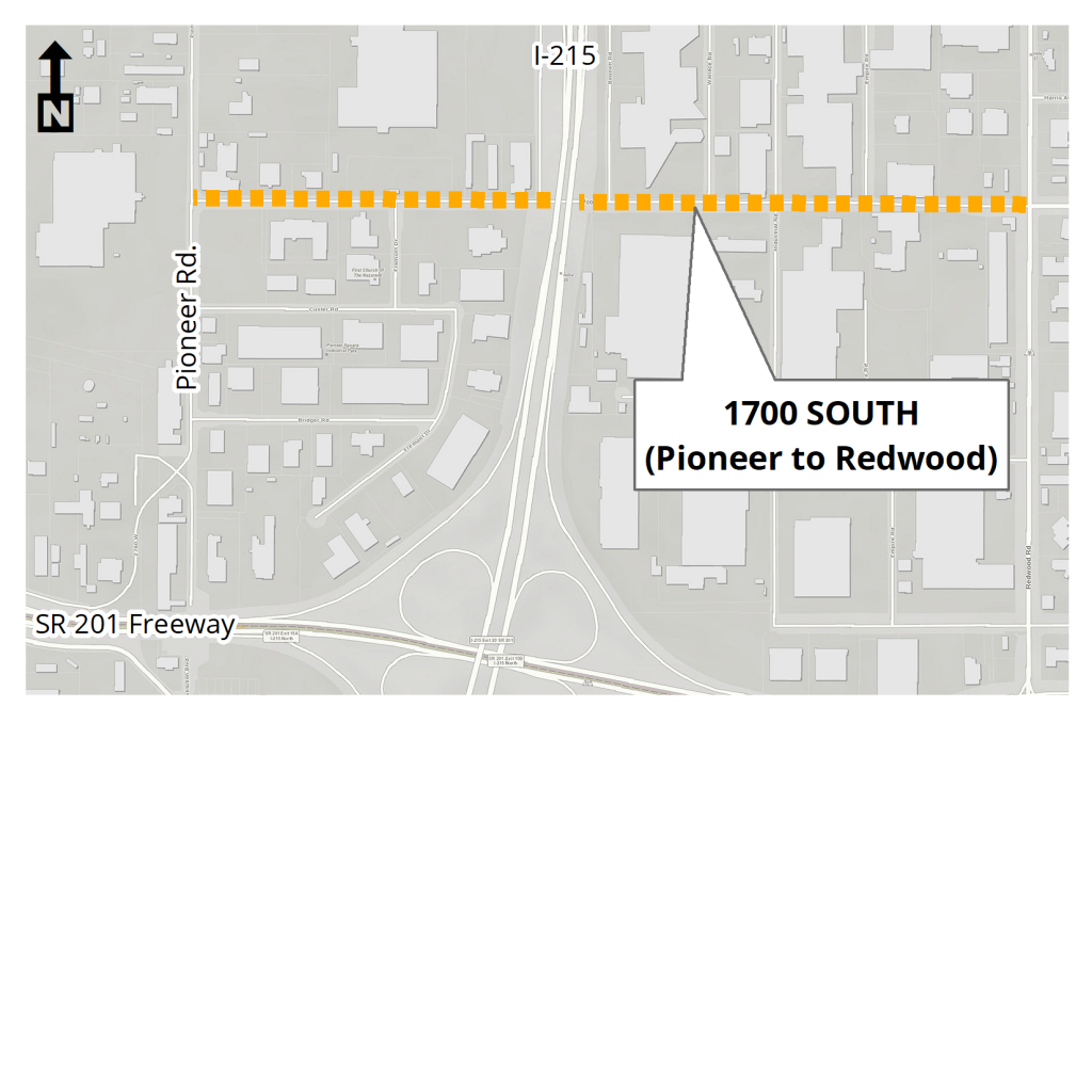
1700 South (300 West to Redwood Road) – Postponed
In the summer of 2024, Salt Lake City plans to resurface 1700 South from 300 West to Redwood Road. This resurfacing presents an exciting opportunity for the City and community to reimagine changes to striping on this stretch of street between the newly constructed 300 West bikeway and the forthcoming Glendale Regional Park.
The Transportation Division has already created a concept for the stretch between 300 West and 900 West that removes one vehicle travel lane in each direction while also creating wider and more comfortable buffered bike lanes. The Transportation Division has analyzed traffic volume data for the full project extent and is confident that one vehicle travel lane in each direction will support the relatively low vehicle traffic volumes on this corridor. This lane reconfiguration has several potential benefits:
- Reduced right-angle crashes as side street motorists cross three versus four travel lanes
- Fewer lanes for pedestrians to cross
- Opportunity to improve bike lanes and future improvements
- Traffic calming effect and more consistent speeds
- A more community-focused, Complete Streets environment that better accommodates the needs of all road users
Existing Street Layout – 300 West to 900 West
Proposed Street Layout – 300 West to 900 West
Existing Conditions – 300 West to 900 West
In addition, the Transportation Division is starting work on a concept for the stretch of 1700 South between 900 West and Redwood where we are thinking through potential changes to striping (paint), including travel lanes, turn lanes, and bike lanes. We will have more updates on this part of the project in the coming months.
2022
Avenues Streets
In 2022, Salt Lake City will resurface (or slurry seal) several streets in the Avenues neighborhood, including:
- B Street (1st Avenue to 11th Avenue)
- 3rd Avenue (E Street to Virginia Street)
- 11th Avenue (B Street to Terrace Hills Drive)
- Terrace Hills Drive (11th Avenue to the northern terminus)
800 South (at West Temple)
This summer the 800 South/West Temple intersection will be modified to add an additional westbound left-turn lane. When the project is completed, the intersection will have two westbound left-turn lanes to aid in providing motorists access to the West Temple freeway on-ramp. The modification is part of a larger project on 900 South. To learn more about the project on 900 South, please visit the 900 South Reconstruction project webpage.
2700 South (700 East to Highland Drive)
This summer, Salt Lake City will resurface and restripe 2700 South from 700 East to Highland Drive. This is an important step in maintaining the life of the pavement and also provides us with an opportunity to address a missing gap in our transportation network. As part of the project, on-street bike lanes will be added to the entire extent of the project, connecting to previous projects that have developed bike lanes east and west from this area. When the project is complete, bike lanes will extend from 2000 East to 300 West. Completion of this section of our infrastructure reflects the culmination of years of work completed by both Salt Lake City and South Salt Lake City.
These important changes will be accompanied with modifications to on-street parking. On-street parking will be removed from the north side of 2700 South between 700 East and Elizabeth Street (1155 East) as shown below. On-street parking will also be removed from the south side of 2700 South between Elizabeth Street (1155 East) and Highland Drive. These areas have been selected for these parking adjustments based on an analysis of parking use and availability that was completed over multiple days earlier in 2022.
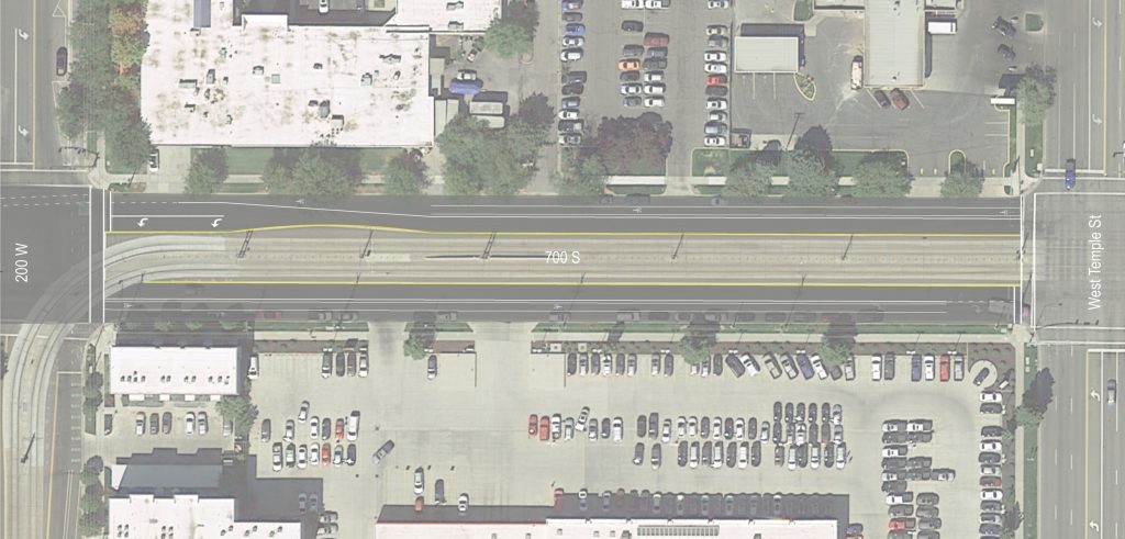
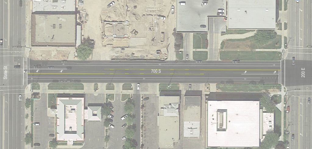
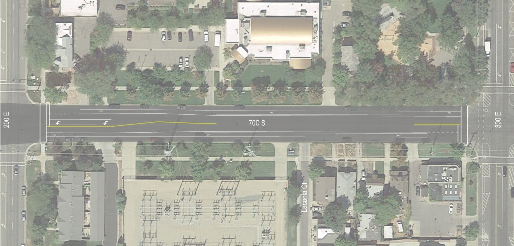
Main Street (700 South to 2100 South)
Since May of this year our project team has been gathering input on the proposed striping changes to Main Street from 700 South to 2100 South as part of the August street resurfacing project. The resurfacing project is not a street reconstruction project that alters curbs, landscaping, or traffic signals, but it creates an opportunity to reconsider the street design and prepare for future upgrades. The ongoing Life on State: Bikeways Study has been looking at ways to make Main Street a high-quality alternative to cycling on State Street, in addition to other street changes that improve safety and support the community. Resurfacing activities began the week of August 15th, 2022, and most of the work will be completed by September. Addition of green bike lane striping and signage changes will follow in September.
So, what did we hear?
- Support for reducing the number of travel lanes between 800 South and 1700 South. While canvassing the corridor and talking to people, our team heard similar comments about this welcome change that will increase safety.
- Support for crosswalk improvements.
- Support for bike lane improvements, including providing parking-protected bike lanes, and extending bike lanes south into South Salt Lake.
- Support for changes that help reduce speeding traffic.
- Enthusiasm for additional investment on the corridor. Many people said they welcome basic changes but don’t want it to stop there. More trees, landscaping, more place, less pavement.
The resurfacing project took steps toward these goals by making the following changes:
- One travel lane in each direction with center two-way-left-turn lane, which functions as a left turn lane at intersections and provides space for future crosswalk refuge islands. This will require reducing the existing number of vehicle lanes between 800 South and 1700 South, matching the design that exists between 1700 South and 2100 South. The reduction of travel lanes to one in each direction with a center turn lane will have major safety benefits at crosswalks, while also reducing the frequency of vehicle crashes by as much as 25%.
- Bike lanes widened (6 ft minimum) including painted buffer where space allows.
- Improvements to bike lane continuity at intersections.
- Parallel on-street parking was maintained next to curb/gutter, widened in some areas where parking currently encroaches into the bike lane. Existing parking stalls set back from the travel lane that are within City property, between the roadway and sidewalk, are not impacted.
Why not parking-protected bike lanes?
This was a common response from people who shared feedback about the striping plan, since the design has worked well on 200 E and 300 East (500 South to 900 South). It’s a fair question, and there a few reasons why Main Street is not a great candidate:
- Frequent driveways and parkstrip parking create discontinuities and conflict points in the PPBL.
- The area next to the curb and gutter is not a good place to position cyclists. The curb is crumbling into the gutter, pavement is rough, and driveway tie-ins are irregular.
- The buffered bike lane will be swept and kept free of snow without additional maintenance requirements.
The Big Picture
While the resurfacing and roadway striping changes won’t accomplish everything, the corridor is better positioned for future planned upgrades in 2022 and beyond. The City is developing a vision document for long-term, transformational improvements on Main Street that will narrow the pavement width and add a separated bike lane and wider sidewalks from 700 South to 2100 South. The new design will also include features like street trees, waterwise landscaping, public art, sidewalk dining, and bike parking. These features will vary depending on the land use of individual street segments, so that the City’s investment can best support businesses and residents along Main Street. This future effort will require a full reconstruction of the street, and is a more significant investment than the City can afford at this time. In the meantime, incremental steps are being taken that will address many of the immediate safety concerns (especially at crossings) and provide significant bicycling improvements.
Main Street Final Striping Plan
801-535-7764
2021
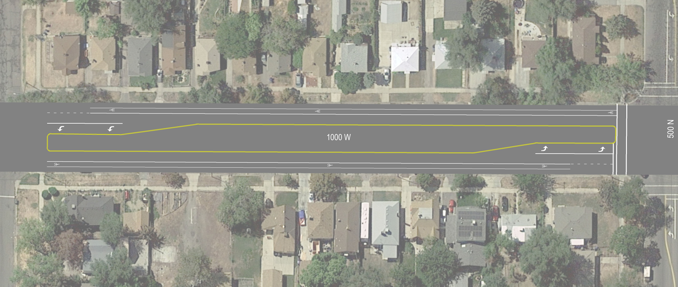
1000 West (North Temple to 600 North)
Project Update
After receiving more feedback from the community and upon further discussions, we decided to keep the striping as is for now and engage with the community to develop a more robust plan for 1000 West. The 1000 West “mini-corridor study” will allow Salt Lake City to engage with all stakeholders, including the State Fair Park, residents, and Community Council, whom expressed support for creating a shared vision for the street. We are hopeful the process will result in meaningful changes that go beyond basic pavement markings. Learn more about the 1000 West Mini Corridor Study here.
Background
The project team is analyzing 1000 West from North Temple to 600 North to determine if there are opportunities to leverage the resurfacing opportunity to make changes recommended by the Pedestrian and Bicycle Master Plan. In the coming months, the project team will communicate with residents and the Community Council about our findings as well as ways for the public to comment on potential striping changes. Residents and the Community Council will be told in advance about any planned changes to striping.
Currently, 1000 West is a four-lane road with a continuous center turn lane and bike lanes. In 2020 the City received feedback about the street from residents, which indicated a strong interest in repurposing excessive street space to slow traffic and improve bicycling and walking safety.
Draft Designs
The project team released the following draft striping plans for this section of 1000 West:
200 East (600 South to 1300 South)
Project Update
We heard from local businesses and residents the need for more on-street parking while still accommodating vehicle mobility and increasing bicycle comfort and pedestrian-friendly areas. Based on feedback and street vehicle volumes, the new street design will have the following enhancements:
- Increased on-street parking by adding angled parking
- Parking protected bicycle lanes going northbound (700 S to 900 S). Buffered bike lanes elsewhere.
- High-visibility merge areas for bike lanes where there are right turns
- Maintaining vehicle flow
This resurfacing design is a significant transformation for 200 East—one that helps balance various needs—supporting local businesses and laying the foundation for future upgrades to keep this area a happening place.
When does street resurfacing start?
Our street resurfacing team doesn’t waste time! They will be starting the first stage of street treatments next week. Then over the next several weeks, striping and parking delineation will go in. Adjacent homes on 200 & 300 East, be on the lookout for door hanger notifications. You’ll receive those 24 hours in advance of any surface treatments. Follow us on Facebook and Twitter to stay up to date on the street resurfacing progress @SLCmoves.
Learn more about the Life on State: Bikeways Study here: www.lifeonstate.com/bikewaysstudyhome
What else is happening on 200 East?
Note that this change is part of a coordinated effort to develop a network of bike facilities adjacent to State Street per the Life on State Implementation: Bikeways Study. 200 East south of 900 South is a quiet residential street and is an ideal candidate for a Neighborhood Byway. No changes to the street or parking are planned; Neighborhood Byway treatments usually involve wayfinding and interventions at major cross streets to make crossings safer and intuitive. Implementation of Neighborhood Byway components will occur separately from the resurfacing project.
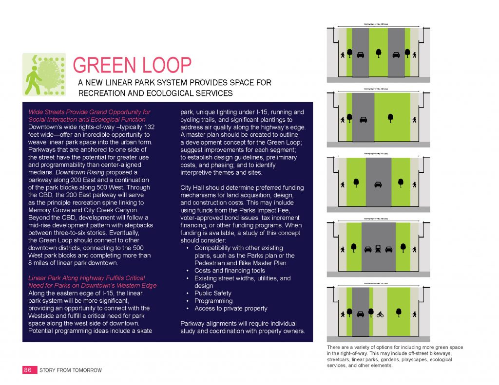
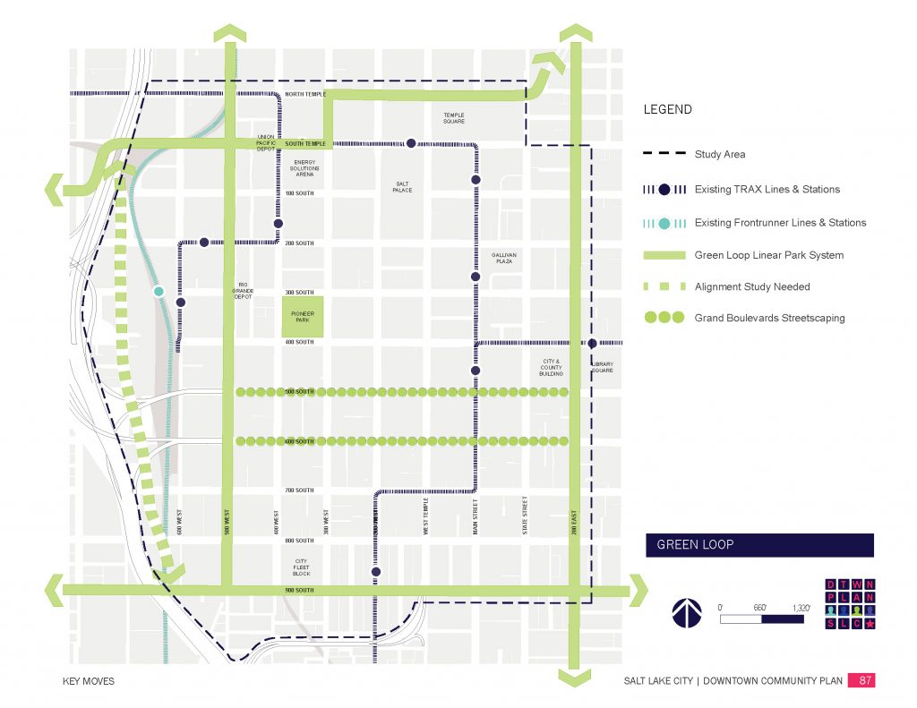
An even bigger change to 200 East is planned as part of the City’s Green Loop linear park system. Detailed planning and community engagement for the Green Loop will start in 2022, so the City is looking for near-term design strategies consistent with adopted plans that are compatible with the long-term Green Loop concept. As such, the segment from 600 South to 900 South is an opportunity to reallocate street space using pavement markings to establish buffered bike lanes that may later be adapted into the Green Loop design.
Review the images below for more information about the Green Loop.
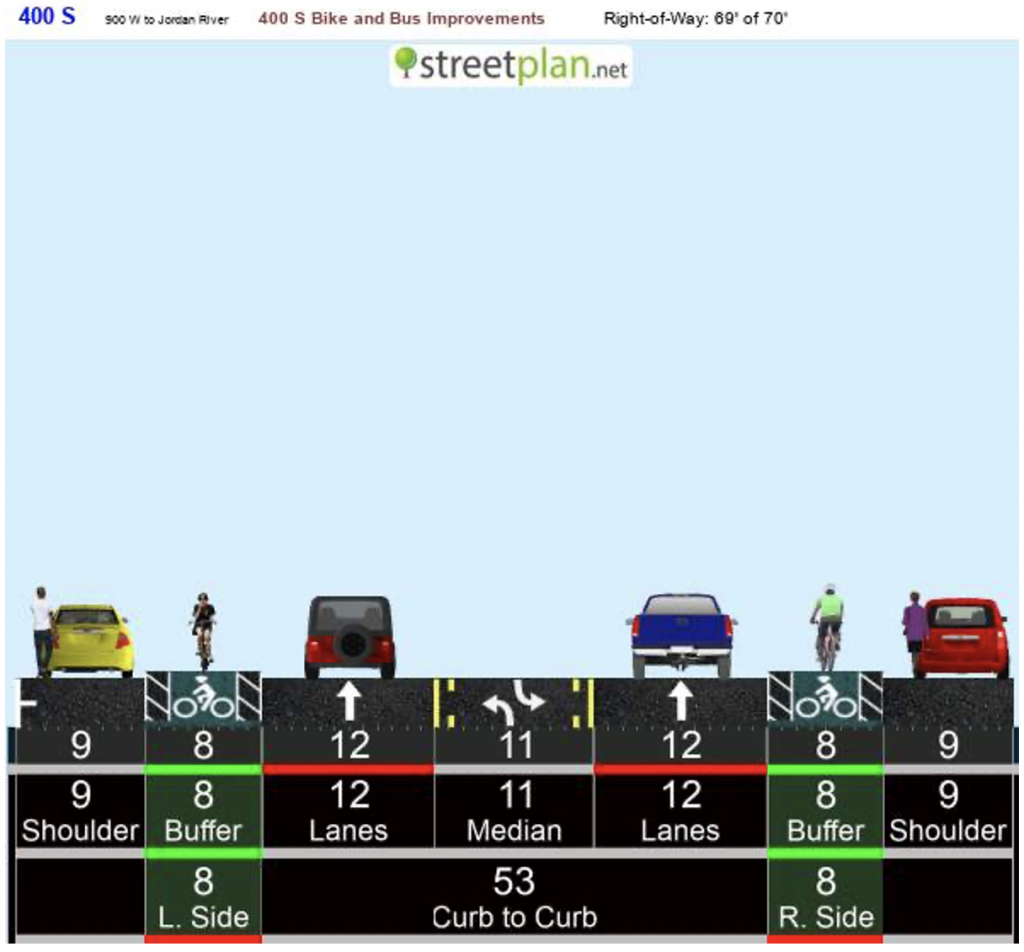
400 South (I-15 to Redwood Road)
Overview
400 South, from I-15 to Redwood Road, will be chip sealed in Summer 2021. A chip seal adds another layer to the roadway surface, prolonging the life of the roadway by 5-7 years. The project team decided to make very minor adjustments to the roadway. The configuration of two travel lanes and a center turn lane will be kept in place, but narrowed very slightly to accommodate a buffer in the existing bike lane. This will result in no reduction to existing parking and no major changes to the streetscape.
Draft Design
The project team has released the following draft striping plan for this section of 400 South:
What’s Coming for 400 South?
The same corridor will likely experience bigger changes in 2022 due to a Community Development Block Grant (CDBG) received in 2021. Design is still in process, but the street will feature on-road bus boarding islands with protected bike lanes. Stay tuned for future updates.
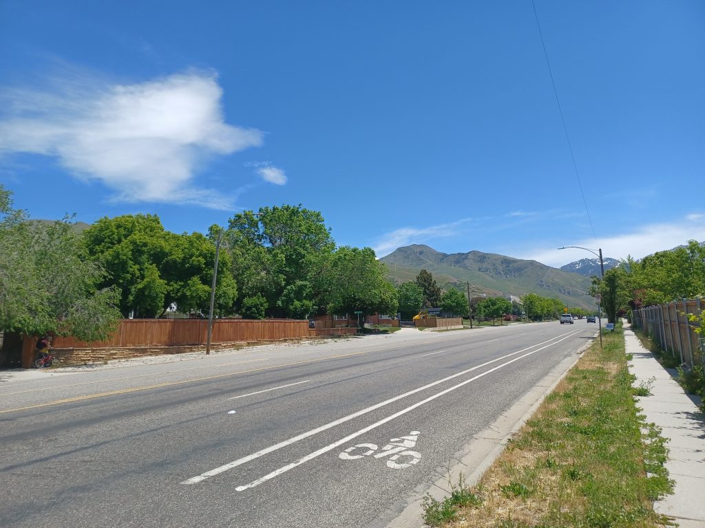
Sunnyside Avenue (Foothill Drive to City Limits)
Overview
Sunnyside Avenue, between Foothill Drive and the City limits, will be chip sealed in Summer 2021. A chip seal adds another layer to the roadway surface, prolonging the life of the roadway by 5-7 years. A chip seal also provides a blank slate and opportunities to rethink the striping for travel lanes, turn lanes, bike lanes, and parking.
The City’s proposed design would maintain the same number of travel lanes (two in each direction, and one center turn lane) in order to accommodate high volumes of motor vehicles during special events at Hogle Zoo and This is the Place Heritage Park.
Sunnyside Avenue, which connects to Emigration Canyon, also boasts the busiest bike lanes in the city. There may be opportunities to improve the width, consistency, and quality of the bike lanes, as well. The project team will be reaching out to residents and stakeholders during 2021 to collect any additional ideas.
Draft Design
The draft design for the 2021 Sunnyside Avenue restriping is now available. Click here to download the Sunnyside Avenue Draft Design (PDF).
Initial outreach to the community, bicycling groups, and Salt Lake County has revealed great ideas, almost all of which have been able to be incorporated into this first design. Your comments now will help us refine the design further and make the project even better. Please let the team know if you have comments on the draft design by either completing the survey or sending an email (survey link and email are toward the bottom of this page).
The City’s and the public’s goal is safer traffic, better bike lanes, and more predictability. Highlighted changes and benefits are included below and in the design document itself.
- Maintaining two traffic lanes in each direction, and one center turn lane, to accommodate commuter and peak event traffic
- Narrowing traffic lanes, resulting in safer speeds
- Widening bike lanes and adding painted buffers in some locations
- Repurposing nine on-street parking spaces between Connor Street and 2200 East in order to add longer dual left turn lanes (westbound) at Foothill Drive
- Formalizing the eastbound, up-canyon lane merge east of the Crestview Drive intersection
Other possible changes (e.g., utility covers, missing or severely degraded asphalt, a new section of the 9-Line/Sunnyside trail, 2300 East crosswalk and median, free westbound right turn closure at Foothill, concrete at Arapeen and Foothill, Bonneville Shoreline trailhead, signage, and speed limits) are still being worked out and may be part of this or future projects.
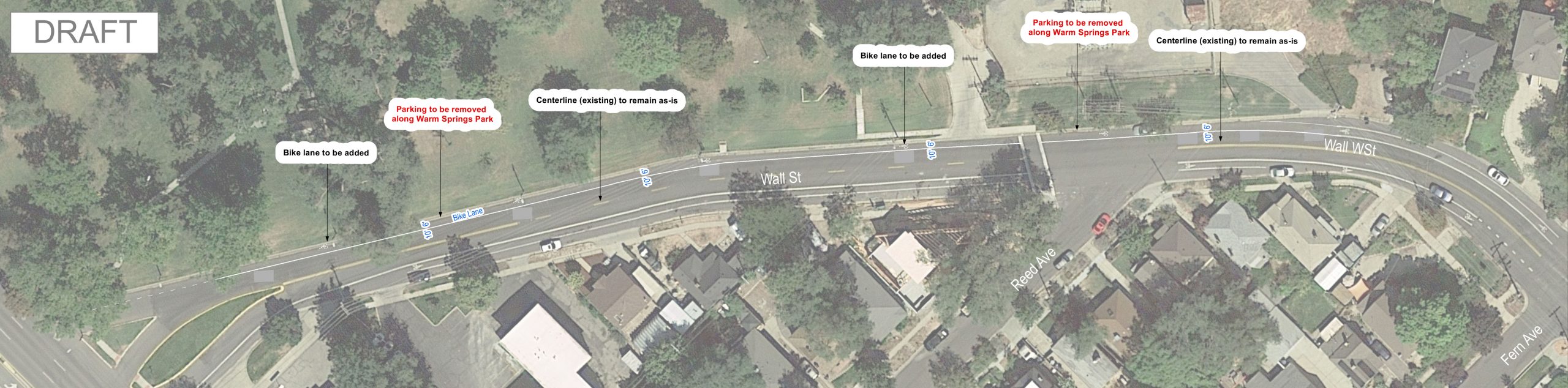
200 West / Wall Street (400 North to 300 West)
Background
200 West is a two-lane road with regular bike lanes and on-street parking on both sides of the road. The regular bike lanes are consistent with the Pedestrian and Bicycle Master Plan. North of Fern Avenue, 200 West connects to Wall Street as it provides access to Warm Springs Park and 300 West. The evaluation will focus on the area adjacent to Warm Springs Park where there are bike lanes in the uphill direction (eastbound) and shared lane markings in the downhill direction (westbound).
Draft Design
A draft design has been prepared and can be reviewed below. Please let the team know if you have comments on the draft design by either completing the survey or sending an email (survey link and email are toward the bottom of this page).
The draft design includes the addition of a westbound bike lane from Fern Ave. to 300 West. The bike lane would connect to the existing bike lane on 200 West and would provide a continuous bike lane from the 200 West/Wall St. intersection to 300 West.
Parking changes with draft design: on-street parking on Wall St. along Warm Springs Park (north side of the road) would be removed. The parking on the south side of Wall St. (where the homes are located) would remain as-is.
The existing shared lane markings (“sharrows”) would be removed (replaced by the bike lane). Both travel lanes would remain as-is and the eastbound bike lane would be replaced as-is.
300 East (500 South to 1300 South)
Project Update
The project team “brought it” with this design. You love your parking-protected bicycle lanes and hate the discomfort of inconsistent bicycle lane treatments. Therefore 300 East will have the following enhancements:
- Maintain parking-protected bicycle lanes
- Added parking-protected bicycle lanes between 500 and 600 South—this does a lot to increase safety of the existing bike lane design
- Close the bicycle lane gap south of 900 South
- Remove “blender lanes” by extending bicycle lane to intersection
The new 300 East design will provide a safer and more comfortable experience for community members walking and bicycling to and from local destinations.
As one community member wrote, “This is an integral piece for the City to move toward a consistent master plan as revitalization efforts begin to make headway and will undoubtedly enhance the atmosphere and convenience of what will soon be a vibrant and bustling section of the City.”
Learn more about the Life on State Bikeways Study.
Highland Drive (Driggs Avenue to City Line)
Background
This area has been identified as a priority corridor in the Local Link regional study. Based on a detailed review of the area, bike lanes were recommended for Highland Drive to improve access between Sugar House and Millcreek’s new downtown development. The design effort by the City will focus on incorporating bike lanes on Highland Drive. In addition, the project team will be closely coordinating with Millcreek as they are planning to restripe their section of Highland Drive (north of 3300 South) from a four-lane roadway to one lane in each direction, a center turn lane, and shoulder areas for people riding bikes. Salt Lake City will be working with Millcreek to find ways to create the best roadway between the two cities for people walking, riding bikes and driving.
Draft Concept Design
The project team studied Highland Drive from Driggs Avenue to the City limit (approximately 3000 South) to look for opportunities that make biking safer and more accessible while improving safety and efficiency for drivers. Both priorities will be accomplished on this section of Highland by restriping the road during an upcoming pavement maintenance project.
The maintenance work consists of a chip seal to preserve the life of the road and will take place in May. Once complete, the road will be striped to include a bike lane on each side of the road. To make room for the new bike lanes, on-street parking will be shifted solely to the east side of the road, except for the area in front of the retail shops on the south end of the project.
Before finalizing the design, the project team presented the plan to the Sugar House Community Council for input. To keep the community in the loop on the project, the team will send a project newsletter, deliver door hangers, and present at future community council meetings. For questions or concerns, or to subscribe to updates please contact the project team at 385-341-2898 and [email protected].
The draft design includes the addition of northbound and southbound bike lanes. On the southern end of the project area (at the Salt Lake City limit) the bike lanes will connect with the resurfacing project being completed by Millcreek, which is planned to occur this summer. Coordination with Millcreek has been occurring on both the design and timing of projects so that people can seamlessly travel between the cities.
Parking changes with draft design: on-street parking on Highland Drive between Driggs Avenue and Malvern Avenue would be removed from the west side of the road. On-street parking on the east side of the road will remain as-is.
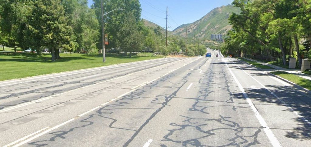
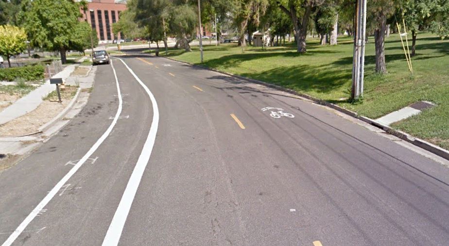
For reference, the illustration below shows the existing lane layout with wide, striped shoulders.
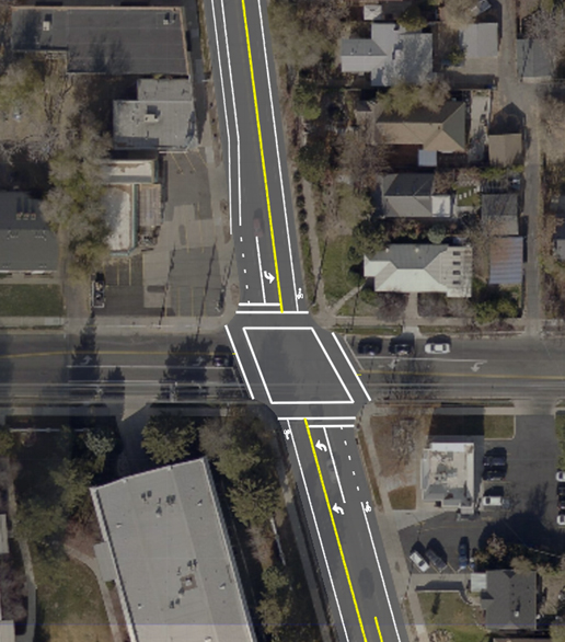
The major intersections in the study area are also planned to receive striping changes. Below is an illustration of the draft design for the Highland Drive/2700 South intersection. The draft design continues the bike lanes through the intersection and maintains all existing vehicle turning movements.
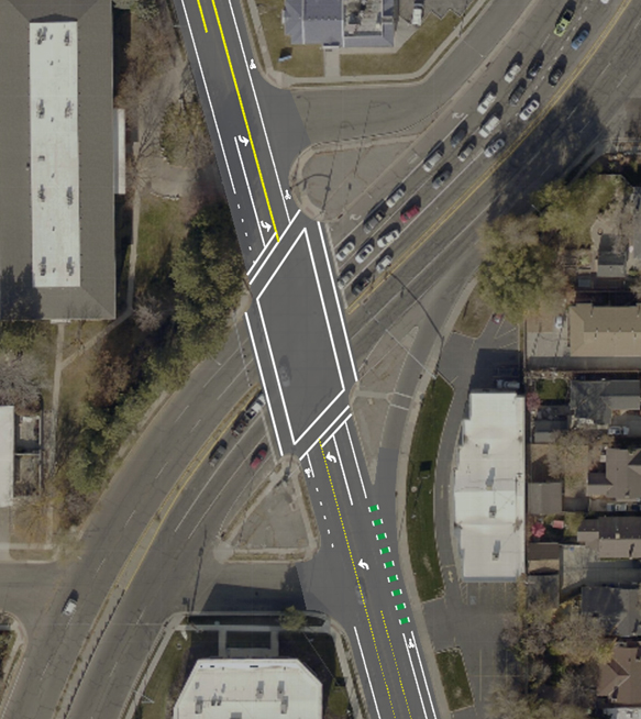
Below is an illustration of the draft design for the Highland Drive/1300 East intersection. The draft design continues the bike lanes through the intersection and maintains all existing vehicle turning movements. Northbound and southbound left-turn lanes have been added to allow motorists to wait for a gap in on-coming traffic without remaining in the through lanes. The green dashed bike lane just south of the intersection is intended to increase visibility of the bike lane in the area of the “free” right-turn lane and is planned to be added as part of a separate project.
2020
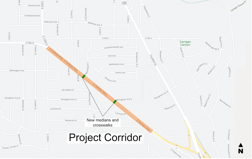
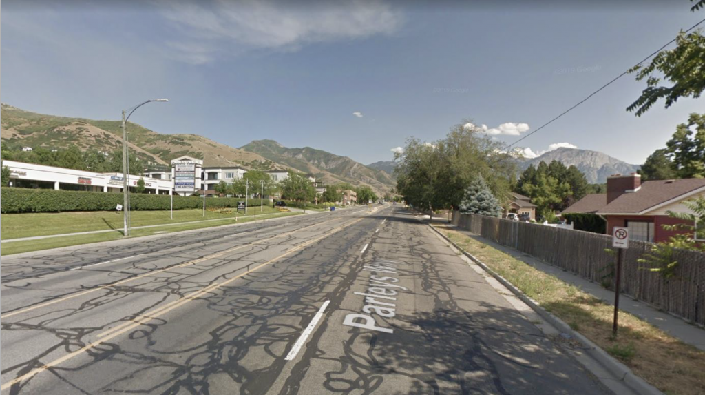
Parley’s Way (2300 E to 1-80)
Overview
This project implemented some recommendations from the Parley’s Way Corridor Plan and followed the City’s Complete Streets Ordinance. Street resurfacing (chip seal) that was completed will help prolong the life of the street. Newly built median islands and enhanced crosswalks at the Wyoming Street & Stringham Avenue intersections improve safety and walkability. Other design changes include right-sizing all four lanes and repurposing the little existing on-street parking in order to paint buffered bike lanes.
Community input about the street
In spring 2020, Salt Lake City gathered community input in considering options for possible changes to the striping design of this street. We asked for your fresh input, to combine with the past input.
There were changes including right-sizing all four lanes and repurposing the little existing on-street parking in order to paint buffered bike lanes. As we did our technical analysis, we wanted to understand better how the community uses the street, and locations of potential concerns.
Common themes in the survey responses:
- People like the easy connection to the freeway, that it’s plowed well, that there’s no traffic/it’s easy to drive on, and the center turn lane
- People don’t like the poor pavement quality, traffic speeds, lack of safe bike lanes and connections to Parley’s Trail, lack of safe crosswalks, that it’s wide and not a visually attractive street, and gutter/drainage issues
- Regarding safety, 91% feel safe or very safe driving (or are neutral about safety) compared with 58% of people who feel safe walking and only 31% of people who feel safe bicycling
- People typically don’t feel safe at intersections like 2300 East, Wyoming, Stringham, and Wiltshire, reasons including:
- cars are driving too fast (speeding)
- lack of frequent and comfortable crosswalks
- crosswalks too long, exposed
- speed differential, especially bikes going uphill
The Salt Lake City Streets Division has resurfaced Parley’s Way (chip seal). Buffered bike lanes were added to the roadside. All traffic lanes and turn lanes remain. The eastbound outside or right turn lanes from Lynwood to Wiltshire were also be reconfigured to reduce conflict at and between nearby intersections, and solve some traffic issues that the neighborhood south of the Wiltshire Drive signal had been experiencing. The Engineering Division also installed new median islands, colored crosswalks, and crossing beacons (RRFBs) at Wyoming Street and Stringham Avenue.
These changes reflect the requests, recommendations, and values found in the 2017 Parley’s Way Corridor Plan and the early 2020 community survey results.
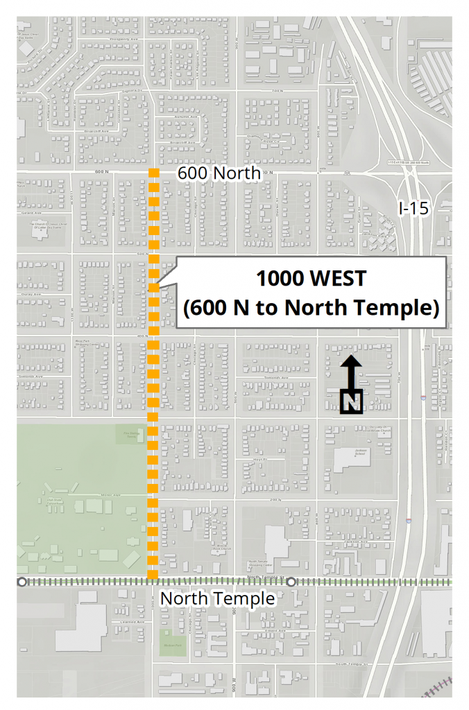
1000 West (600 North to North Temple)
Project Update
While we had planned for this street to receive a surface treatment in the summer of 2020, we postponed this project until the summer of 2021. This decision factored in several considerations including: condition of the street, needs on other streets, and staff/equipment prioritization.
Project Area
Community Input About This Street
In Spring 2020, Salt Lake City gathered community input for possible changes to 1000 West; our major takeaways from our survey are summarized below.
While the scope of this project was to resurface the street and address potential improvements achieved through restriping, the survey asked a variety of questions that helps the City better understand how people use the street, challenges they experience, and things they enjoy about the street. While not all issues and feedback were able to be addressed through this specific project (and may not be relevant to street and transportation projects), this community input provided context, helped identify themes, and can inform future projects.
Common themes in the survey responses:
- Many respondents noted that the level of traffic does not warrant the number of travel lanes, although it was noted that events at the Fairgrounds generate a lot of activity and on-street parking demand.
- The width of the street and infrequent intersection control (e.g. stop signs) can result in speeding vehicles.
- There were several suggestions to repurpose space to take advantage of street width, including:
- median for greening and traffic calming
- multi-use pathway
- protected bike lanes
- crosswalks improvements related to visibility, reduced crossing distance/exposure
Draft Designs
The survey helped inform our Draft Designs which can be viewed below.
We developed two concepts for 1000 West: a median option and a buffered bike lane option. *Click to expand the green bar below to learn more about each option.*
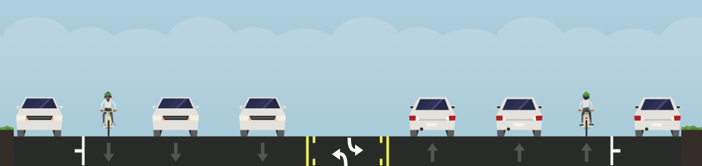
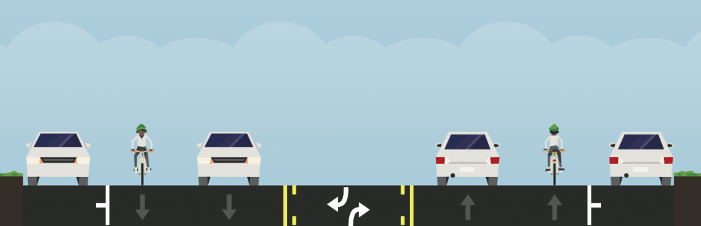
Important Note: Replacing the existing roadway striping is an option. For the two reconfiguration alternatives, vehicle travel lanes would be reduced from two to one in each direction. The amount of traffic that uses 1000 West could be adequately accommodated in the lane reconfiguration of one vehicle lane in each direction. On-street parking would not be impacted by any options.
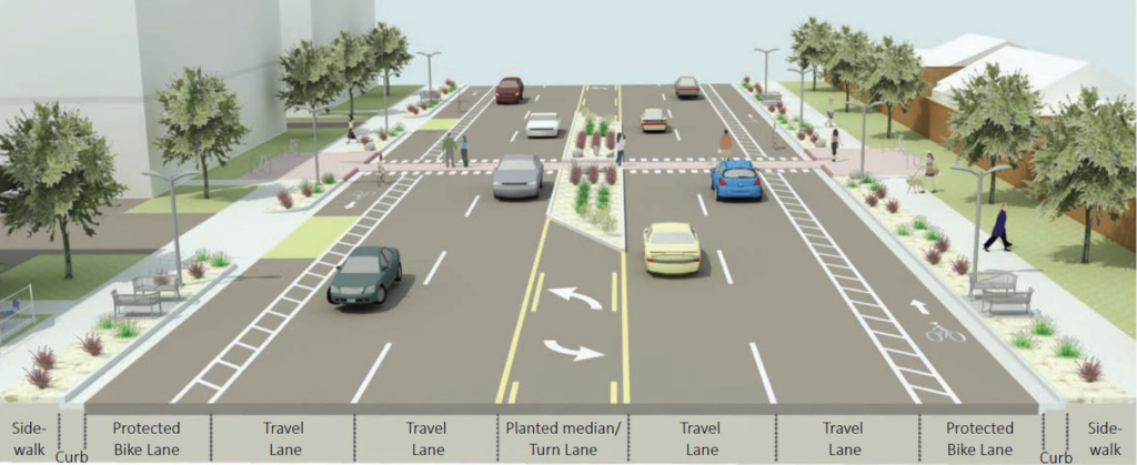
Median Option
This concept would delineate a wide center median and reduce vehicle travel lanes in each direction. We realize that a painted median does not provide the transformative benefits of a planted median. However, by piloting the lane median concept with striping re-configuration, we have an opportunity to test it out and make refinements based on experience and feedback. If it is successful as a pilot, it would be the first step in a process to implement more transformational changes. The design concept is shown between North Temple and 300 N but represents a treatment that we are considering between 300 N to 600 N as well. This would not impact on-street parking.
Draft Design – Plan View
Draft Design – Cross-Section View
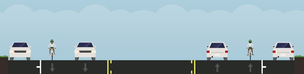
As a comparison, below is a cross-section of the existing conditions.
Please note: the default layout is the existing layout and it is an option for this project. Please feel free to let us know if you prefer the existing layout.
Existing Conditions – Cross-Section View

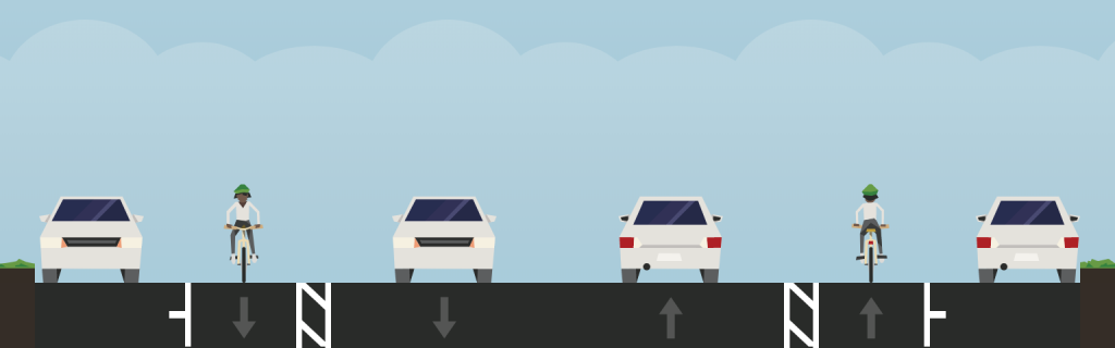
Buffered Bike Lane Option
This concept would reduce vehicle travel lanes in each direction and provide buffered bike lanes. The buffer space adjacent to the bike lanes improve cyclists comfort and safety. Initially the buffer will be striped with paint. This would not impact on-street parking.
Draft Design – Plan View

Draft Design – Cross-Section View
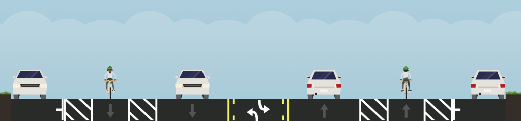
As a comparison, below is a cross-section of the existing conditions.
Please note: the default layout is the existing layout and it is an option for this project. Please feel free to let us know if you prefer the existing layout.
Existing Conditions – Cross-Section View
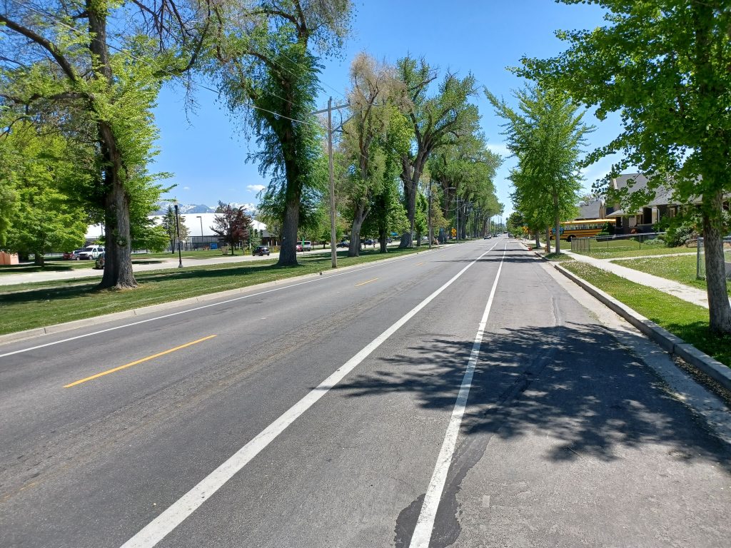
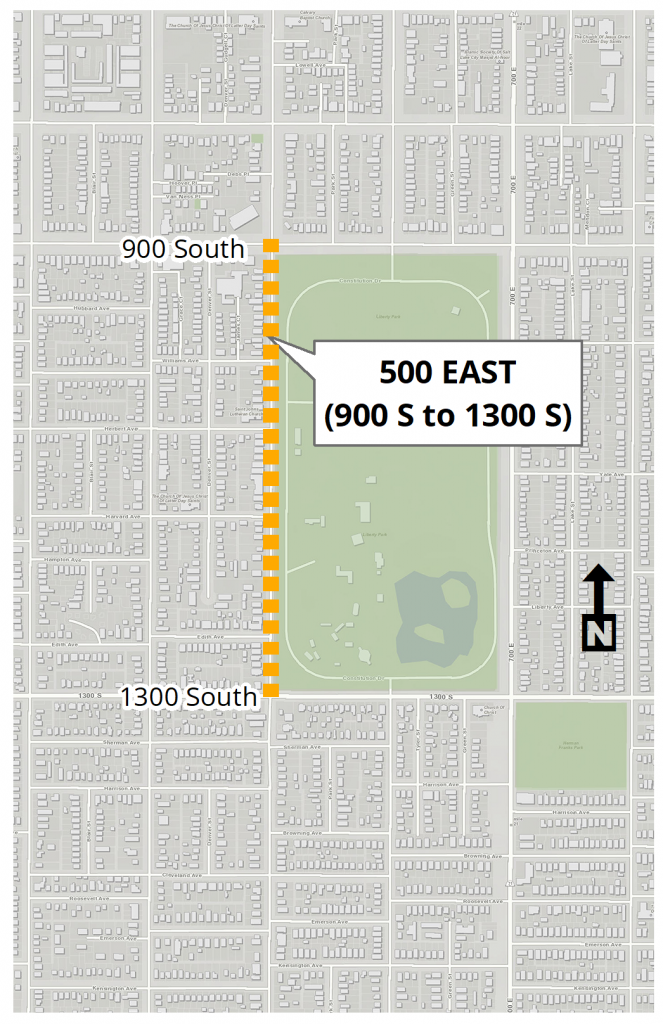
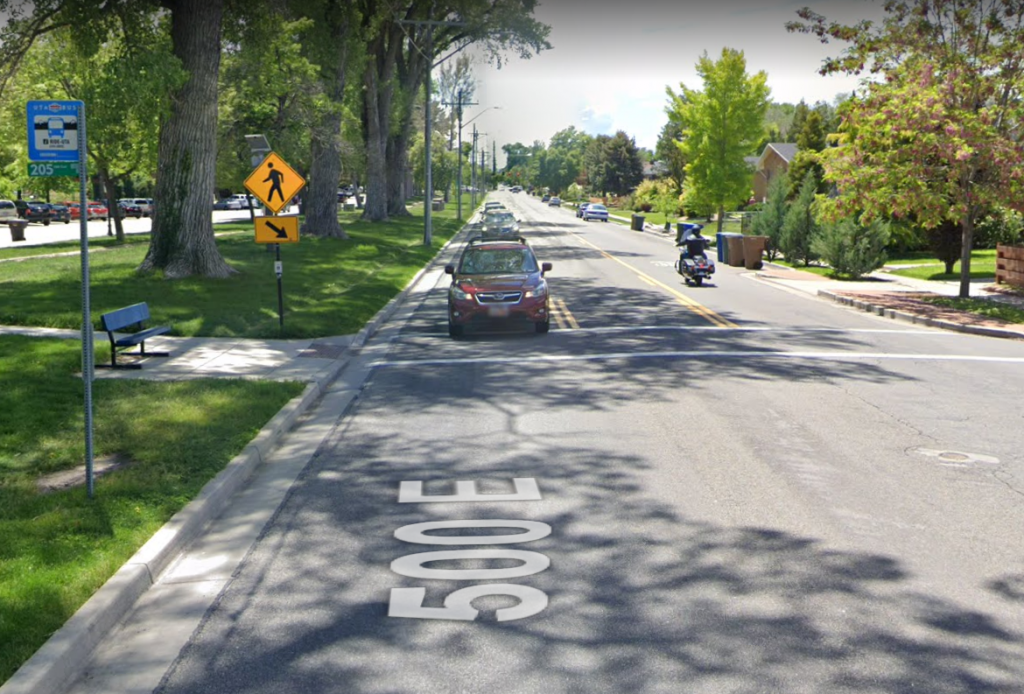
500 East (900 South to 1300 South)
Community input about this street
In Spring 2020, Salt Lake City gathered community input for possible changes to the striping design of this street. Thanks to everyone for participating in our survey for the street resurfacing projects. For the 500 East project, our major takeaways from our survey are summarized below.
While the scope of this project is to resurface the street and address potential improvements achieved through restriping, the survey asked a variety of questions that helps the City better understand how people use the street, challenges they experience, and things they enjoy about the street. While not all issues and feedback can be addressed through this specific project (and may not be relevant to street and transportation projects), this community input provides context, helps identify themes, and can inform future projects.
Survey Summary
Who took the survey?
The survey had a total of 122 respondents (not all people answered all the questions) and were a mix of people that live on the street, use the street to commute, own property, and those that use the street occasionally. The large majority of those that took the survey walk, bike, and drive on 500 East daily or weekly. While not all comments are consistent, this summary represents a compilation of the most common responses to the questions asked.
What do people like about this street?
People that took the survey commented on liking the street for its light vehicle traffic and speeds compared to 700 East, the locations of the crosswalks and the proximity to Liberty Park and the benefits that brings to this street.
“It’s just a great park facing & public street that serves traffic excellently between two very popular & populated areas of our young city.”
“I like that it is close to the park and has good crosswalks, I enjoy that it has good sidewalks.”
“I like that the park is right next to it. I also like the curb extensions on the west side of the street.”
“Proximity to Liberty Park and surrounding neighborhood, with restaurants and other businesses on the corners of 900 South and 1300 South.”
What do people not like about this street?
Respondents commented on disliking the volume and speed of traffic, lack of striped bicycle lanes, missing sidewalks on the East side of the road, road surface conditions, and the lack of traffic control measures at certain intersections.
“I was bummed when this street was painted to have sharrows and the bike lane removed. With so many users at the park, it would be great to have a walk bike space immediate parallel to the park.”
“The cars and no bike lane”
“The overflow commuter traffic from 7th east is congesting it”
“No separate defined bike lanes. Cars often speed.”
How safe does this street feel?
People responded feeling very safe to neutral about traveling on 700 South by most modes, except for bicycling and bicycling with children. Locations where people felt unsafe were generally spread over the entire area with hot spots at intersections. People cited lack of a bike lane as the reason they feel unsafe.
Other considerations
Respondents indicated the “Mobility of People” was the most important function for this street.
Draft Design
Thanks to everyone that commented on the draft designs. The comments received helped to inform the final design. The draft design would add a northbound bike lane to the roadway so that it is consistent with 500 East to the south and to meet the stated preference of the community as received in the outreach part of the project.
There would be no changes to the amount of on-street parking or number of through vehicle travel lanes as part of this project.
Draft Design – Cross-Section View
Draft Design – Plan View
As a comparison, below is a cross-section of the existing conditions.
Please note: the default layout is the existing layout and it is an option for this project. Please feel free to let us know if you prefer the existing layout.
Existing Conditions – Cross-Section View
Final Design
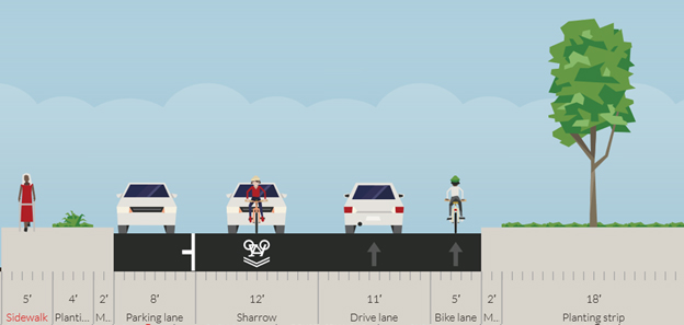
Thanks to everyone that commented on the draft designs. The comments received helped to inform the final design. Striping on this roadway will be changed as part of the resurfacing. The changes include:
- Bike lanes will be added to both sides of the roadway, in accordance with input received from the Liberty Wells Community Council
- The Center Turn Lane will be permanently removed from the roadway.
Below is a cross-section view of the upcoming striping layout (view looking north):
The changes to the striping layout have been determined based on a thorough evaluation by the Salt Lake City Transportation Division. The evaluation included a review of the traffic volumes, existing roadway characteristics, public outreach and engagement with the Liberty Wells Community Council and Bicycle Advisory Committee.
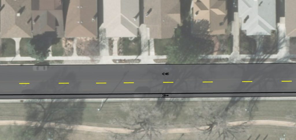
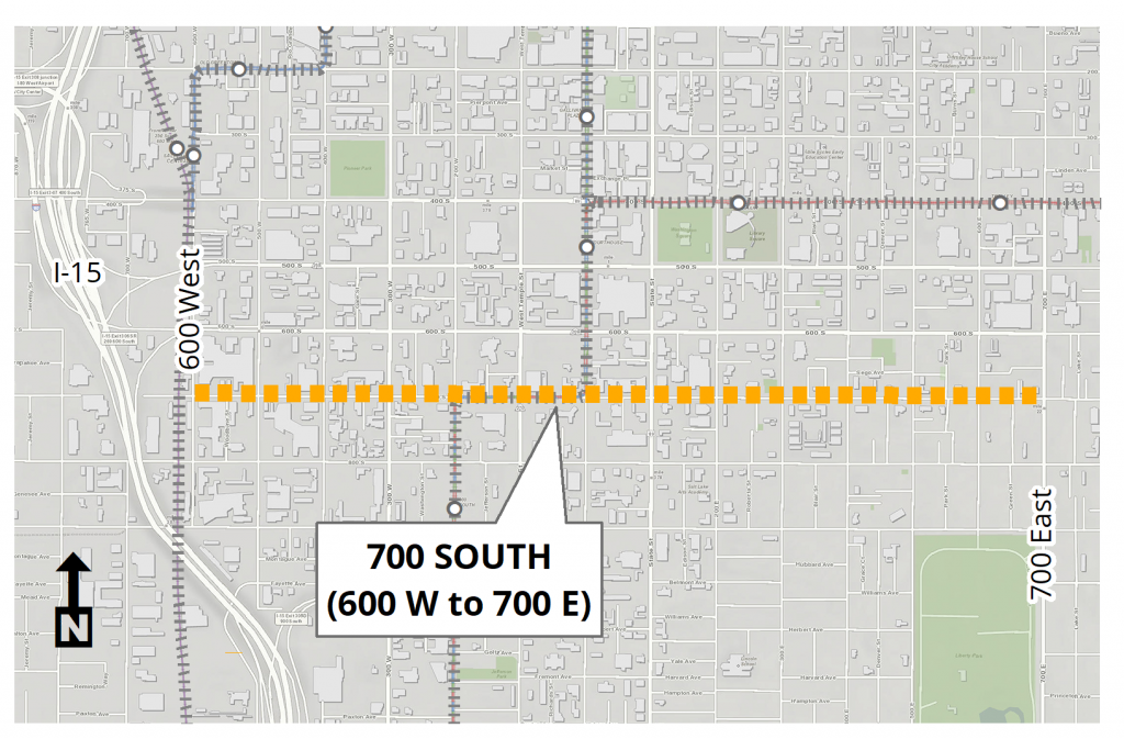
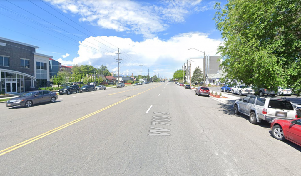
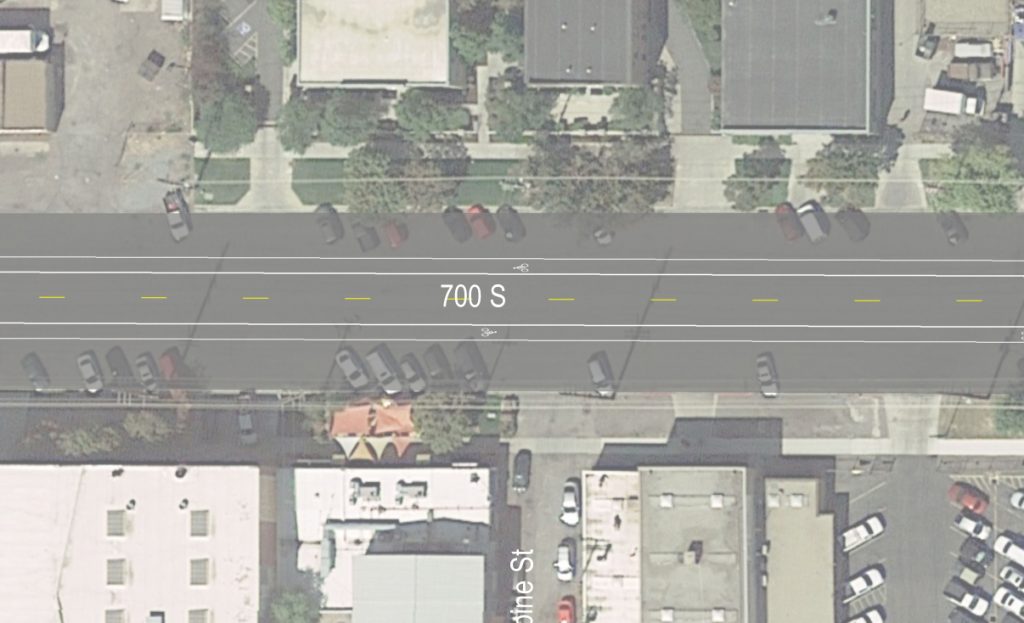
700 South (600 West to 700 East)
This street received a surface treatment in the summer of 2020. Marking and striping were changed along some stretches of the street.
Community Input About This Street
In Spring 2020, Salt Lake City gathered community input for possible changes to the striping design of this street. For the 700 South project, our major takeaways from our survey are summarized below. *Click on the green bar to expand to the survey summary.*
While the scope of this project was to resurface the street and address potential improvements achieved through restriping, the survey asked a variety of questions that helps the City better understand how people use the street, challenges they experience, and things they enjoy about the street. While not all issues and feedback were able to be addressed through this specific project (and may not be relevant to street and transportation projects), this community input provides context, helps identify themes, and can inform future projects.
Who took the survey?
28 people took the survey (not all people answered all the questions) and were a mix of people that live on the street, use the street to commute, own property, and that use the street occasionally. More than half of those that took the survey walk, bike, and drive on 700 South daily or weekly.
What do people like about this street?
People that took the survey commented on liking the street for its light vehicle traffic compared to other streets, being wide enough to provide space for riding a bicycle, and for its connection to transit, businesses, and other parts of the city.
“I use t[r]ax to downtown so I appreciate that. I live so I walk 700 daily.”
“I love my Central City neighborhood! I appreciate that this is one of the quieter streets in the immediate area.”
“It has large safe shoulders to bike on. It’s fairly quiet.”
“It’s a quiet street that connects to several businesses i like to visit”
What do people dislike about this street?
Respondents commented on the lack of striped bicycle lanes, missing and narrow sidewalks, the street being overly wide, road surface conditions, the lack of traffic control measures at certain intersections, and people experiencing homelessness creating camps along sections of the road.
“No bike lane, bad crosswalk timers”
“Too wide! Needs a median with trees.”
“No dedicated space for bikes, narrow sidewalks, tons of asphalt”
“Homeless camps.”
“Traffic moves way too fast! We need a 4 way stop sign at the intersection of 600 E and 700 S (for traffic on 600 E moving N/S). I would love to see designated bike lanes, speedbumps, and more pop out curbs for crosswalks to ease traffic flow and make it more friendly to families, bikers, walkers etc”
How safe does this street feel?
Most people responded feeling very safe to neutral about traveling on 700 South by most modes, except for bicycling with children. People cited vehicles driving too fast and being unaware of bicyclists, and a general sense of safety, and other reasons as the cause for feeling unsafe bicycling with children.
Other considerations
Additionally, here is a sample of other things survey respondents would like to have considered:
“The lack of signage on the intersection of 600e and 700. A bike path and generally more people friendly for walking”
“This is a great place for median development and the street should be used much more efficiently to create vibrancy to the neighborhood”
Final Design
Thanks to everyone that commented on the draft designs. The comments received helped to inform the final design.
The preferred design would add bike lanes to the roadway. The number of vehicle travel lanes would remain as-is as part of this project (with the exception of turn lanes that would be removed in some locations).
The design would result in some on-street parking removed at the 700 South/Main Street intersection.
The three cross-section examples shown are representative of the project segments: 1) 600 West to 200 West, 2) 200 West to Main St, 3) Main St to 200 East, and 4) 200 East to 300 East. *Click on the green bar to expand to the project segments.*
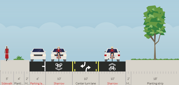
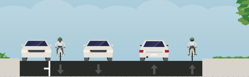
Design for 600 West to 200 West Segment – Plan View
Design for 600 West to 200 West Segment – Cross-Section View
Design for 200 West to Main St Segment – Plan View
Design for 200 West to Main St Segment – Cross-Section View
Design for Main St to 200 East Segment – Plan View
Design for Main St to 200 East Segment – Cross-Section View
Design for 200 East to 300 East Segment – Plan View
Design for 200 East to 300 East Segment – Cross-Section View
As a comparison, below is a cross-section of the previously existing conditions.
Please note: if funding is not available for project implementation, then the existing layout will remain.
Previous Conditions for 200W to Main Street Segment– Cross-Section View
Previous Conditions for Main St to 200 East Segment – Cross-Section View
Previous Conditions for for 200 East to 300 East Segment – Cross-Section View
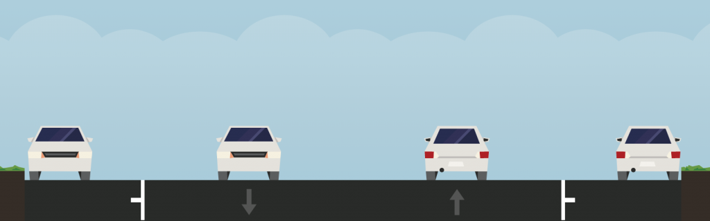
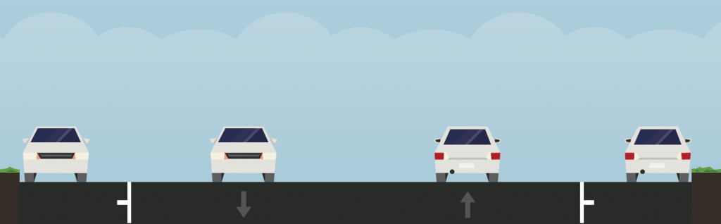
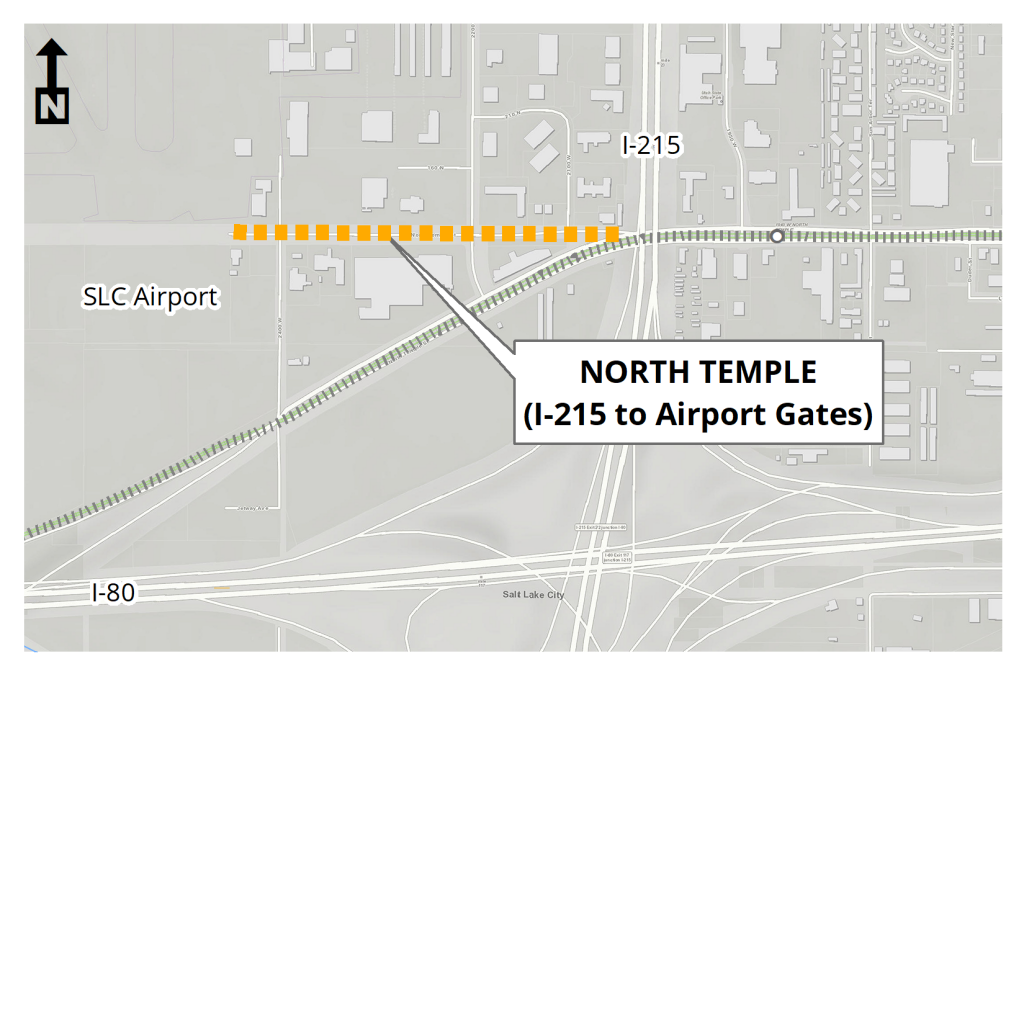
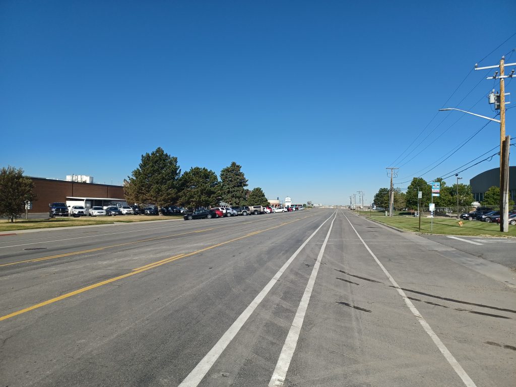
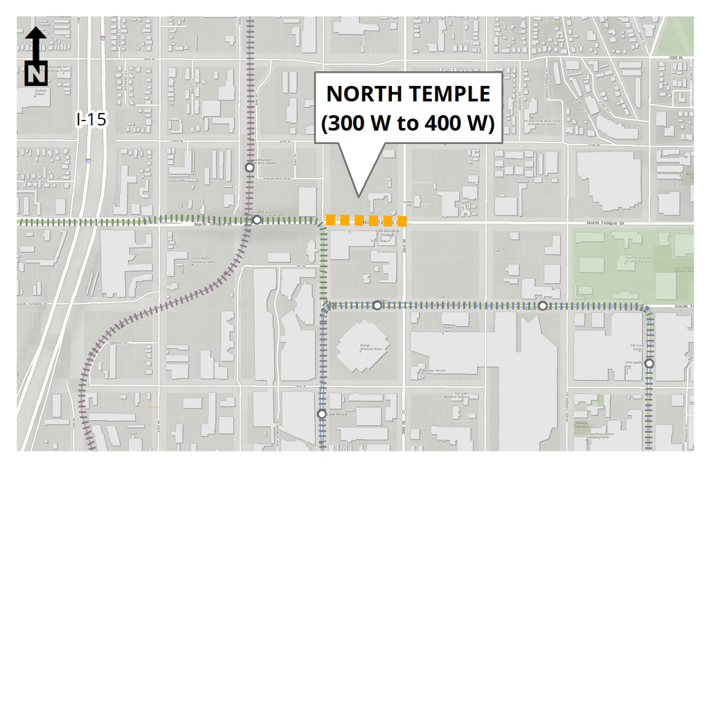
North Temple (I-215 to Airport Gates)
This street received a surface treatment in the summer of 2020.
Community input about this street
In Spring 2020, Salt Lake City gathered community input for possible changes to the striping design of this street.
Thanks to everyone for participating in our survey for the street resurfacing project. For the North Temple (Airports Gates to I-215 Overpass) project, our major takeaways from our survey were:
- Concern about the side-street stop controlled intersection at 2200 West
- Concern about the potholes and roadway surface quality
- Mobility of people and vehicles rank as high priorities
Final Design
Thanks to everyone that commented on the draft designs. The comments received helped to inform the final design.
The preferred design would add bike lanes to roadway. There would be no substantial change to the amount of on-street parking or number of vehicle travel lanes as part of this project.
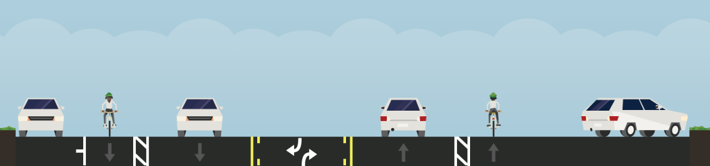
Final Design – Plan View
Final Design – Cross-Section View
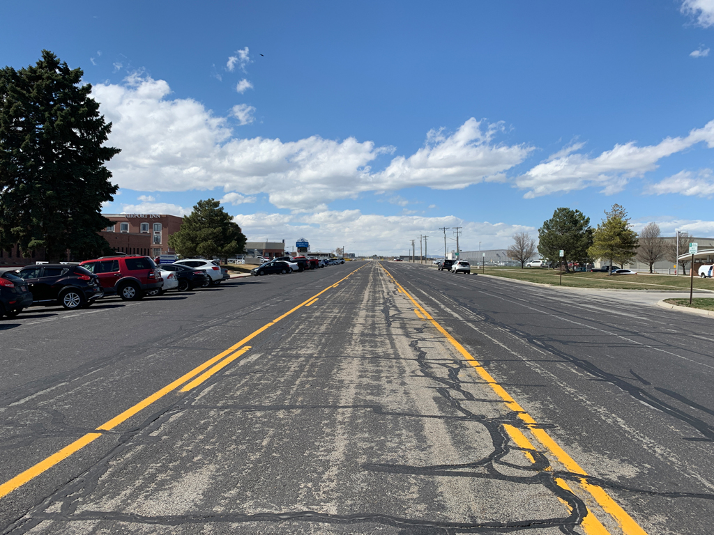
North Temple (300 West to 400 West)
This street will receive a surface treatment in the summer of 2020. Access & parking will be restricted for a maximum of 6 daytime hours on 1-3 days. There may be changes to striping & markings.
Community input about this street
In Spring 2020, Salt Lake City gathered community input for possible changes to the striping design of this street.
Thanks to everyone for participating in our survey for the street resurfacing project. The comments received have helped us develop a draft layout for this block.
Thank you to everyone who took the survey!
Final Design
Please Note: Implementation of this project is dependent on funding availability. The Project Team is working to secure funding for full implementation; however, the project isn’t guaranteed to be implemented this summer.
Thanks to everyone that commented on the draft designs. The comments received helped to inform the final design.
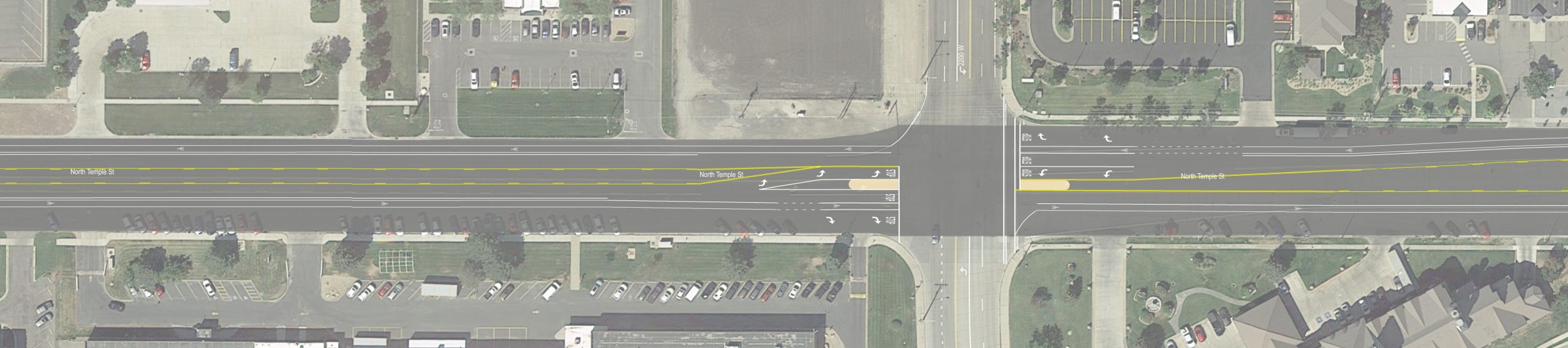
The preferred design would begin the eastbound bus only lane on the westside of the 300 West intersection. Beginning the bus only lane would allow UTA buses to reduce the amount of time they spend in eastbound traffic at the intersection. There would be no substantial change to the amount of on-street parking or number of vehicle travel lanes as part of this project.
Final Design – Plan View

Please note: if funding is not available for project implementation, then the existing layout will remain.
What is next?
To be added to the project email list for future input and design updates, please send “updates for North Temple West” to [email protected].
| Early Spring 2020 | Project Announcement and community input. | |
| Spring 2020 | Draft conceptual design available for community input. | |
| 3-4 weeks before surface treatment | Notice of final design made public along with information about what to expect on the 1-3 days when the surface treatment work will affect use of this street. | |
| Summer 2020 | Surface treatment and restriping by SLC Streets Division. |
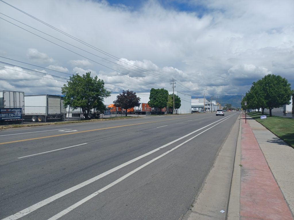
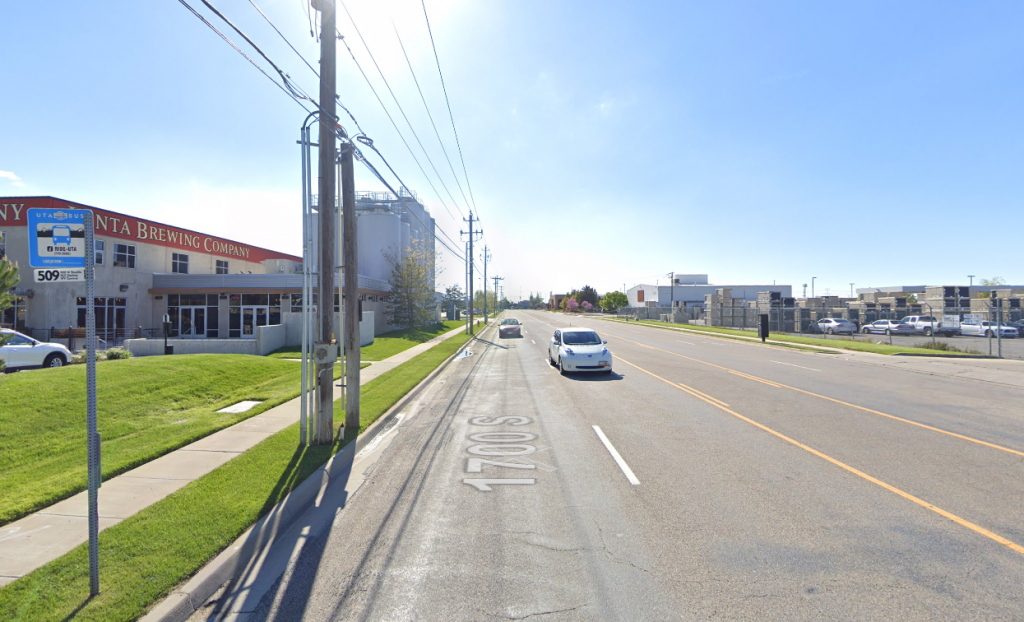
1700 South (Redwood to Pioneer)
Community input about this street
In Spring 2020, Salt Lake City gathered community input for possible changes to the striping design of this street.
Thanks to everyone for participating in our survey for the street resurfacing projects. For the 1700 South project, our major takeaways from our survey are summarized below. *Click on the green bar to expand to the survey summary.*
While the scope of this project was to resurface the street and address potential improvements achieved through restriping, the survey asked a variety of questions that helps the City better understand how people use the street, challenges they experience, and things they enjoy about the street. While not all issues and feedback were able to be addressed through this specific project (and may not be relevant to street and transportation projects), this community input provided context, helped identify themes, and can inform future projects.
Survey Summary
People that took the survey commented on liking the street for its light vehicle traffic, ease of access and easy commute.
Respondents commented on disliking the lack of greenery, issues with the lane lines and lack of enforcement and lack of curb-gutter in some places.
People responded feeling unsafe walk, bicycling, skateboarding, walking with children, bicycling with children and using assistive devices (wheelchair, walker, crutches, etc.). Locations where people felt unsafe were generally spread over the entire area with hot spots at intersections. People cited lack of a bike lane as the reason they feel unsafe. Locations where people feel unsafe are spread across the project area. Reasons for feeling unsafe include uneven surfaces, large trucks and high speeds
Respondents indicated the “Mobility of People” was the most important function for this street. Specific changes requested included to add trees and bike lanes, as well as maintain business access (semis and delivery vehicles).
Glendale Community Council Support
Additionally, the Glendale Community Council provided a letter of support for the project requesting bike lanes and additional crosswalks. Historically, these locations have been evaluated for marked crosswalks and were found to have too low of pedestrian demand to warrant adding the crosswalk. This condition will continue to be monitored in the future.
Thank you to everyone who took the survey!
Final Design
Thanks to everyone that commented on the draft designs. The comments received helped to inform the final design.
The preferred design has incorporated the desire to add protected bike lanes, which will tie into the bike lanes to the west of Redwood Road. There would be no changes to the amount of on-street parking.
The project would remove a travel lane in the westbound direction.
Final Design – Plan View

Final Design – Cross-Section View
As a comparison, below is a cross-section of the existing conditions.
Please note: if funding is not available for project implementation, then the existing layout will remain.
Existing Conditions – Cross-Section View