Introduction
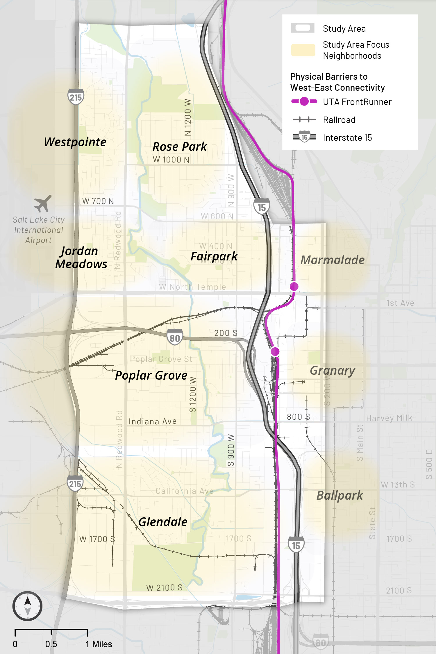
Salt Lake City’s Westside neighborhoods are physically separated from eastern parts of the city, including downtown, by I-15 and major railroad tracks including the Union Pacific Railroad and FrontRunner commuter rail.
These barriers create a daily challenge for people crossing to the east side. Parked trains affect Westside residents daily, causing delays, longer travel times, and safety concerns. Currently, crossings are limited to just a few major streets. The map shows the study area, roughly bounded by I-215, 2100 North, 2100 South, and 300 West. I-15 and the railroad run through the middle.
About the West-East Connections Study (WE Connect)
Salt Lake City (SLC) began a transportation study, funded by the Reconnecting Communities Pilot Grant Program in 2025, to identify and prioritize solutions that improve west-east connectivity across the divide. The two-year planning effort will:
- Analyze transportation needs across all modes—driving, walking, biking, and transit.
- Engage directly with residents and stakeholders to define the problem and co-create solutions.
- Recommend infrastructure improvements that reflect community priorities and lived experiences.
These videos provide an overview of the first two phases of public engagement:
Phase 1: defining the problem
Phase 2: brainstorming solutions
Community-centered approach
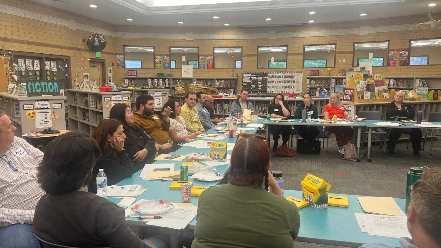
The SLC West-East Connections Study takes a community-centered approach, ensuring those most affected by the divide define the challenges and help shape solutions. Study success depends on ongoing engagement and collaboration between the city, community, and partner agencies. A Community Advisory Board made up of Westside residents and businesses, and an Arts Engagement Group with six local arts are helping guide the team throughout the process, with engagement opportunities to help develop a community-supported, unified plan by the end of 2026. Click the CAB Summary Reports drop down menu below to review meeting reports and activities.
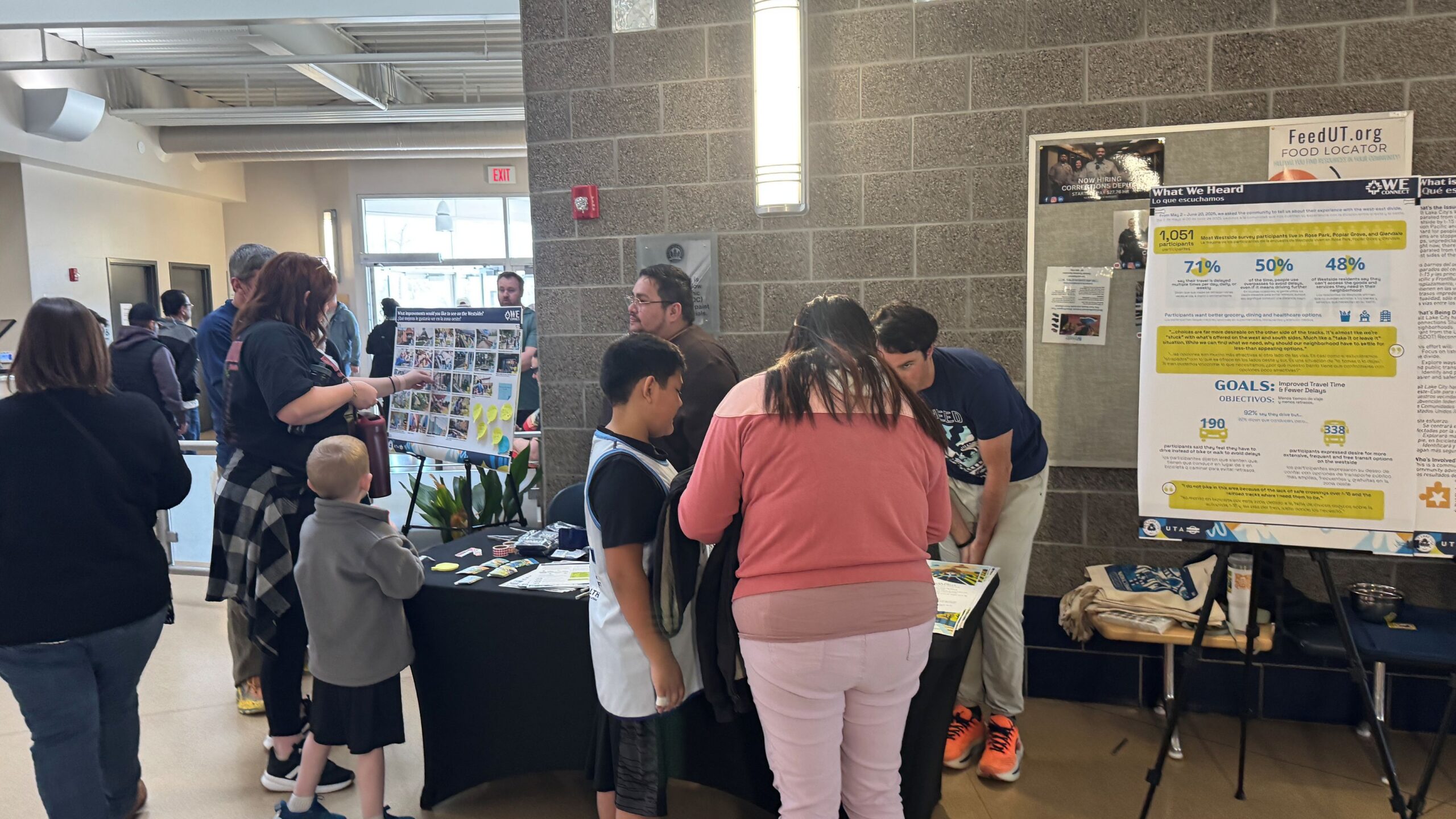
Upcoming events
We’re out and about! Meet the WE Connect team at these upcoming community events.
Partners in the Park at Jordan Park
June 2, 2026 | 6 to 8 p.m.
Neighborhood House Summer Celebration
June 12, 2026 | 4 to 6 p.m.
Partners in the Park at Nature Center at Pia Okwai
June 23, 2026 | 6 to 8 p.m.
Partners in the Park at Northwest Rec Center
July 14, 2026 | 6 to 8 p.m.
What we’ve heard from you
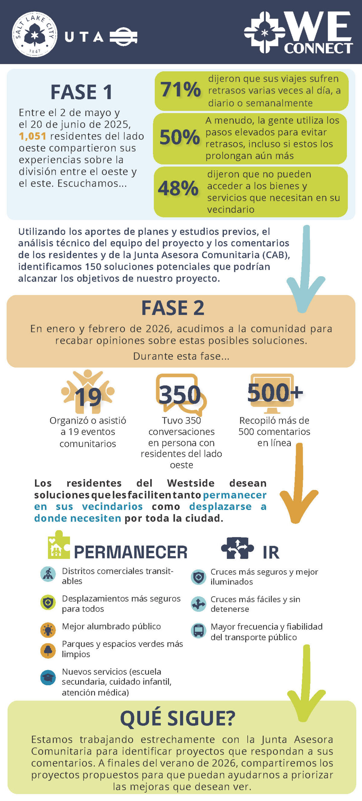
Phase one
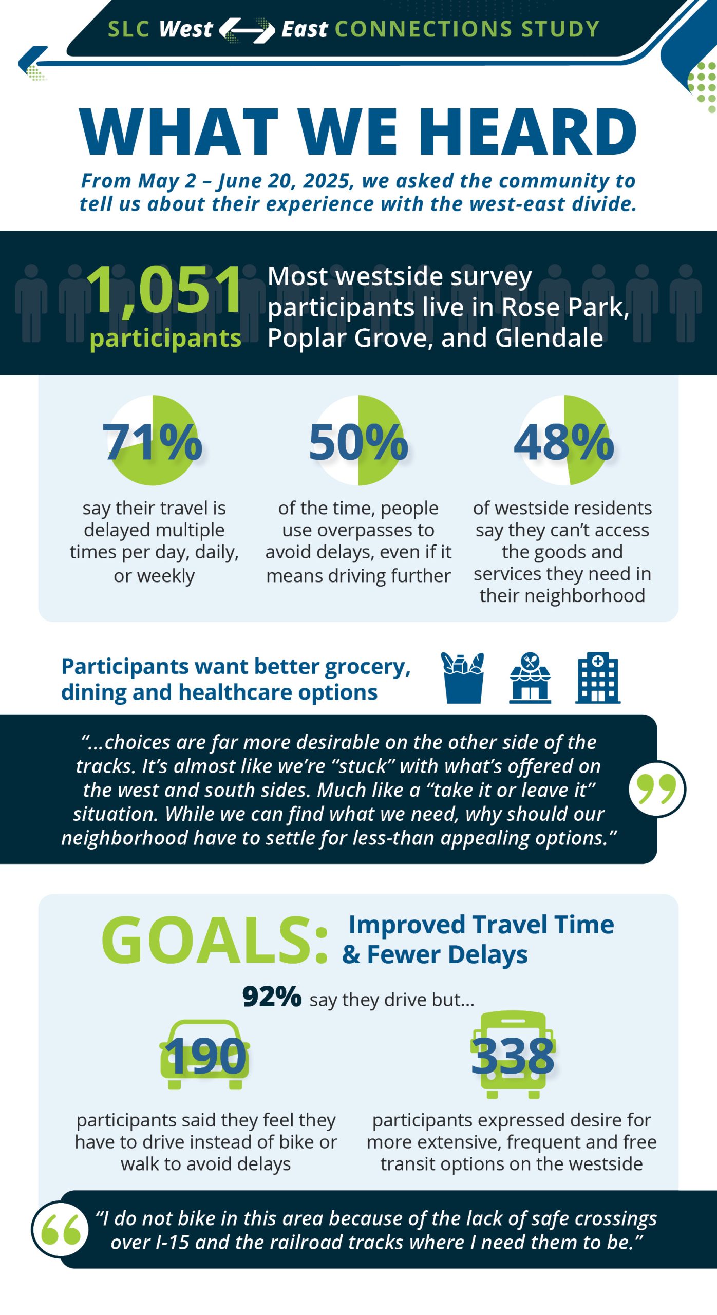
Between May 2 and June 20, 2025, 1,051 community members shared their experiences with the West-East divide. The majority of participants live in Rose Park, Poplar Grove, and Glendale.
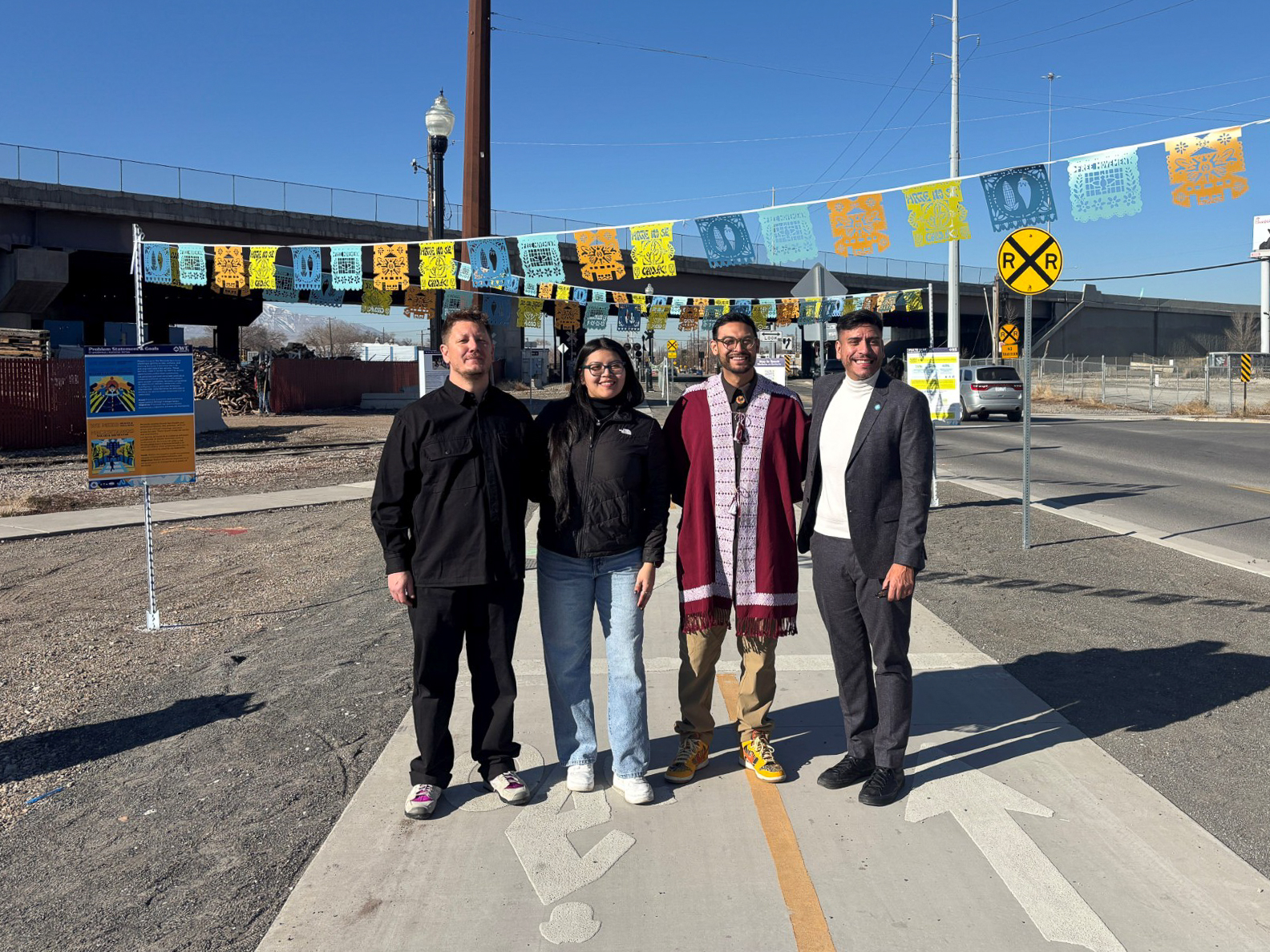
In late 2025, the WE Connect Community Advisory Board, five local artists, and the project team collaborated to develop new artwork that better represents the input you shared with us.
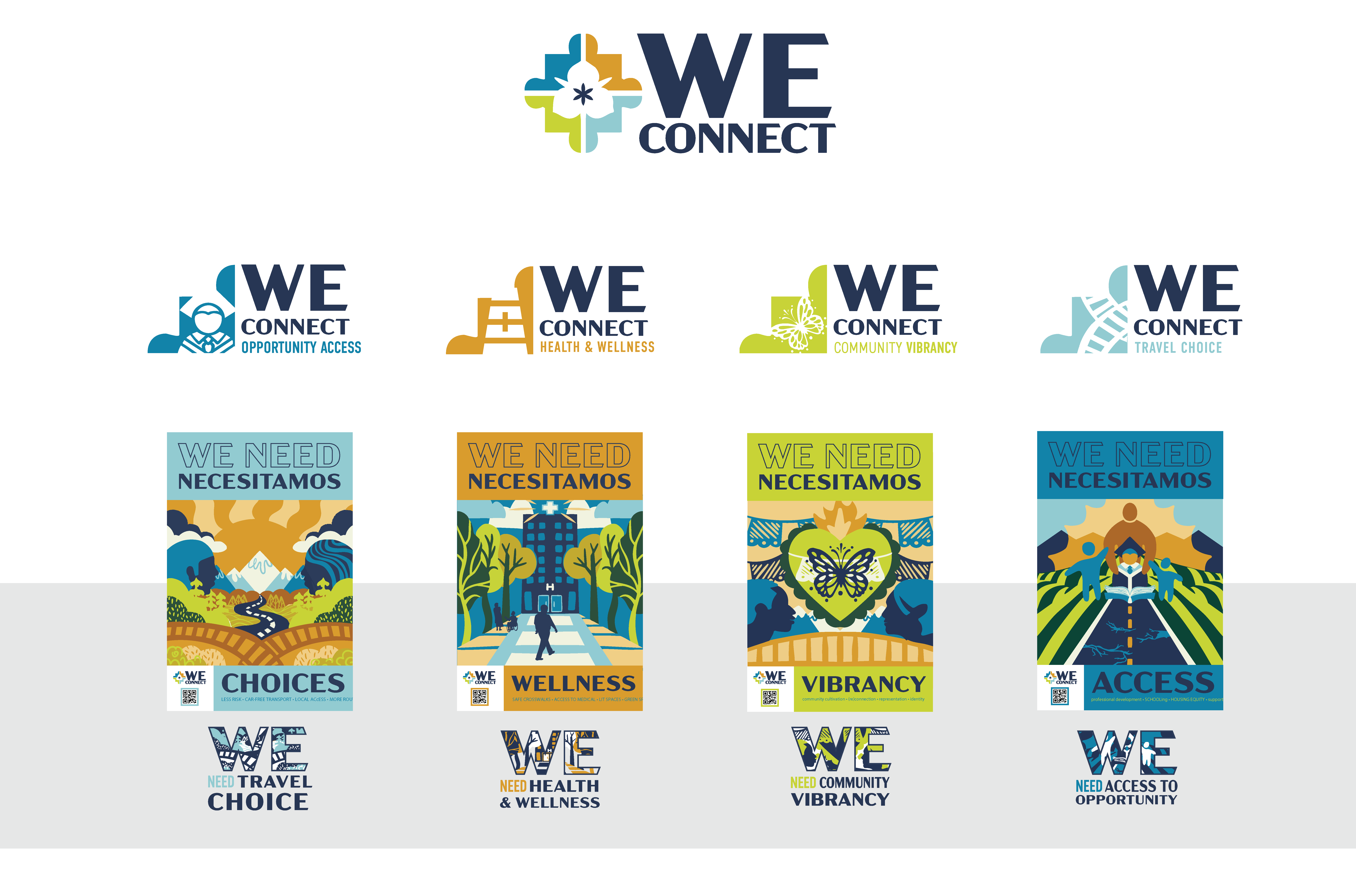
The four puzzle pieces represent the four major problem statements you—the Westside community—told us were caused by the physical divide between the west and east sides of Salt Lake City—travel choice, health and safety, community vibrancy, and access to opportunity.
Phase two
Between January and March 2026, we asked Westside community members to share ideas for solutions to the west-east divide that address the problems you identified in Phase 1. The team also asked for your preferences on ideas we’d heard during other City plans and studies, or those that you shared in Phase 1. In total, the team is now reviewing over 350 proposed solutions to address travel choice, health and safety, community vibrancy, and access to opportunity across the divide.
There are a wide range of ideas, from burying the train to adding bridges or tunnels; from expanding GREENbike stations, transit service, and active transportation infrastructure, to building more walkable commercial districts and essential Westside amenities like a high school, hospital, fitness facilities, and childcare centers. Requests for more street lighting were also popular.
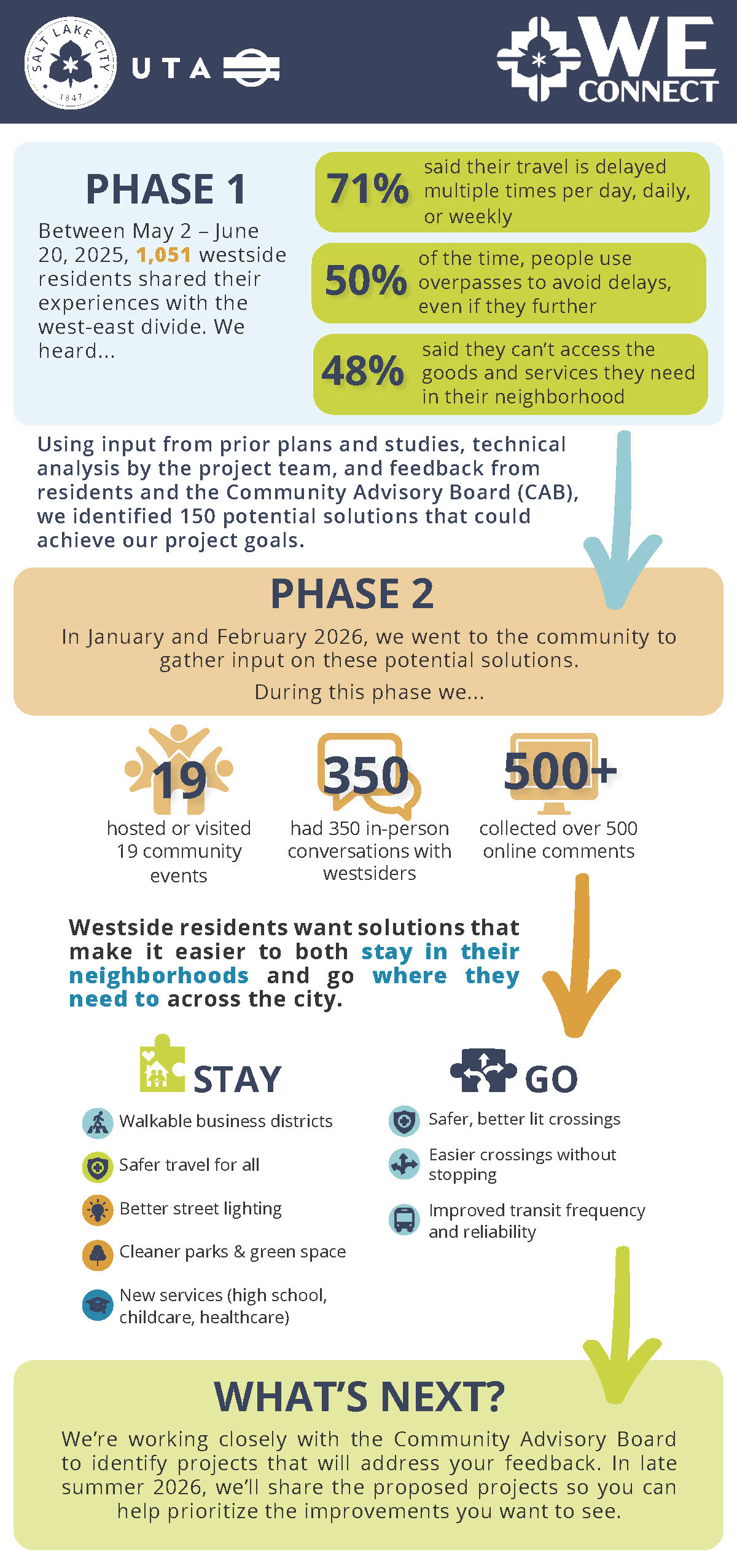
What’s next
Through early summer, the WE Connect team will be evaluating all of these ideas to see how they might be combined to address as many of the problem areas as possible, how costly they might be, and who might need to be involved to see them through to completion. We’ll come back to you in August 2026 to get community feedback on which of the proposed solutions you think best meet the community’s needs and should be prioritized for funding. Sign up for email updates so you can participate!
More information
The following reports summarize what we have learned so far:Project progress
Project progress
In recent years, Salt Lake City has taken steps to address the divide through several Westside projects, including: Additional projects are planned for 2026, including the 600/700 North reconstruction. While these efforts improve access across the divide, a more holistic approach is needed to create a unified plan that reconnects the Westside and better meets community needs.Past projects
Past projects
Salt Lake City received a grant from the USDOT as part of the Reconnecting Communities Pilot Grant Program. Funding will be used to prepare a plan that analyzes needs and recommends potential solutions to improve transportation infrastructure surrounding the west-east divide. Agency partners will focus on the technical and infrastructure needs and potential solutions: Read the full grant application narrative.Reconnecting Communities grant
Reconnecting Communities grant
Funding partners and local match commitments
The east-west division began in 1870, the year the Transcontinental Railroads famously joined in Utah. This was only 27 years after Europeans first settled in the area and well before the modern City Government. The railroad was celebrated, but it also divided the city. Homesteads and farms built west of the rails became less desirable as industrial uses dominated along the railroad and the nearby Jordan River was used as a dumping ground. In the following decades, the arrival of the freeways made the division worse and brought unsafe conditions and pollution to the west side. Large bridges were built to carry cars over the rail lines with high-speed interchanges to help vehicles get on and off the freeways. Later, freeway widening expanded the infrastructure barriers. Now, finally, is the time to begin to come to terms with this divide. Reconnecting Communities is a robust community-centric planning effort to envision solutions for east-west crossings focused on a 6.1 mile highly urbanized corridor.How did we get here?
Historical overview
Related plans and studies
Related plans and studies
- Connect SLC – Transportation Master Plan update (2024)
- Ballpark Station Area Plan (2022)
- Westside Transportation Equity Study (2021)
- Regional Transportation Plan (2019)
- 9 Line Trail Extension Study (2018)
- Salt Lake County Active Transportation Implementation Plan (2017)
- Salt Lake City Transit Master Plan (2017)
- Wasatch Front Central Corridor Study (2017)
- Utah Freight Plan Summary (2017)
- Salt Lake City Pedestrian & Bicycle Master Plan (2015)
- Westside Master Plan (2014)
- Salt Lake City Transportation Master Plan (1996)
Letters of support and comments from the general public
Letters of support
The SLC West-East Connections Study has broad support from government agencies, community councils, freight operators, and business advocacy groups. This study will build on this support to bring together groups who are actively working to improve life in Salt Lake City.
“I want to express our support of Salt Lake City’s initiative to address east-west connections across the Interstate 15 (I-15) and north-south rail corridors, particularly for people walking, biking, and taking transit.” – Salt Lake City Council
- 300 West Merchants’ Association
- Ballpark Community Council
- Bicycle Collective
- Bike Utah
- Building Salt Lake
- Capitol Hill Neighborhood Council*
- Central 9th Community Council
- Central City Community Council
- City of South Salt Lake
- Cycling West
- Downtown Alliance
- Fairpark Community Council
- Fisher Brewing
- Fourth Street Clinic
- Gardner Batt LLC
- Glendale Community Council
- Granary District Alliance
- GREENbike
- Jordan Meadows Community Council
- Lux Events
- Neighborhood House
- NeighborWorks
- Poplar Grove Community Council
- Rio Grande Plan co-author, Cameron Blakely
- Rio Grande Plan co-author, Christian Lenhart
- Rose Park Community Council*
- Salt Lake Bees Minor League Baseball*
- Salt Lake City Arts Council
- Salt Lake City Bicycle Advisory Committee
- Salt Lake City Council
- Salt Lake City Public Library
- Salt Lake City Transportation Advisory Board
- Salt Lake County
- Salt Lake Education Foundation*
- Salt Lake Garfield & Western / Patriot Rail
- Shelter The Homeless
- Sorenson Community Center
- Sweet Streets
- University of Utah – City & Metropolitan Planning*
- Union Pacific Railroad (UPRR)*
- U.S. Representative Chris Stewart
- Utah Department of Transportation (UDOT)
- Utah Inland Port Authority
- Utah Rail Passengers Association
- Utah State Fair
- Volunteers of America
- Wasatch Front Regional Council
- Westside Coalition
* East-West Connections support for similar grant.
Read the comments from the general public.
Media and articles
Media and articles
- Train-Bicyclist Fatality at 900 South (October 2023)
- Train-Pedestrian Injury at 900 South (December 2018)
- Train-Pedestrian Fatality at 900 South (August 2018)
- Train-Bicyclist Fatality during 999 Social Bicycle Ride (July 2018)
Stay in touch
Send us an email at [email protected].