Central Pointe Station Area Plan
March 2026 Update
The Planning Division will be working on an update to the City’s Central Community Plan this year. That community plan area encompasses the boundary of the Central Pointe Station Area Plan. This station area plan will be incorporated into the Central Community planning work. Updates on the Central Community planning process will be found on the Planning Division webpage.
Central Pointe Station Area Plan Documents
- Read the latest draft of the Central Pointe Station Area Plan
- View supplemental sections and appendices to the plan
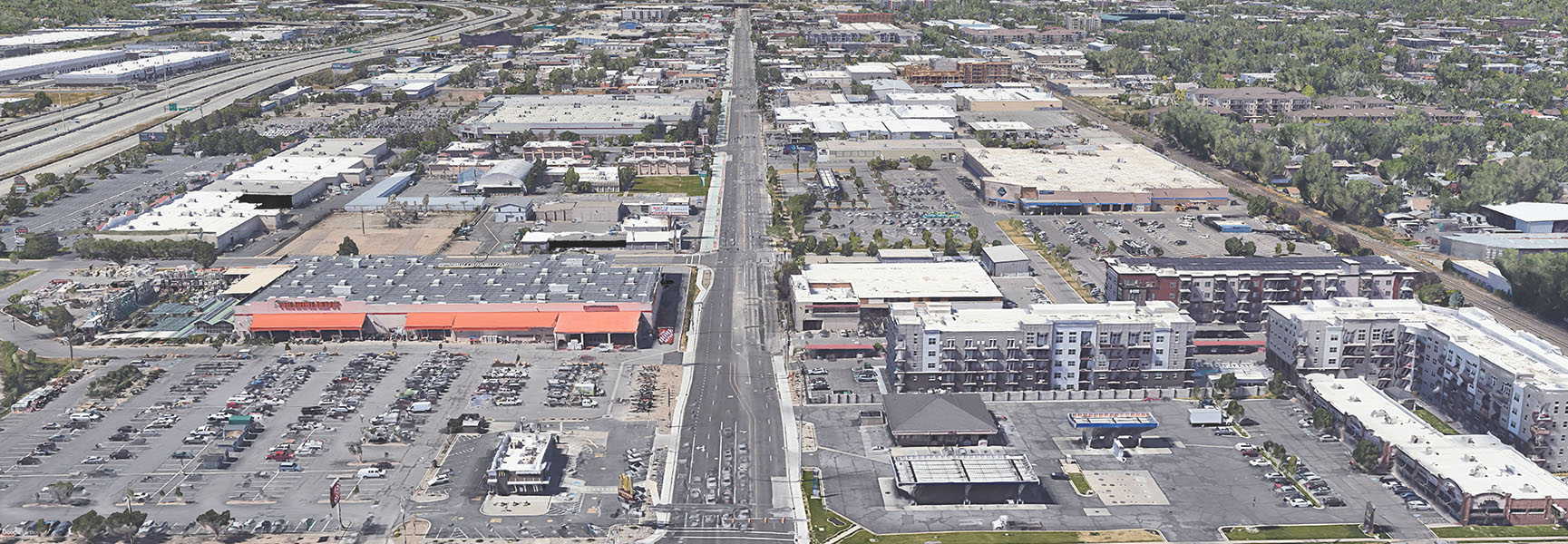
Salt Lake City is working on a new small area plan covering the blocks adjacent to 300 West between approximately 1000 South (900 South/I-15 Ramp) and 2100 South. The planning effort will do the following:
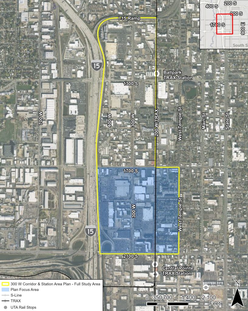
- Create a new plan with general policies and land use/zoning focused policies for the area between 1700 S and 2100 S and I-15 to West Temple (the “focus area.”)
- Update the zoning for the entire project area.
Draft Plan Public Review
Based on public feedback, the project team has completed a final draft plan document and is seeking additional input before taking the plan through the City’s adoption process. Please visit the draft plan webpage to access a copy of the plan and to find more information on the public input and adoption process.
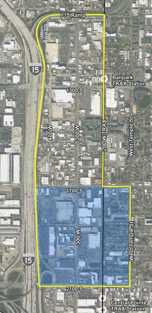
A map of the project area is shown here and a larger size map is available in the section below.
The plan currently in place for the area, the Central Community Plan, was adopted in 2005 and doesn’t necessarily reflect current Citywide goals and priorities for the area. One of the key reasons the area was chosen for updating is due to the ongoing transportation improvements to 300 West, including the significant bicycling infrastructure. The area has seen a lot of new development and development interest in the past few years. However, while the current zoning of the corridor, General Commercial, allows for mixed use development, it does not include development standards that promote a walkable or bicycle-oriented development pattern.
The plan and zoning update will focus on analyzing the appropriate scale and types of buildings, appropriate development standards, and the necessary mix of uses that will benefit from and complement the public infrastructure that exists near the corridor and that is being constructed within the corridor.
The planning effort is being led by the consultant Design Workshop.
Sign up for Updates!
Sign up to receive email updates regarding the 300 W Corridor & Central Pointe Station Area.
Project Area Map
Engagement and Input Opportunities
Open House and Survey (March 2024)
In March, the project team posted an online survey to collect feedback on the draft plan content available from the draft plan webpage. The team also held an open house to gather in-person feedback on March 26th at the Ballpark Playground. The project team used feedback gathered in March to help finalize the complete draft plan document.
Scenario Survey (September to December 2023)
The project team collected neighborhood suggestions and ideas last year and prepared two draft development scenarios based on that input The team developed a survey that was open from September to December to get community input. The survey is now closed and the team has been evaluating the input and developing a draft plan for additional community input.
Open House (September 2023)
The project team held an open house at the Ballpark Playground on September 26th. The information boards from that open house can be viewed here. Input from the open house will be analyzed and inform development of the draft plan.
Initial Public Input – Interactive Map (July to September 2023)
The project team utilized public input from the below interactive map to help develop the scenarios. The map was open to comments from July through September. The interactive map is now closed to comments. Please provide any new comments utilizing the survey above.
Related Materials
- Central Community Master Plan (2005)
- Central Community Future Land Use Map Amendments:
- Ordinance 79 of 2008
- Ordinance 14 of 2016
- Ordinance 23 of 2017
- Ordinance 26 of 2022
Project Management Team
Salt Lake City Planning Division
- Daniel Echeverria, Senior Planner // [email protected]
Design Workshop (Consultant)
- Jessica Garrow, Principal-in-Charge
- Marianne Stuck, Project Manager
Salt Lake City Corporation is committed to ensuring that its digital content is accessible to all users. If you need an ADA accommodation, please submit a Request an Alternative Format form at least 48 hours in advance. Available alternative formats and services may include braille, large print, audio recordings, sign language interpreters, or other auxiliary aids and services.