Legacy BST Ridge Utility Road
Rehabilitation Plan
Status
In Planning. Rehabilitation was scheduled for November 2022 but was postponed due to the Rocky Mountain Power Wildfire (RMP) Mitigation Project in the same area. It is now estimated to occur in spring 2024 after the completion of Phase III of the RMP project.
Project Location
- Trail access from 1021 Terrace Hills Drive
- Trail access from Bonneville Shoreline Trail
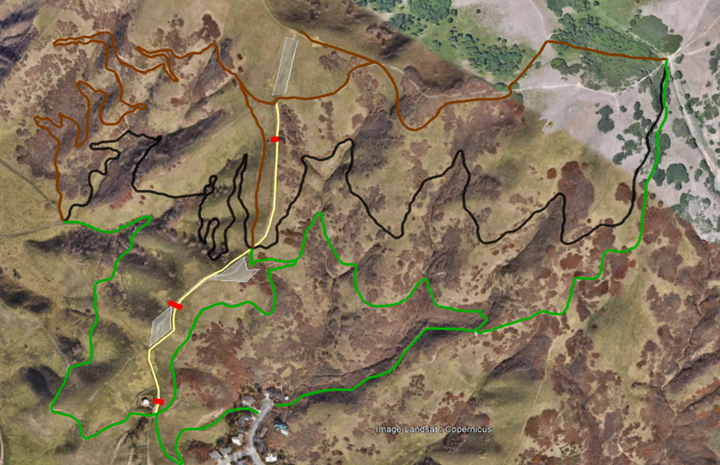
- Gaia Track (GPS recorded route of the ridge)
Project Background
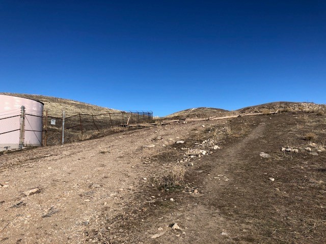
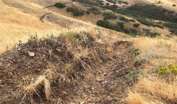
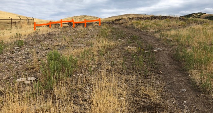
In spring of 2021, the City’s Public Lands Department built a realigned 2000-ft. (0.4 mi.) segment of the BST Valleyview trail as part of the Phase I implementation of the Foothills Trail System Plan. At that time, the City made the decision to close the widening and eroding ridgeline utility road that had that had been included as part of the BST when it was built in the 1990s. With portions of the utility road approaching 20% grade and braiding causing it to widen up to 40 feet, the City determined that it did not meet fit into best practices for sustainable trail maintenance and decided to actively close the trail and commence restoration efforts. Another 1800-ft legacy jeep track trail with grades up to 35% at the summit was also closed. The trail closures were implemented by installing lodgepole fences to block access to the segments at three locations and by digging trenches at strategically designated locations to impede travel.
The trail closures were met with community frustration and confusion. This new alignment was not listed in the Foothills Plan nor was the management practice of decommissioning trails by trenching. While the City is committed to active repair and restoration of damaged land from decades of misuse, the Public Lands team acknowledges that the trenching of the trails was an overly aggressive management practice and will not be repeated.
While City leadership implemented a pause in new trail construction in the fall 2021 to conduct a thorough evaluation of the Foothills Plan and Phase I trail construction, the Public Lands team was still immersed in various other aspects of open space management, including monitoring the impacts of the Rocky Mountain Power’s (RMP) Wildfire Mitigation Project, which had left a heavy footprint on the trails on University of Utah property. The City’s plans for restoration and rehabilitation work on the ridgeline utility road BST in fall 2022 was put on hold as this road would be a critical access corridor for RMP’s project.
As of 2023, the rehabilitation plan has been put on hold until RMP has completed it’s Phase III project, which is scheduled for spring 2024. Until that time, the Public Lands Department encourages trail users to utlize the sustainability built and maintained trails from Phase I, but will not prohibit use of the ridgeline utility road, or any other user-created ridge trail, until the Foothills Plan evaluation has been completed and a more comprehensive restoration and recreation proposal has been finalized for the area.
Project Rehabilitation Plan
The Public Lands Department is working with Rocky Mountain Power to develop a restoration plan to repair the trenching damage and designate a 12′-15′ wide “utility access corridor” so RMP can access its poles for repairs and emergencies. (RMP has a utility easement underneath its power lines but requires City approval for any access routes deviating from its easement.) All of the fences knocked over by vandalism and/or wind has been dismantled and stacked in the vicinity awaiting its next job. The utility access corridor will be accessible to the public for recreational use, but due to its grades and inability to disperse water, it will not be a trail maintained by Public Lands. Signage at trail junctions will label this utility corridor and will encourage users to stay on the designated trails so the ridgeline can revegetate naturally over time.
Rehabilitating the trenches: Rocky Mountain Power will access the utility road from Terrace Hills West to access the poles along the ridge. After the project is complete, they will be responsible for restore any of the impacts they have made and additionally will repair the three dugout trenches and level it out to existing grades. A native seed mix provided by Public Lands botanists will be tilled into the disturbed soil around the time of our first winter snowfall for optimal natural growth potential at that elevation. The disturbance areas of the three trenches, measuring 70’ x 15’, 90’ x 15’, and 40’ x 15’, will be marked off and signed for protection.
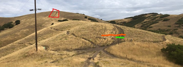
Fencing and signage: A lodgepole fence will be installed adjacent to the water storage tank at the bottom of the ridge trail to guide trail users to the designated ridge trail corridor. The fence will also serve as a hub for trail use wayfinding and interpretive signage. There will not be fencing at the upper junctions with the 19th Ave or Avenues Ridge Trail but there will be additional interpretive and wayfinding signage at those two junctions. Signage at the uppermost junction with the Avenues Ridge Trail will guide users to access the ridgeline summit from the east ridge to help the revegetation recovery of the legacy jeep track on the south slope.
Next Steps
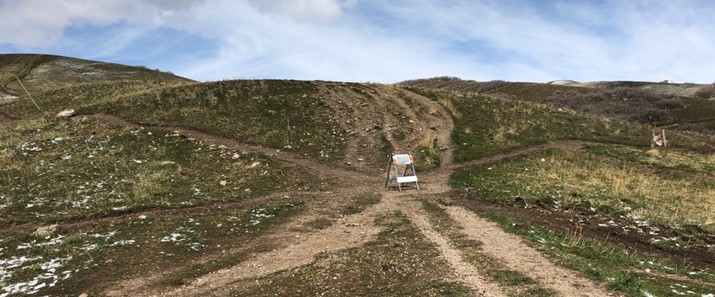
Public Lands staff worked with local natural lands managers and botanists to design a plan for re-seeding and revegetation of the rehabilitated trenches and to designate a preferred ridge trail to minimize the width of the trail corridor. This proposal will be shared and reviewed by the key stakeholder groups and is open to public feedback. Public Lands will publicize this project through signage at trailheads and at the trail as well as through its website and social media channels.
For questions or information, please contact SLC Public Lands Recreational Trails Manager, Tyler Fonarow, at [email protected].