
Victory Road
Location: 670 Victory Rd, Salt Lake City, UT 84103
STATUS: Work has commenced as of 11/2/24. Estimated completion date is late spring 2025.
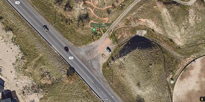
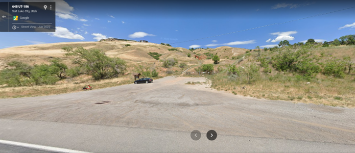
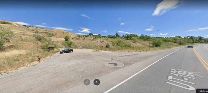
The Victory Road Trailhead is located north of Victory Road between Warm Springs Park and the Utah State Capitol. This location represents the lowest elevation (4450 ft) and westernmost access to the Foothills Trail System within Salt Lake City. The current footprint consists of approximately 6 unmarked parking stalls on a flat dirt lot and a trailhead kiosk. The Victory Road Trailhead serves as a major access point for the northern and western Foothills trails around Ensign Peak, Meridian Peak, Hell Canyon, and the Bonneville Shoreline Trail.
The Victory Road Trailhead will include:
- Paved parking for 10 designated spaces including one designated ADA space
- Rope and timber fencing and non-irrigated landscaping
- A welcome plaza with a trailhead information kiosk and a seat wall
- “Be W.I.L.D.” welcome station including dog waste bags, waste receptacles, invasive weed cleaning brush
- 3 bike racks
Note: This location is on a Public Utilities parcel with critical City water infrastructure. The footprint of the new trailhead infrastructure has been shifted to protect underground pipes and provide requisite access for its management.
Existing Conditions
Construction Design
These documents are the 100% drawings submitted to the Engineering Division for publication to bidding contractors. The Engineering Division will select contractors for the trailhead projects in collaboration with the Public Lands Department. Contractors should be selected and contracts completed in March so that construction can occur at a TBD timeline from April to June 2024.