Help decide which Westside projects to focus on
Tell us which of the 10 proposed corridors matter most to you. It takes about 5 minutes and closes Friday, September 25.
The West-East divide
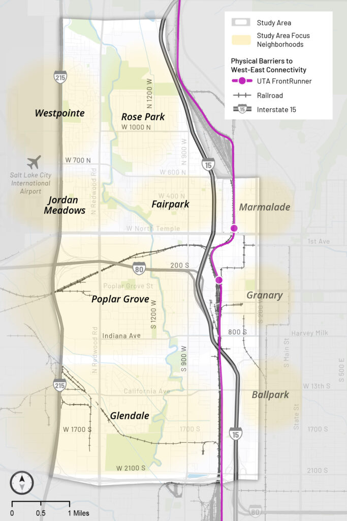
I-15 and the railroad tracks, including Union Pacific and FrontRunner, separate Salt Lake City’s Westside neighborhoods from downtown and the rest of the city. Only a few major streets cross, and stopped trains regularly block them, causing delays, longer trips, and safety concerns for Westside residents.
The study area is roughly bounded by I-215, 2100 North, 2100 South, and 300 West, with I-15 and the railroad running through the middle.
About WE Connect
The West-East Connections Study (WE Connect) is a two-year planning study, begun in 2025, to identify and prioritize projects that make it easier to cross the divide by car, on foot, by bike, and on transit. Salt Lake City leads the study in partnership with the Utah Transit Authority, the Utah Department of Transportation, and a wide array of stakeholders, with funding from the federal Reconnecting Communities Pilot Grant Program.
The people most affected by the divide define the problems and help shape the solutions, and every recommendation comes directly from them. A Community Advisory Board of Westside residents and businesses and an Arts Engagement Group of six local artists guide the team, with a final plan expected by the end of 2026.
The study itself provides no capital funding. Any proposal would require both funding and the coordination, permission, and participation of every entity that controls the affected area through ownership, easement, or policy.
What we’ve heard from you
Phase one: defining the problem
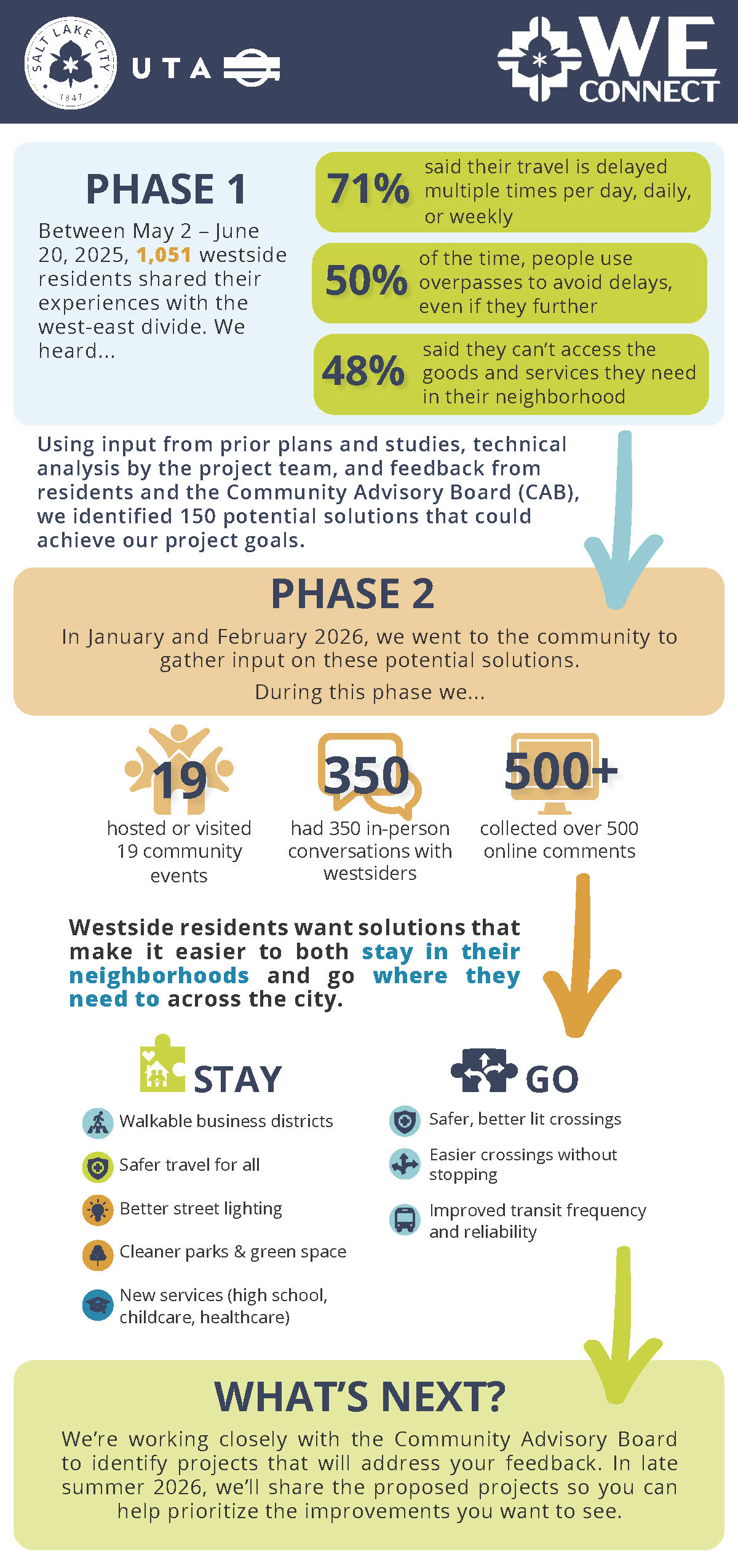
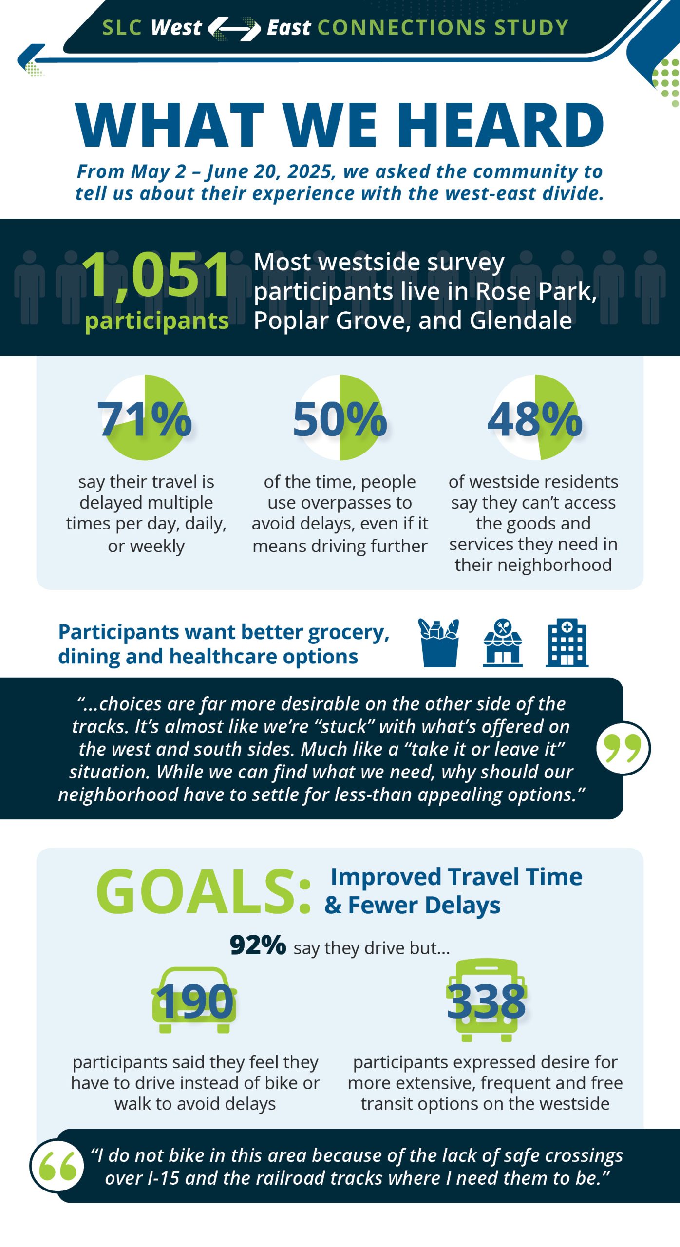
From May 2 to June 20, 2025, 1,051 community members, most of them from Rose Park, Poplar Grove, and Glendale, told us how the divide affects them:
- 71% said their travel is delayed weekly or more often.
- About half the time, people detour to an overpass to avoid train delays, even when it’s farther.
- 48% said they can’t get the goods and services they need in their neighborhood.
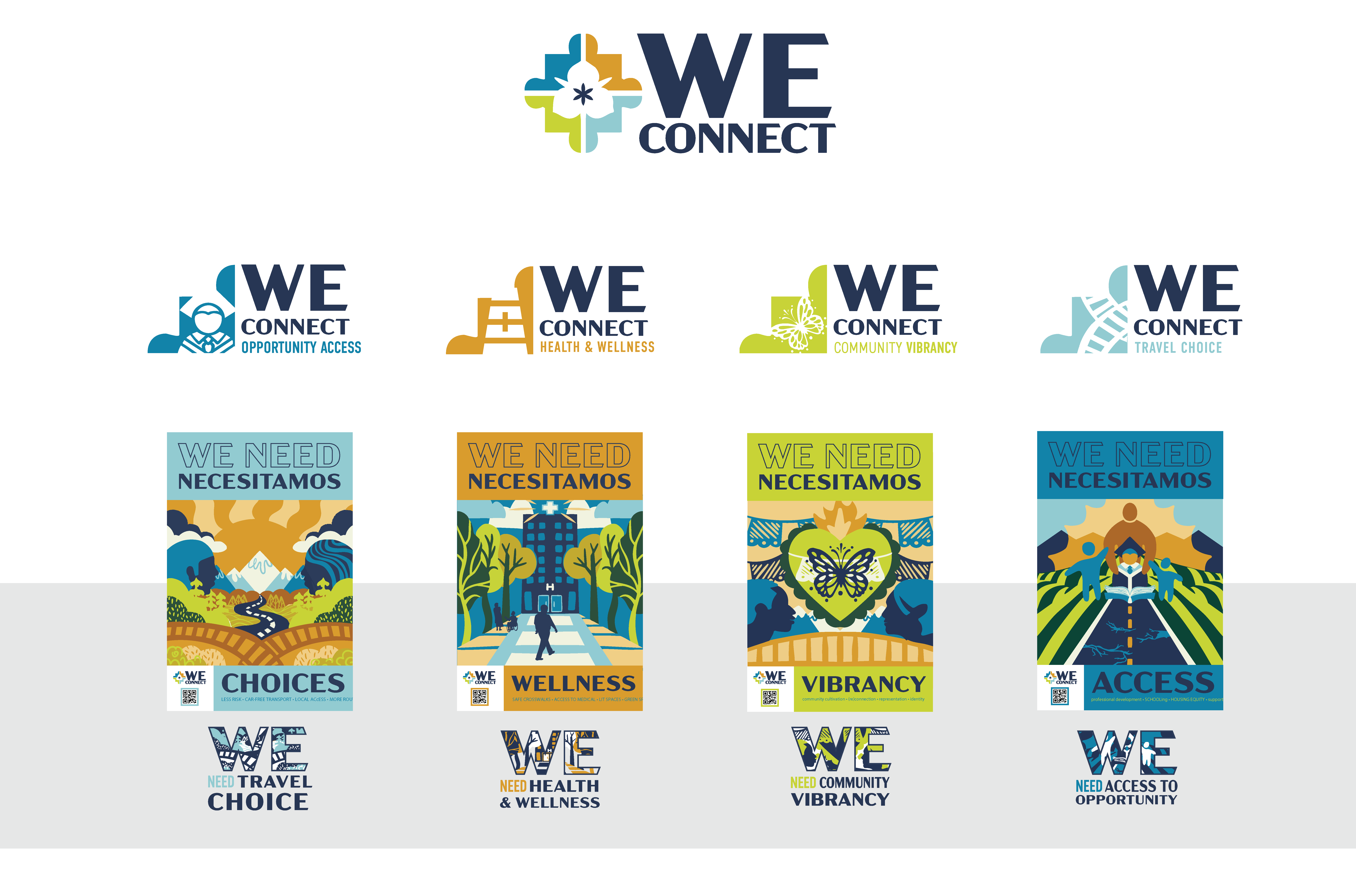
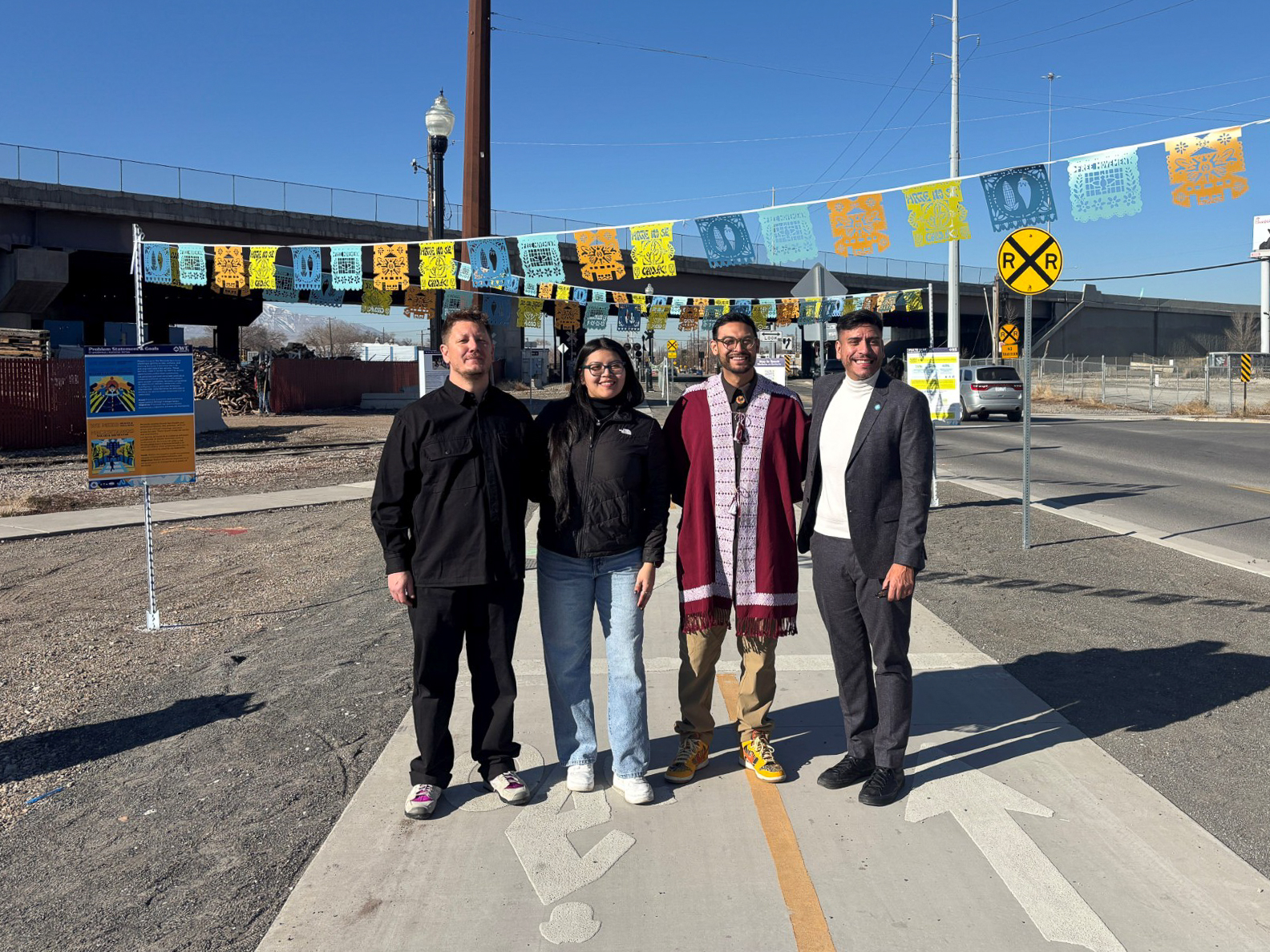
You named four major problems: travel choice, health and wellness, community vibrancy, and access to opportunity. The Community Advisory Board, local artists, and the project team turned them into the four puzzle pieces in the WE Connect artwork.
Phase two: brainstorming solutions
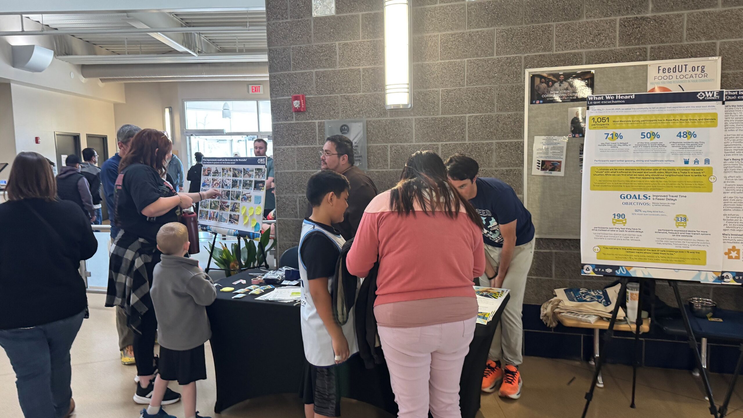
In early 2026, we came back to ask for solutions. The team hosted or visited 19 community events, had 350 in-person conversations with Westsiders, and collected more than 500 online comments.
Ideas ranged from burying the train and adding bridges or tunnels to more GREENbike stations, better transit, street lighting, walkable business districts, and Westside amenities like a high school, hospital, and childcare. Overall, you want solutions that make it easier to both stay in your neighborhood and go where you need to across the city:
- To stay: walkable business districts, safer travel for everyone, better street lighting, cleaner parks and green spaces, and new services like a high school, childcare, and healthcare.
- To go: safer and better-lit crossings, crossings you can use without stopping, and more frequent, reliable transit.
See the phase two summary graphic in English or Spanish, or read the full engagement summary.
Where we are now
Over the summer, the team evaluated your ideas: how they could be combined, what they might cost, and who would need to be involved to build them. The result is a set of proposed improvements on 10 corridors, which we shared at two block parties in August.
Now we need your help deciding which should come first. The survey describes each corridor and asks you to rank them, and the results will help shape the final plan.
Reports and documents
Everything the study has produced so far, newest engagement results first.
- Phase two engagement summary: what we heard in early 2026 when we asked for solutions.
- Existing and future conditions report: data on how people travel across the divide today and how that is expected to change.
- Goals and objectives: what the study is trying to achieve, used to screen and prioritize solutions.
- Problem statement: the four problems the community says the divide causes, drawn from the phase one survey, community events, and past studies.
- Survey summary (phase one): full results from the 2025 survey of more than 1,000 community members.
- “What We Heard” infographic (phase one): a one-page visual version of the survey results.
- Foundations report: background research on how I-15 and the railroad affect Westside travel, health, housing, and access to jobs and services. Short on time? Read the summary.
- Fact sheet / Hoja informativa: a quick overview of the study in English and Spanish.
Background
History, past projects, and the grant
The West-East division began in 1870, when the railroad reached Salt Lake City, a year after the transcontinental railroad was famously joined in Utah. This was only 23 years after Europeans first settled in the area and well before the modern city government. The railroad was celebrated, but it also divided the city. Homesteads and farms built west of the rails became less desirable as industrial uses dominated along the railroad and the nearby Jordan River was used as a dumping ground.
In the following decades, the arrival of the freeways made the division worse and brought unsafe conditions and pollution to the west side. Large bridges were built to carry cars over the rail lines, with high-speed interchanges to help vehicles get on and off the freeways. Later, freeway widening expanded the infrastructure barriers.
The crossings are also a safety problem. People walking and biking have been killed or injured by trains in Salt Lake City, including in July 2018, August 2018, December 2018, and October 2023.
Now, finally, is the time to begin to come to terms with this divide. Reconnecting Communities is a robust, community-centric planning effort to envision solutions for east-west crossings, focused on a 6.1-mile, highly urbanized corridor.
Past projects
Salt Lake City has taken steps to address the divide through several Westside projects, but a unified plan is still needed:
- 300 North pedestrian bridge and street reconstruction
- 400 South Viaduct Trail
- 400 South safety and transit improvements
- 900 South street reconstruction and 9 Line Trail
- Neighborhood Byways
- Traffic calming projects
- 600/700 North reconstruction (2026)
Reconnecting Communities grant
The study is funded by a USDOT Reconnecting Communities Pilot Program grant, with local match commitments from Salt Lake City, the Utah Transit Authority, the SLC Community Reinvestment Agency, and SLC Public Utilities. Read the grant application narrative.
Letters of support
The grant application was backed by 48 letters from government agencies, community councils, railroads, businesses, and community organizations. Select a name to read the letter.
Government and agencies: Salt Lake City Council, Salt Lake County, City of South Salt Lake, Utah Department of Transportation (UDOT), Wasatch Front Regional Council, Utah Inland Port Authority, Utah State Fair, U.S. Representative Chris Stewart, Salt Lake City Arts Council, Salt Lake City Public Library, Salt Lake City Bicycle Advisory Committee, Salt Lake City Transportation Advisory Board.
Community councils: Ballpark, Capitol Hill*, Central 9th, Central City, Fairpark, Glendale, Jordan Meadows, Poplar Grove, Rose Park*, Westside Coalition.
Railroads and rail advocates: Union Pacific Railroad*, Salt Lake Garfield & Western / Patriot Rail, Utah Rail Passengers Association.
Community organizations and advocates: Bicycle Collective, Bike Utah, Building Salt Lake, Cycling West, Fourth Street Clinic, GREENbike, Neighborhood House, NeighborWorks, Salt Lake Education Foundation*, Shelter The Homeless, Sorenson Community Center, Sweet Streets, University of Utah City & Metropolitan Planning*, Volunteers of America, Rio Grande Plan co-authors Cameron Blakely and Christian Lenhart.
Businesses and business groups: 300 West Merchants’ Association, Downtown Alliance, Fisher Brewing, Gardner Batt LLC, Granary District Alliance, Lux Events, Salt Lake Bees*.
* Letter written for a similar, earlier grant application. You can also read the comments from the general public.
Related plans and studies
- Connect SLC Transportation Master Plan (2024)
- Ballpark Station Area Plan (2022)
- Westside Transportation Equity Study (2021)
- Regional Transportation Plan (2019)
- 9 Line Trail Extension Study (2018)
- Salt Lake County Active Transportation Implementation Plan (2017)
- Salt Lake City Transit Master Plan (2017)
- Wasatch Front Central Corridor Study (2017)
- Utah Freight Plan Summary (2017)
- Salt Lake City Pedestrian & Bicycle Master Plan (2015)
- Westside Master Plan (2014)
- Salt Lake City Transportation Master Plan (1996)