What’s a Neighborhood Byway?
Neighborhood Byways are quiet residential streets designed for safe and comfortable walking, biking, and rolling. With safer crosswalks, traffic calming, bicycle-friendly design, wayfinding signs, and better connections to destinations, these routes offer a pleasant alternative to busy roads. Salt Lake City is building a network of people-friendly streets that makes active transportation an easy choice for everyday trips. Discover all the routes and learn more on the byways home page.
1300 West improvements
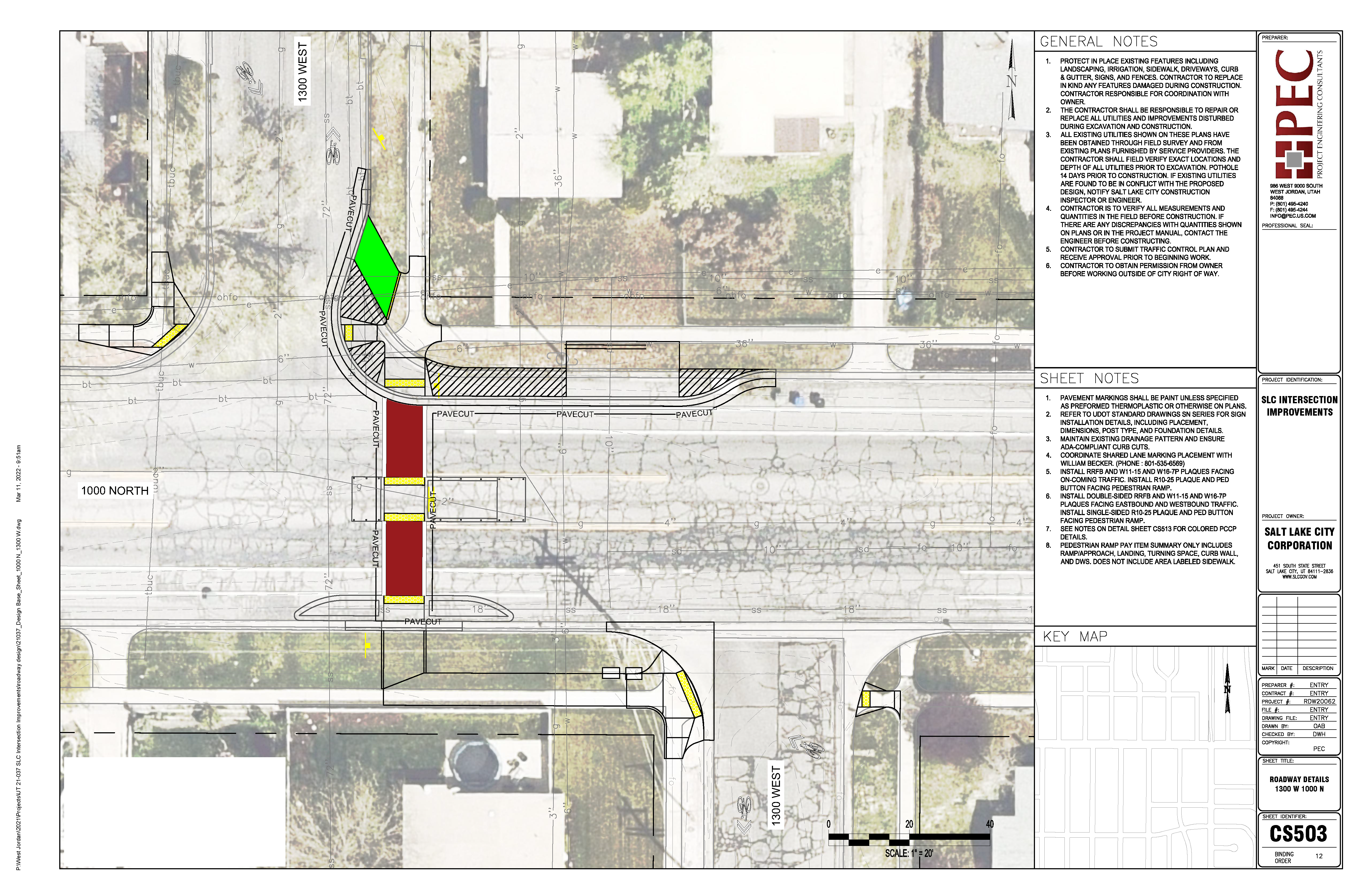
Crossing improvements at 1000 North and 600 North along 1300 West were completed in fall 2023 as part of the Rose Park and Fairpark Neighborhood Byway. The final designs reflect community feedback, project goals, and technical analysis.
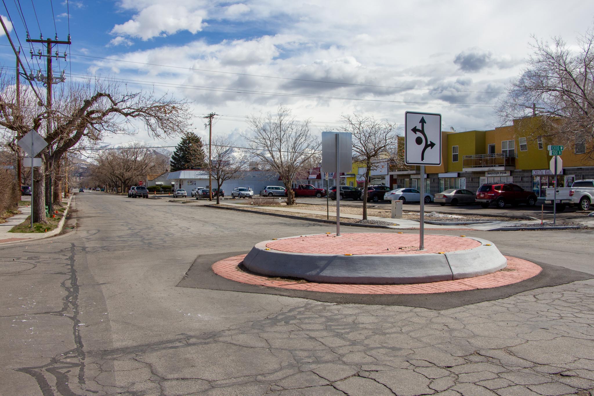
Adding to the improvements at these intersections, the 500 North traffic calming project also added a traffic circle at the intersection of 500 North and 1300 West.
Learn more
Background and goals
Background
The Rose Park Community Council was awarded Capital Improvement Program funds for the first phase of a north-south Neighborhood Byway through the Rose Park and Fairpark neighborhoods, as recommended in Salt Lake City’s Pedestrian & Bicycle Master Plan.
The project began in 2019, and a potential byway route and related safety improvements were proposed. The team gathered feedback through community events, public meetings, and door-to-door outreach.
In response to early input, the team conducted additional analysis to evaluate route options based on existing conditions, connectivity, access to key destinations, and other factors. Combining this analysis with community feedback and guidance from the master plan, the project team proposed an updated route for the byway.
Goals
- Accommodate people who walk or bicycle, linking them to critical destinations, including neighborhood retail areas, parks, schools, and transit stations.
- Improve safety for all roadway users.
- Implement the SLC Pedestrian and Bicycle Master Plan.
Frequently asked questions
What changes are being made?
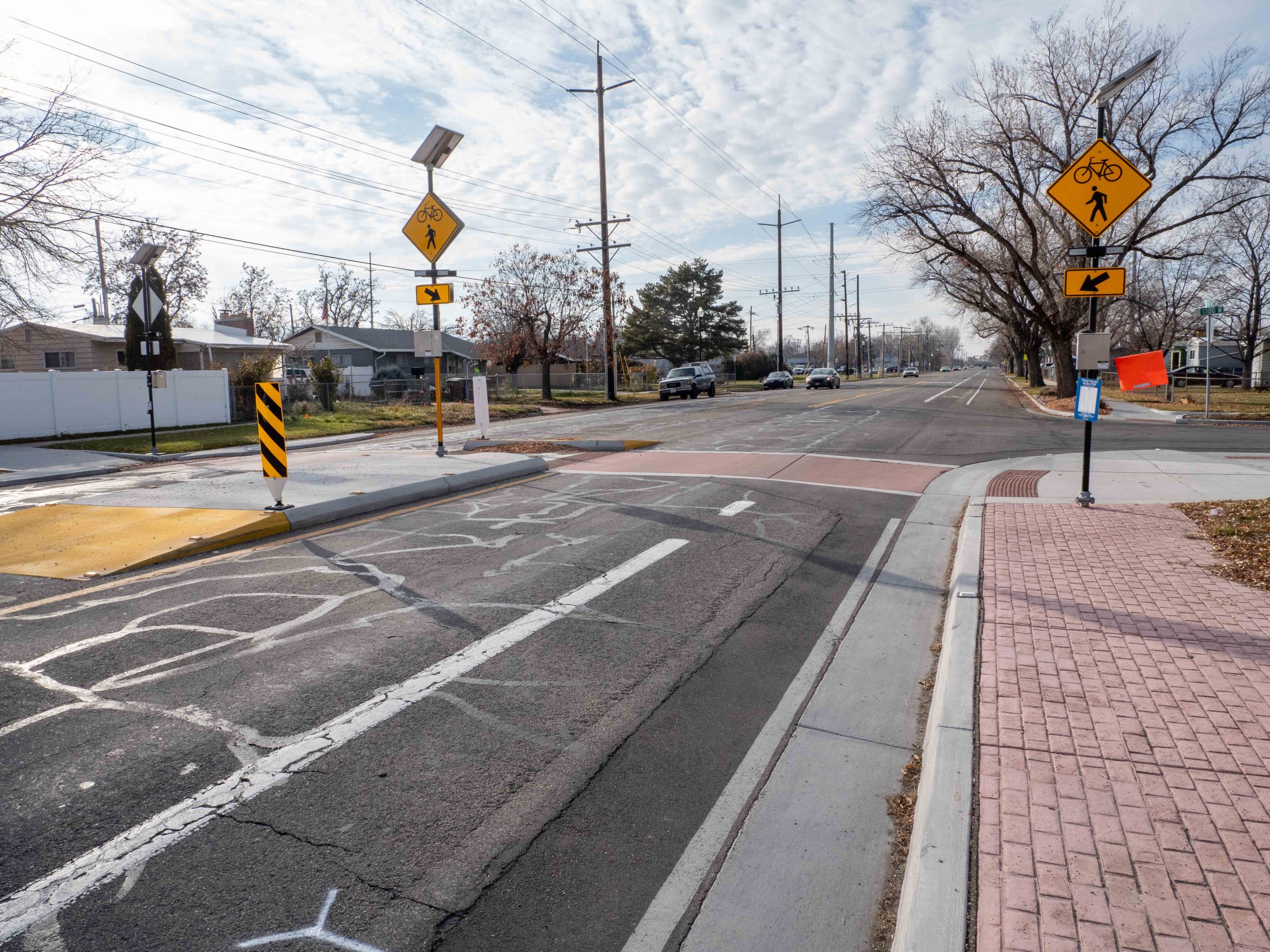
The City will construct crossing safety improvements along 1300 West. These safety improvements include:
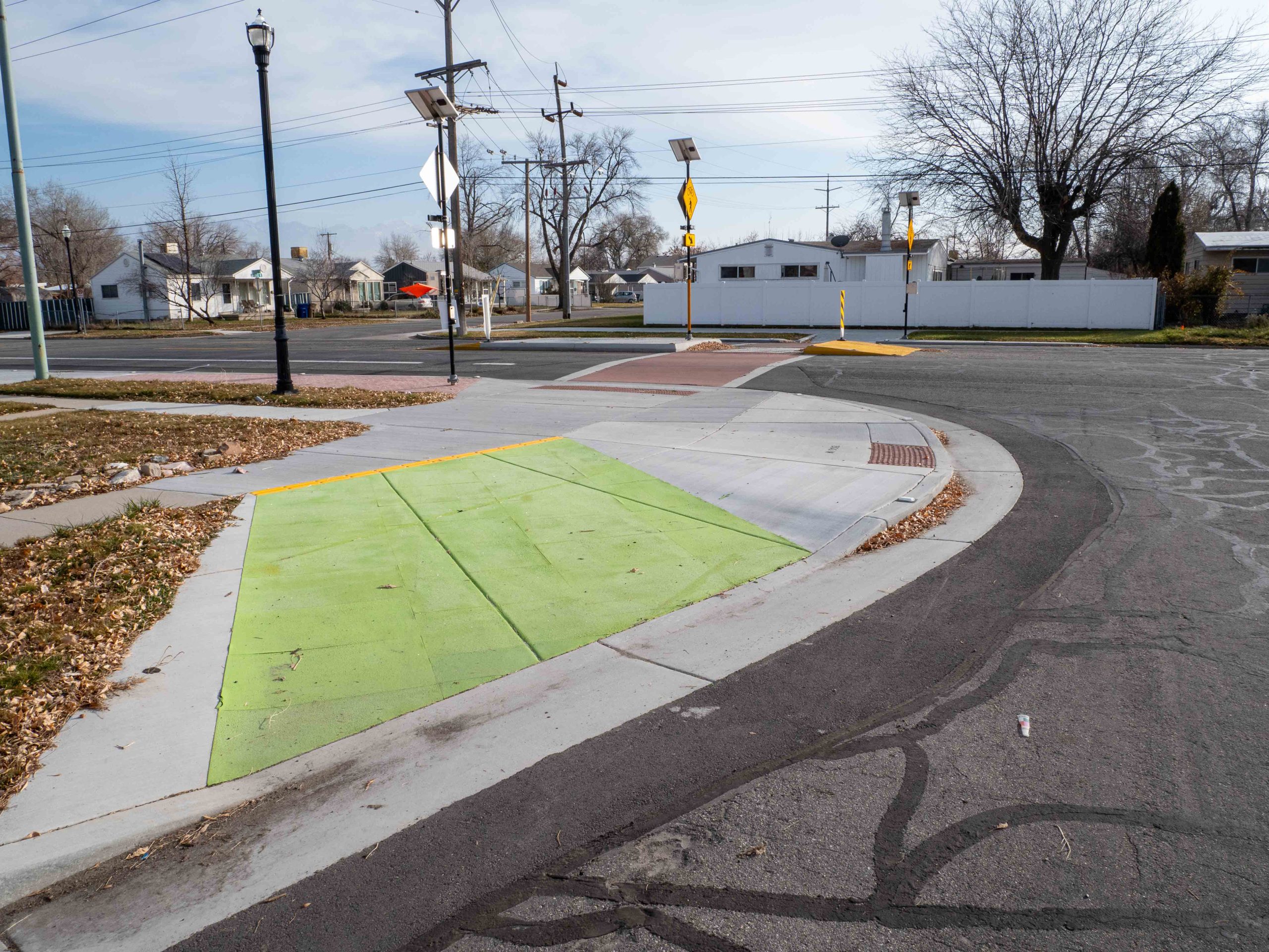
- Curb extensions (also known as bulb-outs) at the corners of the intersections to shorten the distance when crossing the street and help calm vehicle traffic
- High visibility crosswalks
- Push-button activated flashing beacons (RRFBs) to alert drivers that there is someone in the crosswalk
- Curb ramps for bicycle access to the beacon push buttons and crosswalk
- Signalized crossings
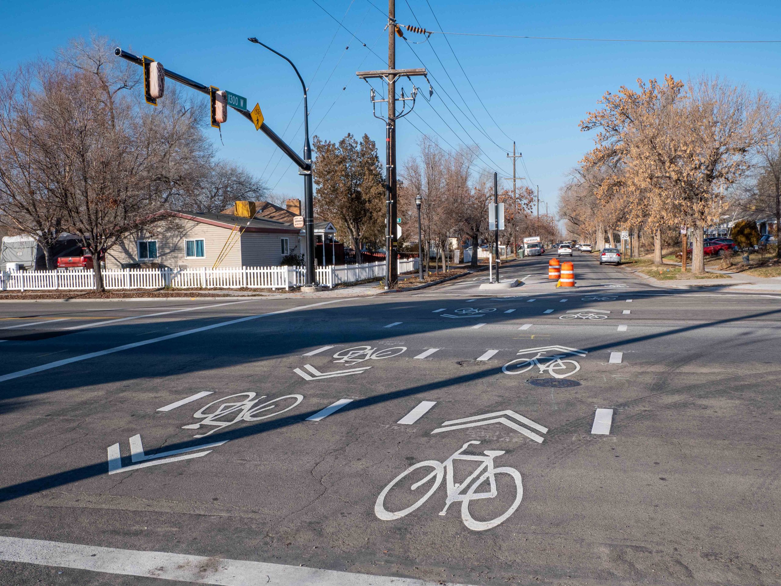
Improvements will also include wayfinding signage and pavement markings such as shared lane markings to help guide people along the byway.
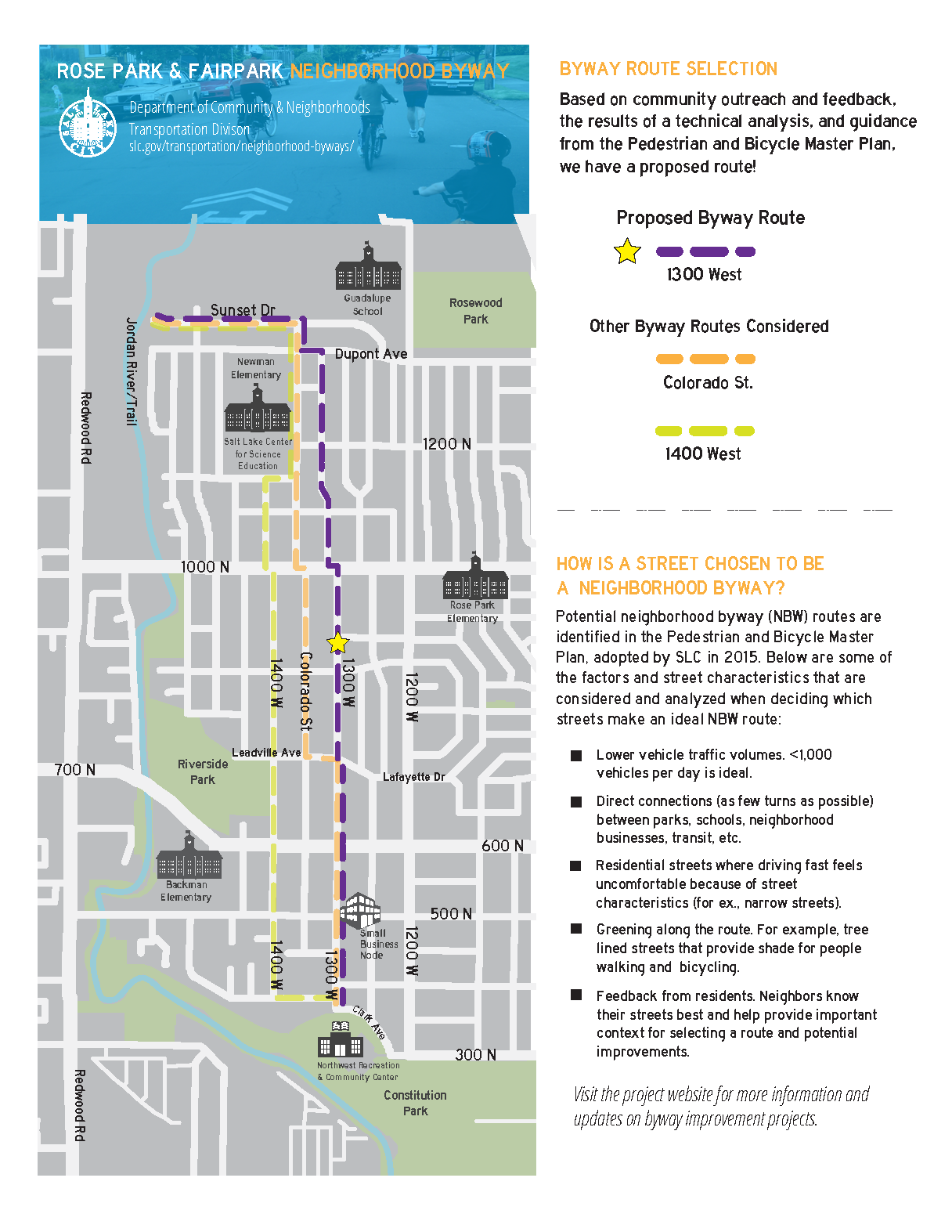
Why was 1300 West selected when 1200 West already has a bike lane?
Byway routes are selected based on many factors including:
- Lower traffic volumes
- Lower speeds – narrow streets or other characteristics that make driving fast in a vehicle feel uncomfortable
- Direct connections between neighborhood destinations
- Greening along the route – for example, street trees that provide shade
Neighborhood Byway routes are identified in Salt Lake City’s Pedestrian and Bicycle Master Plan, adopted in 2015. These routes are designed to create a more comfortable and inviting street network for people walking and biking.
The project team considered factors like existing street conditions, connections to nearby destinations (such as the Jordan River Trail, schools, parks, community centers, and businesses), and overall network connectivity. Based on this analysis—along with public input gathered through events, surveys, and other outreach—the 1300 West route was selected.
What kind of bike lanes are being added?
The City will implement shared lane markings (i.e., “sharrows”) along the route to help guide people riding bicycles and to indicate a travel lane shared by bicyclists and motor vehicles. According to NACTO, shared lane markings “reinforce the legitimacy of bicycle traffic on the street and recommend proper bicyclist positioning.”
Will the project include lower speed limits or safer crossings?
This phase of the project focused on safety improvements at the intersection of busy streets that cross the byway (such as 600 North and 1000 North), which may help calm vehicle traffic turning onto the byway. One reason that 1300 West was chosen as a byway is due to the street’s relatively low traffic volume and speeds. However, further analysis, feedback from residents, and funding availability may lead to additional traffic calming along the byway in the future.
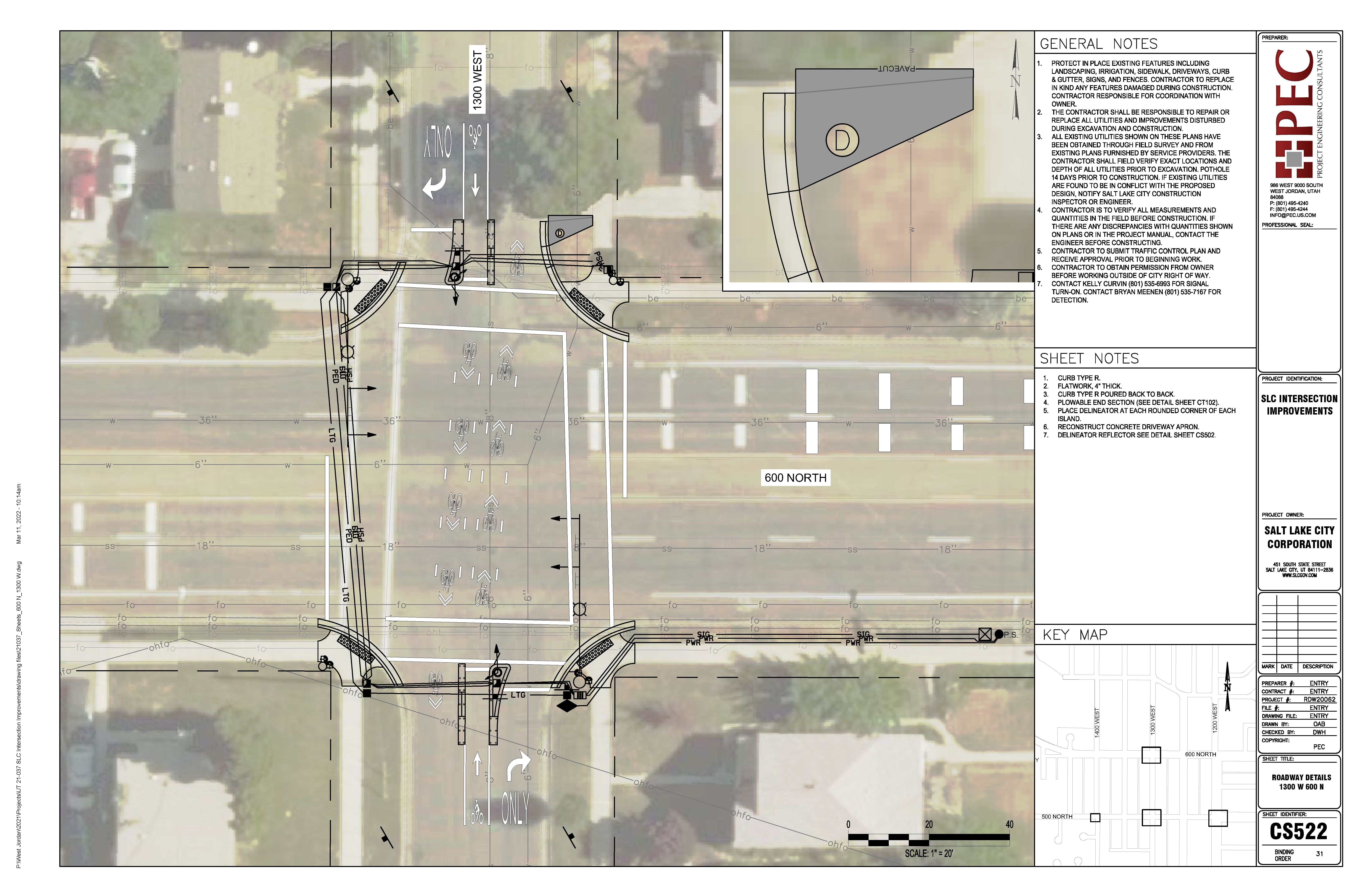
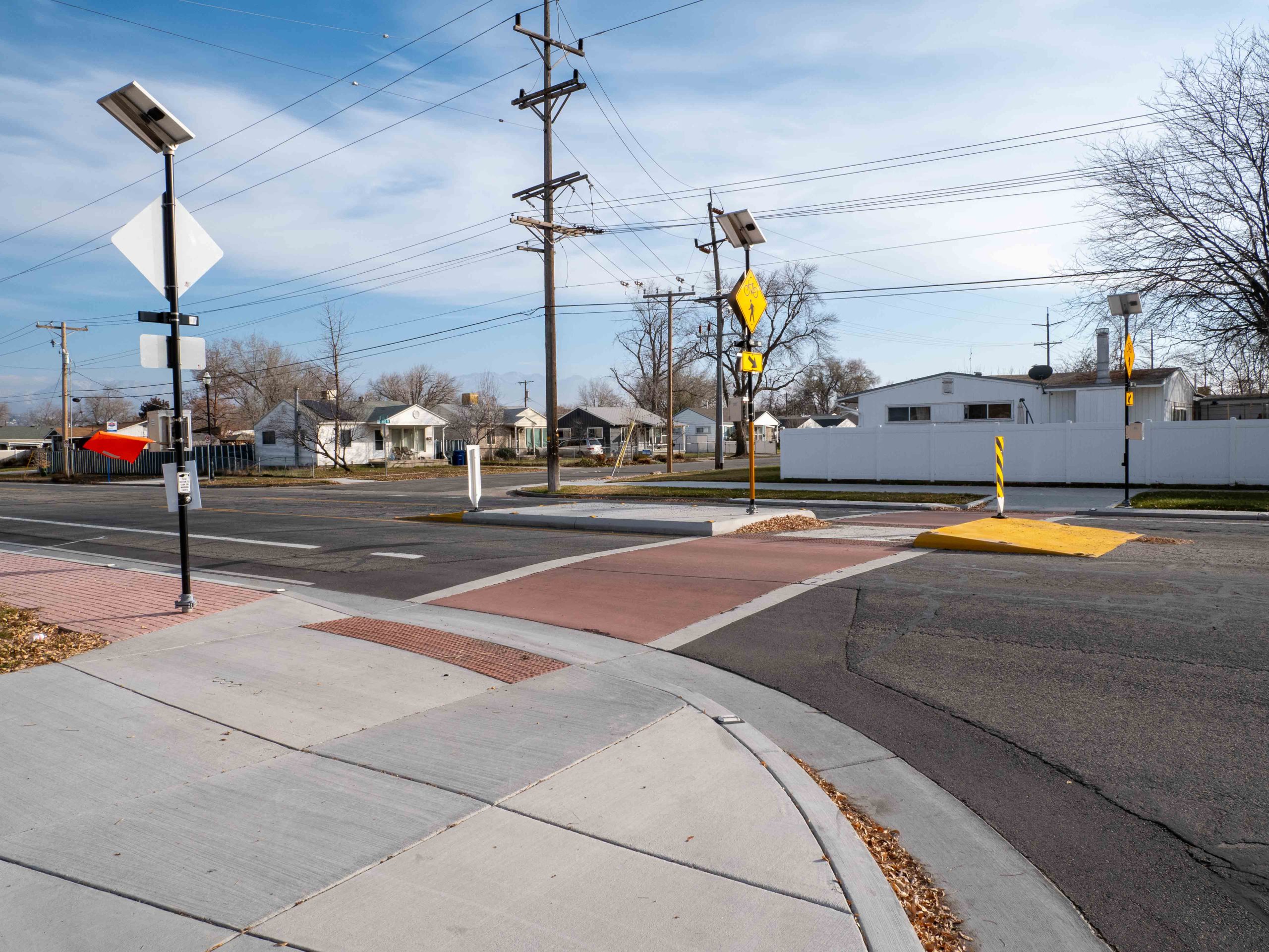
What changes were made at the 600 North intersection?
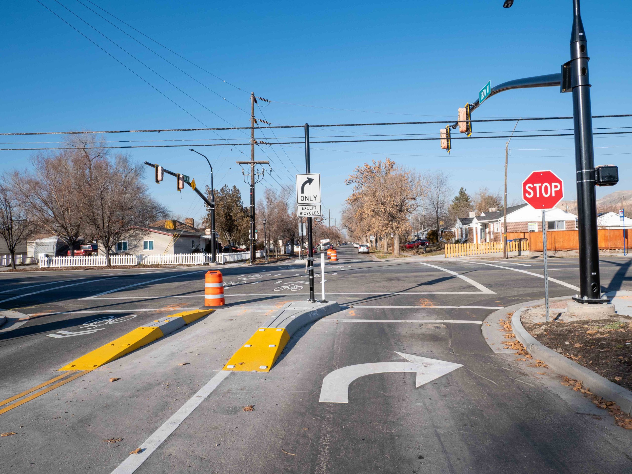
Previously, there was only one crosswalk on the west leg of the intersection with no additional beacons or traffic control devices to indicate to drivers traveling on 600 North that people are crossing. The new design provides crosswalks on both sides of 600 North and drivers traveling east and west on 600 North will be stopped by a traffic signal when someone walking or bicycling is present and has activated the signal. The biggest change for drivers is that vehicles traveling north and south on 1300 West are only allowed to make right turns at 600 North. Residents that live near the intersection will be affected most by this change.
The 1300 West neighborhood byway crossing at 600 North is referred to as a Toucan, meaning “two can” cross simultaneously — someone walking and someone bicycling. Toucan crossings are a standard crossing design for Salt Lake City’s growing network of neighborhood byways on busy streets like 600 North. Other locations where this type of crossing has been installed include the 600 East neighborhood byway crossings at 2100 South and 1300 South.
Why this design on 600 North?
One of the primary issues residents experience when crossing 600 North (see our community survey results) are vehicles speeding and not stopping for people walking and bicycling. This type of crossing design provides a safe and effective crossing at major streets that have high vehicle traffic volumes and speeds without adding a four-way traffic signal. Four-way traffic signals are more expensive and can potentially attract more vehicles to 1300 West.
How does a Toucan work?
The Toucan crossing lets people walking or biking on 1300 West stop traffic on 600 North by pressing a button. Pedestrians use the standard corner push buttons, while people biking ride to the center bike lanes, where there are push buttons and bike signals in the median. When activated, the signal gives a walk sign to pedestrians and a green light to bikes. The signal only turns red for cars on 600 North when someone activates it—so it doesn’t stop traffic unless needed.
This design also prevents cars from using 1300 West as a cut-through. Drivers on 1300 West must turn right at 600 North, which helps reduce traffic and makes the byway more comfortable for people walking and biking, and residents enjoy less vehicle traffic on their street.
Surveys, summaries, and resources
Surveys, summaries, and resources
See what community members said about the proposed changes to 600 North and 1000 North along the 1300 West corridor—plus a letter of support from the Bicycle Advisory Committee.
- 1000 North and 1300 West crossing draft design summary (2020)
- 600 North and 1300 West crossing draft design comment summary (2021)
- Neighborhood Byway tour fact sheet
- BAC Letter of Support
Visit the 600/700 North Mobility, Safety, and Transit Improvements Study project page for more information.
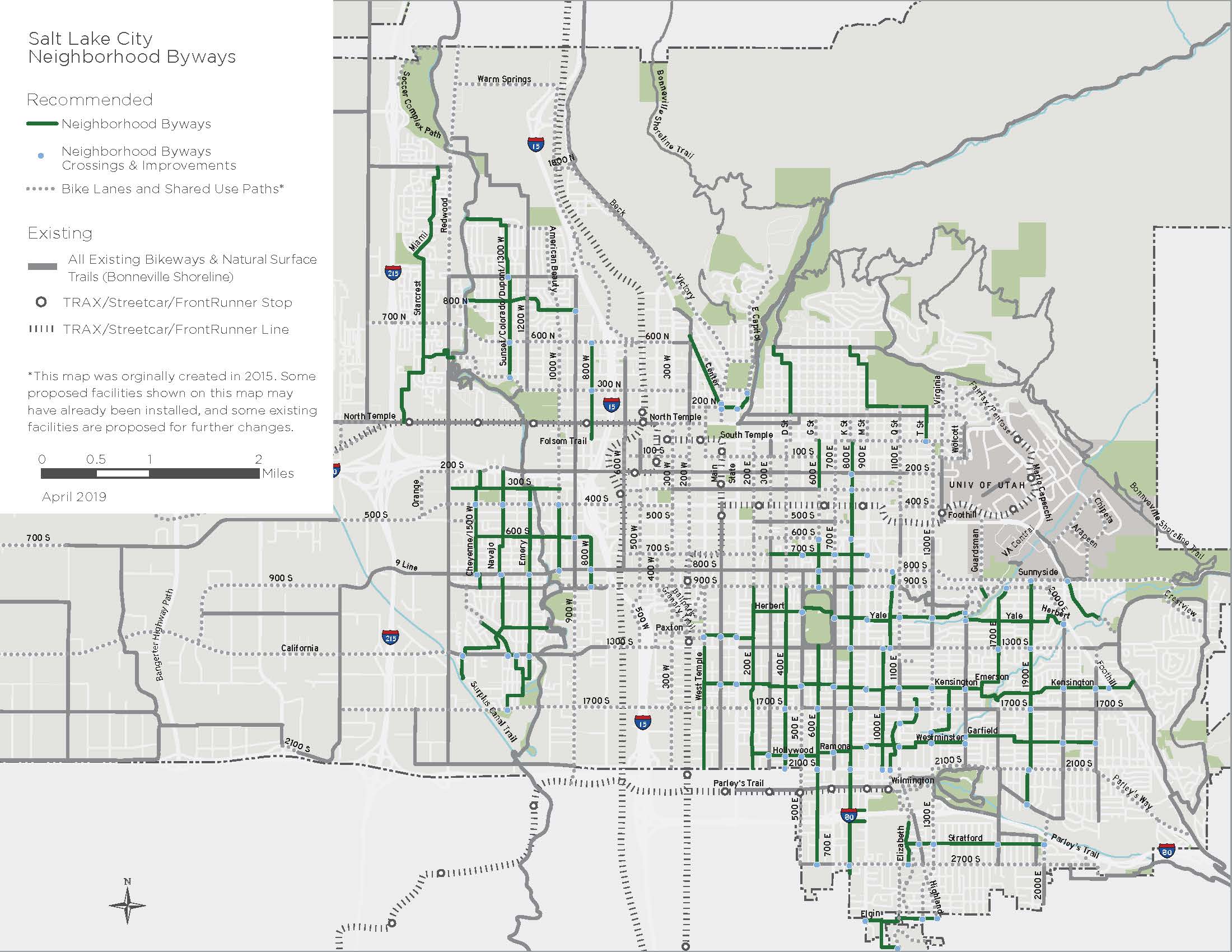
Citywide byways map
Citywide byways map
The following byway routes were identified in Salt Lake City’s Pedestrian and Bicycle Master Plan in 2015.
Designs
600 North and 1300 West design
1000 North and 1300 West design
Check out 1300 West!
These photos show new crosswalks, traffic calming, and design features that make 1300 West more comfortable for walking and biking.
Contact us
Have a question or want to stay connected?
Email: [email protected]
Subscribe to the SLC Moves newsletter to get email updates.