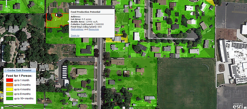
Salt Lake City’s Community Food Production Mapping Project
Have you ever wondered how much food you could grow in your yard if you took the time to garden? By following the simple steps below you can not only click on your property to find out an estimation of its food production potential, you will also be linked to resources that will educate and empower you to grow more food.
1) Find your house! The mapping tool takes into consideration the tree canopy, average pavement area, and building footprint to identify the most productive areas of your property to grow food. (Please note that this an evolving project that generates an estimate based on calculations and assumptions to simulate how much food could be grown if best management practices were applied. As a result, some errors and inconsistencies may occur on certain properties. Start mapping!
2) Learn more! After you view your property, you will be linked to resources regarding health, nutrition, food production, and food assistance programs to help guide you in accessing and growing more local food.
Why Garden?
The average grocery food item travels 1500 miles before arriving to your table. Local agriculture eliminates the costs of, and demand for, the energy resources needed for transportation and preservation, along with the related pollution. When we reduce the distance from farm to plate, the opportunities for food to be contaminated or vulnerable to disruptions in the supply chain are greatly reduced or eliminated. Growing your own food not only allows you to eat fresher, more nutritious produce, it also gives you the peace of mind of knowing exactly where your food is coming from.
The mapping element of this project was created by Kevin Bell, Salt Lake City GIS Coordinator in partnership with the University of Utah’s Department of City and Metropolitan Planning students Tammy Hunsaker, Ali Oliver, and Xi Wang with instructor Martin Buchert.